1 Ray Ave
An address in Mount Dennis, outside TRCA flood and shoreline hazard areas, with 8 active development applications within 250 metres.
Data as of Nov 7, 2026 · Every item lists its source
- 2 open building orders or notices.
- Outside TRCA flood and shoreline hazard areas.
- 8 active development applications and 0 Committee of Adjustment applications within 250 m.
01The building
Recent permits (4)
- Building Permit Related (DR) · Issuance Pending · Jun 1, 2026
Drain - Proposal for a 2 storey rear addition, interior alterations, convert to an SFD.See also 26 141646 WNP. · Permit 26 159391 DRN - Multiple Projects · Examiner's Notice Sent · May 12, 2026
Proposal for a 2 storey rear addition, interior alterations, convert to an SFD.See also 26 141646 WNP. · Permit 26 159391 BLD - Building Permit Related(PS) · Issuance Pending · May 12, 2026
Plumbing - Proposal for a 2 storey rear addition, interior alterations, and convert to an SFD.See also 26 141646 WNP. · Permit 26 159391 PLB - Interior Alterations · Closed · Aug 24, 2012
Interior alterations to a residential/commercial building · Permit 12 194323 BLD
02Risks and the ground
TRCA mapping is for screening, not site-specific decisions. Lead results are voluntary samples from homes in the postal area, not this address.
03What’s changing nearby
- 116 Denarda St · 213 m · Site Plan · OMB AppealSite Plan Application in relation to rezoning application, file #23 174306 WET 05 OZ.File 23 174316 WET 05 SA · submitted Jul 14, 2023 · City record
- 214 Denarda St · 221 m · Site Plan · OMB AppealSite Plan Application in relation to rezoning application, file #23 174306 WET 05 OZ.File 23 174316 WET 05 SA · submitted Jul 14, 2023 · City record
- 312 Denarda St · 224 m · Site Plan · OMB AppealSite Plan Application in relation to rezoning application, file #23 174306 WET 05 OZ.File 23 174316 WET 05 SA · submitted Jul 14, 2023 · City record
- 410 Denarda St · 232 m · Site Plan · OMB AppealSite Plan Application in relation to rezoning application, file #23 174306 WET 05 OZ.File 23 174316 WET 05 SA · submitted Jul 14, 2023 · City record
- 58 Denarda St · 237 m · Site Plan · OMB AppealSite Plan Application in relation to rezoning application, file #23 174306 WET 05 OZ.File 23 174316 WET 05 SA · submitted Jul 14, 2023 · City record
- 66 Denarda St · 240 m · Site Plan · OMB AppealSite Plan Application in relation to rezoning application, file #23 174306 WET 05 OZ.File 23 174316 WET 05 SA · submitted Jul 14, 2023 · City record
- 715 Denarda St · 241 m · Site Plan · OMB AppealSite Plan Application in relation to rezoning application, file #23 174322 WET 05 OZ.File 23 174343 WET 05 SA · submitted Jul 14, 2023 · City record
- 813 A Denarda St · 245 m · Site Plan · OMB AppealSite Plan Application in relation to rezoning application, file #23 174322 WET 05 OZ.File 23 174343 WET 05 SA · submitted Jul 14, 2023 · City record
Development Applications; Committee of Adjustment Applications · 3 registered short-term rentals within 250 m.
04City services
05Quick answers about 1 Ray Ave
Is 1 Ray Ave in a flood plain?
No. It is outside TRCA's mapped flood and shoreline hazard areas. Source: TRCA Regulation mapping 2025.
What is being built near 1 Ray Ave?
8 active development applications within 250 metres, the closest at 16 Denarda St (213 m). Source: Development Applications.
When is garbage day at 1 Ray Ave?
Collection calendar Friday 2. Next garbage pickup: Nov 13, 2026. Source: Solid Waste Collection Schedule.
Answers are generated from the data on this page and update when the data changes.
06From the archives
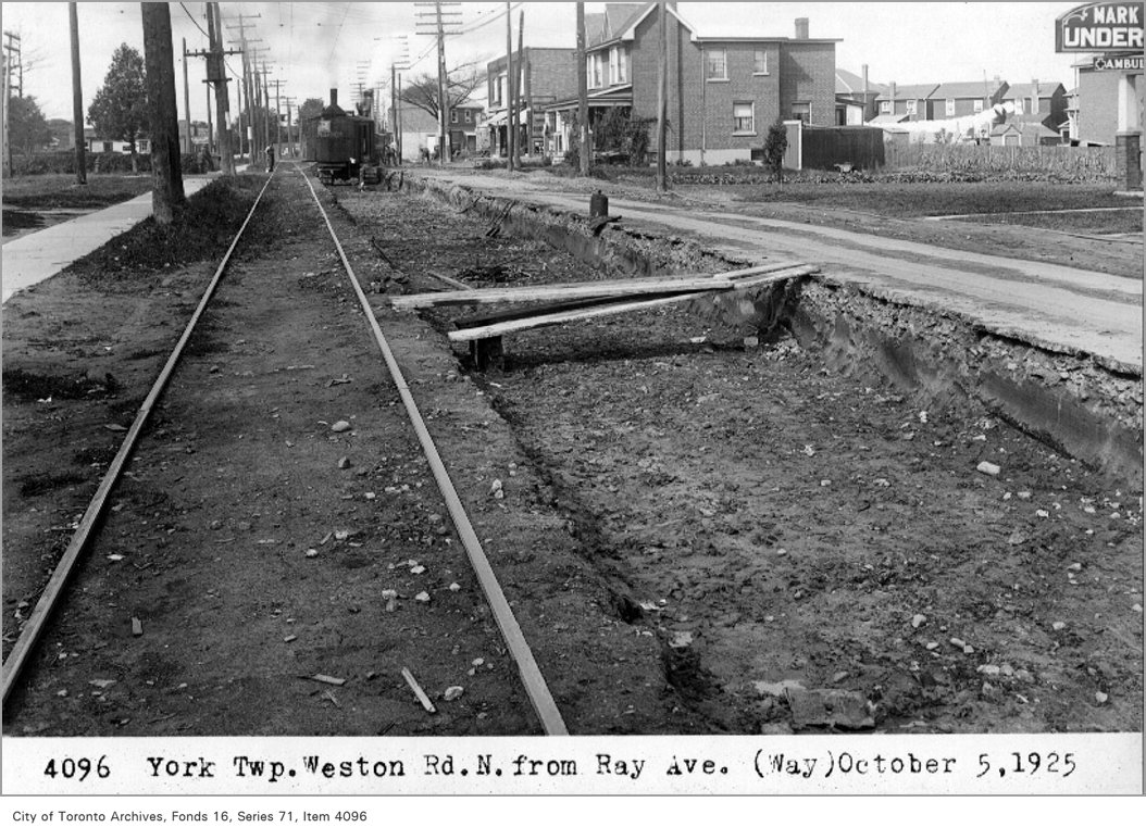
Photo locations are matched from each photo’s title against City street and address data, so some may be off. Report a wrong location