Skip to content
My Address in Toronto
Address report

1097 Queen St E

An address in South Riverdale, outside TRCA flood and shoreline hazard areas, with no active development applications within 250 metres.

Data as of Nov 7, 2026 · Every item lists its source

Follow this address
Key findings
  • Outside TRCA flood and shoreline hazard areas.
  • 0 active development applications and 4 Committee of Adjustment applications within 250 m.
RentSafe score—not a registered apartment building
Fire code violations—no inspection records
Applications4active within 250 m
Flood hazardOutsideTRCA mapping
Berkshire AvePape AveLarchmount AveHeward AveWinnifred AveCaroline AveRushbrooke AveLouvain AveBlong AveCurzon StBrooklyn AveBoston AveJones AveColgate AveEastern AveCarlaw AveQueen St E1234Map data: City of Toronto (Toronto Centreline)
The red circle shows the 250-metre radius used for “Nearby” items. Numbers match the applications listed below.

01The building

ItemFindingPrecisionSource · as of
RentSafe evaluationNot a registered apartment buildingThis addressApartment Building Evaluation
Fire code inspectionsNo inspection recordsThis addressResidential Fire Inspection Results
Building orders and noticesNone on recordThis addressBuilding Construction/Demolition Violations
Building permits, last 5 years0 permitsThis addressBuilding Permits · 4 on record
Short-term rentalNot registeredThis addressShort Term Rentals Registration
Heritage statusNot on the Heritage RegisterThis addressHeritage Register
Recent permits (4)
  • Building Permit Related(MS) · Closed · Jul 2, 2019
    HVAC - Proposal for interior alterations to second floor residential unit of existing mixed use building. UNIT 201 · Permit 18 198953 HVA
  • Building Permit Related(PS) · Closed · Oct 4, 2018
    Plumbing - Proposal for interior alterations to second floor residential unit of existing mixed use building. · Permit 18 198953 PLB
  • Interior Alterations · Closed · Sep 7, 2018
    Proposal for interior alterations to second floor residential unit of existing mixed use building. · Permit 18 198953 BLD
  • Sign Building Permit Related · Closed · Jun 22, 2018
    In conjunction with a two storey building on the premises, proposal to erect and display one illuminated (externally) wall sign, displaying static copy, located on the first storey of the north… · Permit 13 261837 DST

02Risks and the ground

ItemFindingPrecisionSource · as of
River flood hazardOutsideThis addressTRCA Regulation mapping 2025
Lake shoreline hazardOutsideThis addressTRCA Regulation mapping 2025
TRCA regulated areaOutsideThis addressTRCA Regulation mapping 2025
Basement flooding study areaBFA32Your areaBasement Flooding Study Areas · the City divides all of Toronto into study areas; this names yours, not a risk level
Lead in tap water samples, postal area M4M10 of 357 above 0.01 ppmYour area · M4MNon Regulated Lead Sample · Jan 8, 2014 to Oct 5, 2026

TRCA mapping is for screening, not site-specific decisions. Lead results are voluntary samples from homes in the postal area, not this address.

03What’s changing nearby

Nov
25
Nearby · 157 mCommittee of Adjustment hearing: 27 Brooklyn Ave9:30 a.m. · Committee of Adjustment · Minor variance · File A0615/26TEY
Dec
2
Nearby · 74 mCommittee of Adjustment hearing: 111 Caroline Ave9:30 a.m. · Committee of Adjustment · Minor variance · File A0744/26TEY
  1. 1
    111 Caroline Ave · 74 m · Committee of Adjustment · Minor variance · Hearing Scheduled
    To construct a new one-storey detached ancillary building (containing a one-car garage), in the rear yard, abutting the laneway.
    File A0744/26TEY · submitted Oct 23, 2026
  2. 2
    65 Caroline Ave · 157 m · Committee of Adjustment · Minor variance · TLAB Appeal
    To alter the existing two-storey semi-detached dwelling by constructing a rear ground floor deck with a wood privacy screen.
    File A0749/21TEY · submitted Jun 4, 2021
  3. 3
    27 Brooklyn Ave · 157 m · Committee of Adjustment · Minor variance · Hearing Scheduled
    To construct a new two-storey detached ancillary building (containing a one-car garage, and an exterior staircase that will lead to a rooftop deck), in the rear yard, abutting the laneway.
    File A0615/26TEY · submitted Aug 21, 2026
  4. 4
    31 Bertmount Ave · 183 m · Committee of Adjustment · Minor variance · Application Received
    File · submitted Nov 3, 2021

Development Applications; Committee of Adjustment Applications · 9 registered short-term rentals within 250 m.

04City services

ItemFindingPrecisionSource · as of
Garbage dayNovember 19, 2026This addressCollection calendar Thursday 1
Next recyclingNovember 12, 2026This addressSolid Waste Collection Schedule
City councillorPaula FletcherWard 14councillor_fletcher@toronto.ca · 416-392-4060

05Quick answers about 1097 Queen St E

Is 1097 Queen St E in a flood plain?

No. It is outside TRCA's mapped flood and shoreline hazard areas. Source: TRCA Regulation mapping 2025.

What is being built near 1097 Queen St E?

0 active development applications within 250 metres. Source: Development Applications.

When is garbage day at 1097 Queen St E?

Collection calendar Thursday 1. Next garbage pickup: Nov 19, 2026. Source: Solid Waste Collection Schedule.

Answers are generated from the data on this page and update when the data changes.

06From the archives
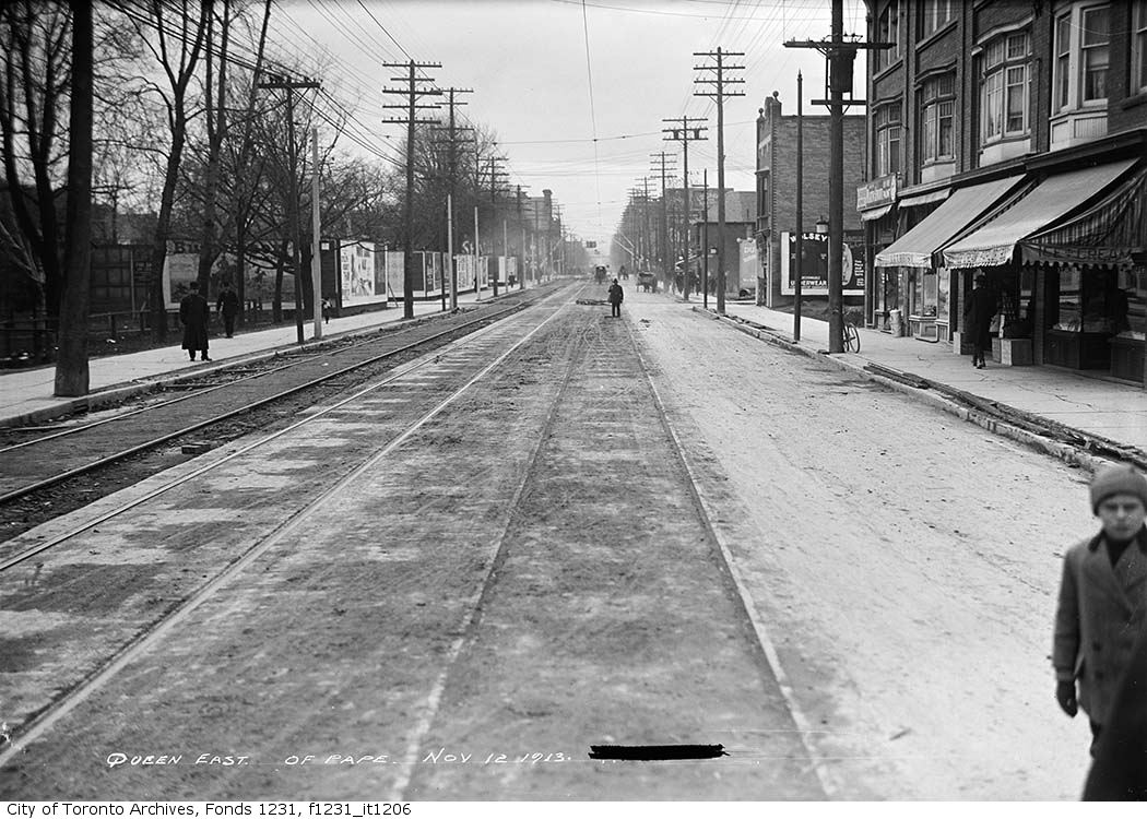
Queen Street east of Pape Avenue
Queen Street east of Pape Avenue, 1913. City of Toronto Archives, Fonds 1231, Item 1206. 148 m away.
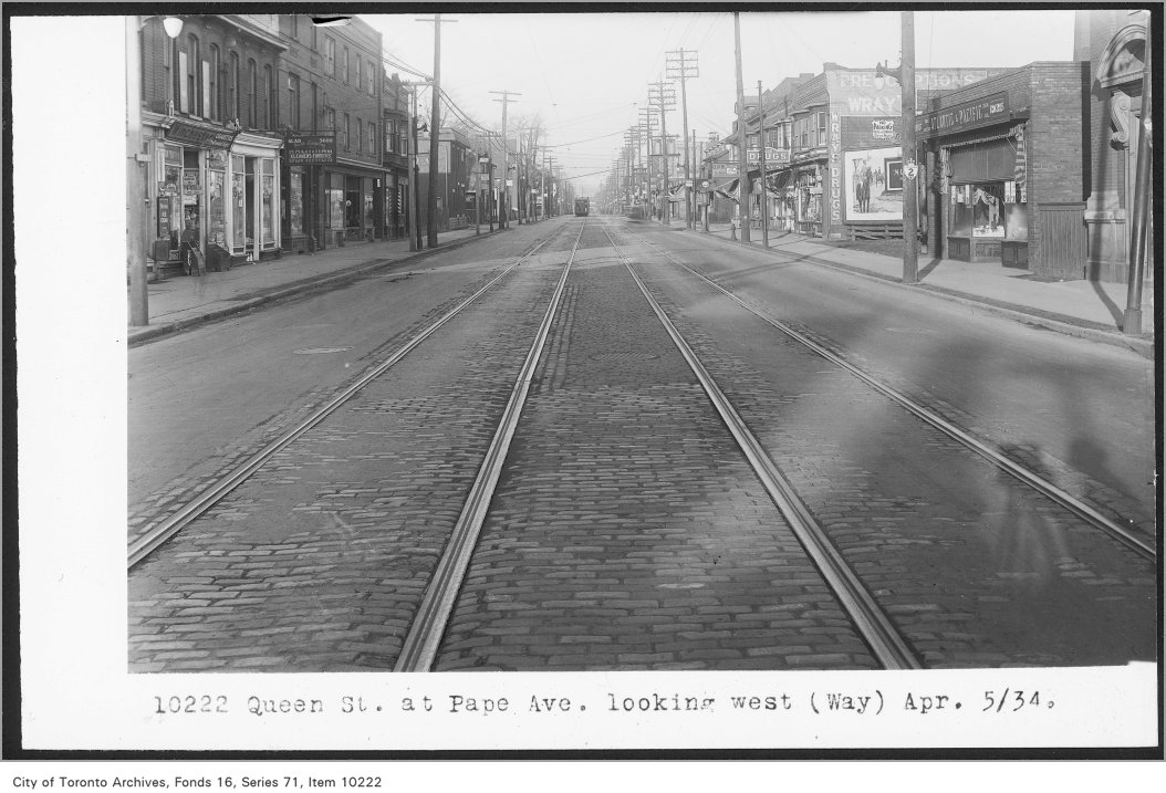
Queen St, at Pape Ave, looking west, (Way Department)
Queen St, at Pape Ave, looking west, (Way Department), 1934. City of Toronto Archives, Fonds 16, Series 71, Item 10222. 148 m away.
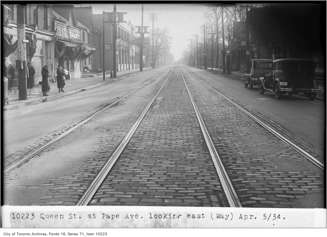
Queen St, at Pape Ave, looking east, (Way Department)
Queen St, at Pape Ave, looking east, (Way Department), 1934. City of Toronto Archives, Fonds 16, Series 71, Item 10223. 148 m away.
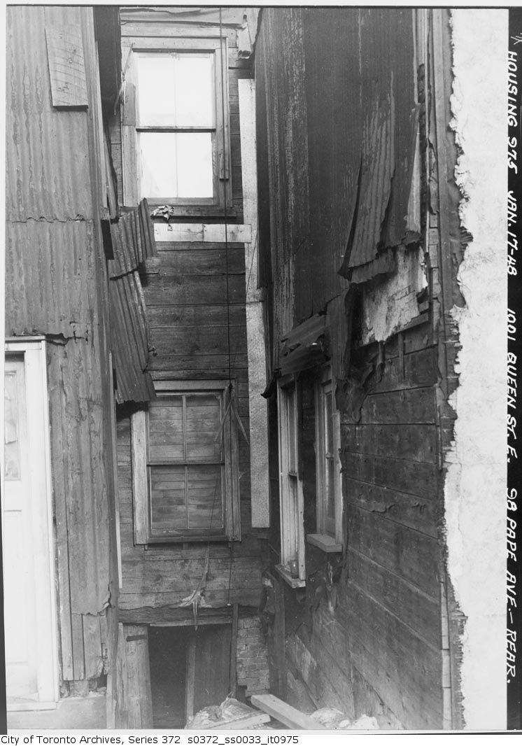
1001 Queen Street E. & 98 Pape Avenue - rear
1001 Queen Street E. & 98 Pape Avenue - rear, 1948. City of Toronto Archives, Fonds 200, Series 372, Subseries 33, Item 975. 148 m away.
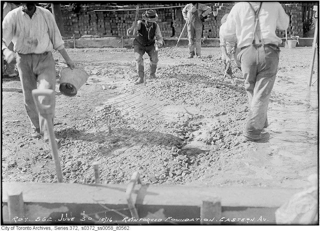
Eastern Ave. between Carlaw and Leslie reinforced concrete foundation
Eastern Ave. between Carlaw and Leslie reinforced concrete foundation, 1916. City of Toronto Archives, Fonds 200, Series 372, Subseries 58, Item 562. 241 m away.
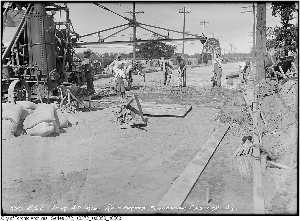
Eastern Ave. between Carlaw and Leslie reinforced concrete foundation
Eastern Ave. between Carlaw and Leslie reinforced concrete foundation, 1916. City of Toronto Archives, Fonds 200, Series 372, Subseries 58, Item 563. 241 m away.
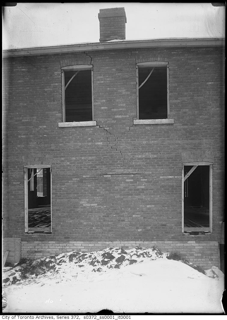
Heward Avenue south of Queen, west side — Cracks in brickwork of house
Heward Avenue south of Queen, west side — Cracks in brickwork of house, 1912. City of Toronto Archives, Fonds 200, Series 372, Subseries 1, Item 1. 248 m away.
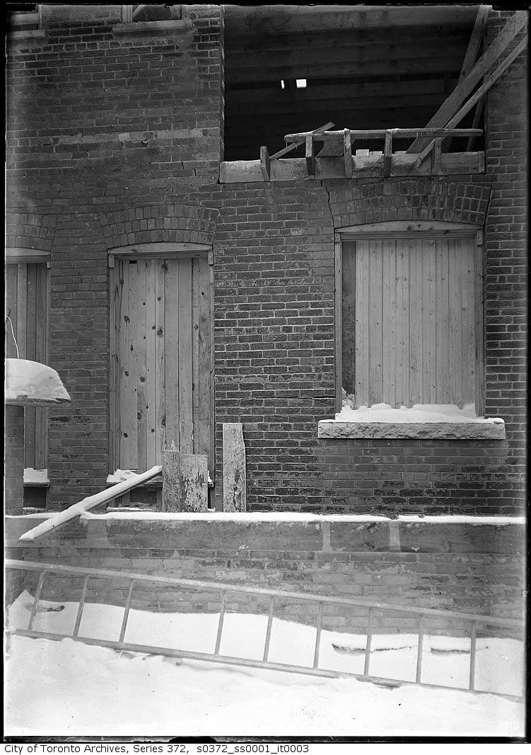
Heward Avenue south of Queen, west side — Cracks in brickwork of house
Heward Avenue south of Queen, west side — Cracks in brickwork of house, 1912. City of Toronto Archives, Fonds 200, Series 372, Subseries 1, Item 3. 248 m away.
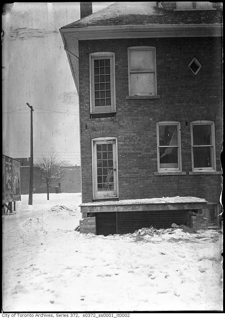
Heward Avenue south of Queen, west side — Cracks in brickwork of house
Heward Avenue south of Queen, west side — Cracks in brickwork of house, 1912. City of Toronto Archives, Fonds 200, Series 372, Subseries 1, Item 2. 248 m away.

Photo locations are matched from each photo’s title against City street and address data, so some may be off. Report a wrong location

1097 Queen St E, Toronto — address report · My Address in Toronto