Skip to content
My Address in Toronto
Address report

129 Kane Ave

129 Kane Ave is in Keelesdale-Eglinton West. It's outside TRCA flood hazard areas, with 2 planning applications within 250 metres.

Data as of Nov 8, 2026 · Every item lists its source

Follow this address
Key findings
  • Outside TRCA flood and shoreline hazard areas.
  • 0 active development applications and 2 Committee of Adjustment applications within 250 m.
Building permits3in the last 5 years
Applications nearby2active, within 250 m
Flood hazardOutsideTRCA mapping
HeritageNot listedCity Heritage Register
Keele StRogers RdScott RdDunraven DrRegent StAileen AveSilverthorn AveBlackthorn AveRosethorn AveKenora CresWatt AveKersdale AveChambers AveKane AveDonald AveFailsworth Ave12Map data: City of Toronto (Toronto Centreline)Rogers RdRosethorn AveWatt AveKersdale AveChambers AveKane AveAileen AveDonald AveDunraven DrSilverthorn AveScott Rd12Map data: City of Toronto (Toronto Centreline)
The red dot is 129 Kane Ave. The circle shows 250 metres, about a 3-minute walk. Numbers match the applications in “What’s changing nearby”.

03The building

ItemFindingPrecisionSource
Building orders and noticesNone on recordThis addressBuilding Construction/Demolition Violations
Building permits, last 5 years3 permitsThis addressBuilding Permits · 3 on record
Short-term rentalNot registeredThis addressShort Term Rentals Registration
Heritage statusNot on the Heritage RegisterThis addressHeritage Register
Most recent permits (3 of 3)
  • Multiple Projects · Inspection · Mar 28, 2023
    Interior alterations, basement underpinning to existing dwelling · Permit 22 225413 BLD
  • Building Permit Related(PS) · Closed · Mar 28, 2023
    Plumbing - Interior alterations, basement underpinning to existing dwelling · Permit 22 225413 PLB
  • Building Permit Related (DR) · Closed · Mar 28, 2023
    Drain - Interior alterations, basement underpinning to existing dwelling · Permit 22 225413 DRN

04Risks and the ground

ItemFindingPrecisionSource
River flood hazardOutsideThis addressTRCA Regulation mapping 2025
Lake shoreline hazardOutsideThis addressTRCA Regulation mapping 2025
TRCA regulated areaOutsideThis addressTRCA Regulation mapping 2025
Lead in tap-water tests, postal area M6M4.2% of tests above Ontario's limitYour area · M6MNon Regulated Lead Sample · 95 tests, Jan 27, 2014 to Aug 23, 2026

TRCA mapping is for screening, not site-specific decisions. Lead results are voluntary samples from homes in the postal area, not this address.

01What’s changing nearby

  1. 1
    150 Aileen Ave · 95 m away
    Committee of Adjustment · Minor variance
    File A0308/26EYK · submitted Jun 22, 2026
  2. 2
    84 Kersdale Ave · 125 m away
    Committee of Adjustment · Minor variance
    To construct a new detached dwelling with an attached garage.
    File A0272/26EYK · submitted Aug 14, 2026
Short-term rentals nearby0 registered homesWithin 250 mShort Term Rentals Registration

Development Applications; Committee of Adjustment Applications; Short Term Rentals Registration.

02City services

ItemFindingPrecisionSource
Garbage dayNovember 20, 2026This addressSolid Waste Collection Schedule
City councillorFrances NunziataWard 5councillor_nunziata@toronto.ca · 416-392-4091

05Quick answers about 129 Kane Ave

Is 129 Kane Ave in a flood plain?

No. It is outside TRCA's mapped flood and shoreline hazard areas. Source: TRCA Regulation mapping 2025.

What is being built near 129 Kane Ave?

0 active development applications within 250 metres. Source: Development Applications.

When is garbage day at 129 Kane Ave?

Collection calendar Friday 1. Next garbage pickup: Nov 20, 2026. Source: Solid Waste Collection Schedule.

Answers are generated from the data on this page and update when the data changes.

06From the archives
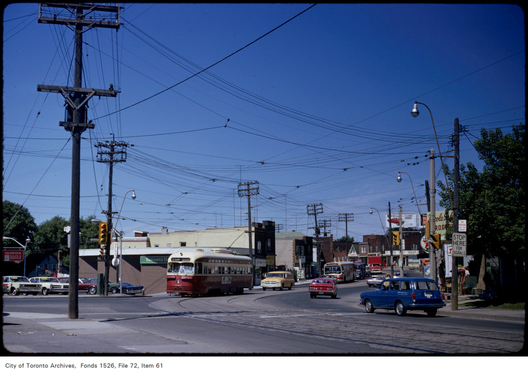
View of Rogers Road from Old Weston Road
1972 · 249 m awayView of Rogers Road from Old Weston RoadCity of Toronto Archives, Fonds 1526, File 72, Item 61
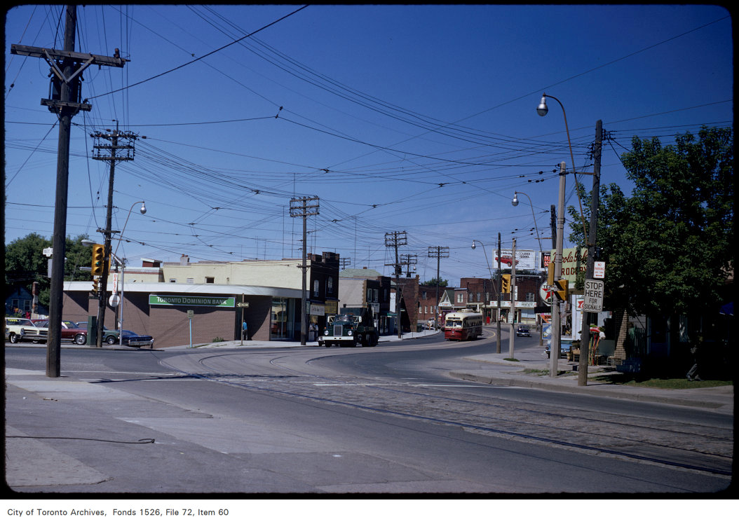
View of Rogers Road from Old Weston Road
1972 · 249 m awayView of Rogers Road from Old Weston RoadCity of Toronto Archives, Fonds 1526, File 72, Item 60
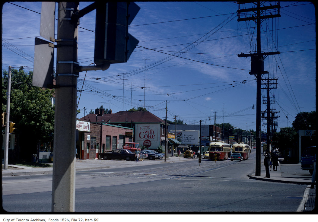
View of Rogers Road looking east from Old Weston Road
1972 · 249 m awayView of Rogers Road looking east from Old Weston RoadCity of Toronto Archives, Fonds 1526, File 72, Item 59

Photo locations are matched from each photo’s title against City street and address data, so some may be off. Report a wrong location

129 Kane Ave, Toronto M6M: permits, flood risk and what's planned nearby · My Address in Toronto