Skip to content
My Address in Toronto
Address report

136 Collier St

A property on the Heritage Register (Listed), outside TRCA flood and shoreline hazard areas, with 4 active development applications within 250 metres.

Data as of Nov 7, 2026 · Every item lists its source

Follow this address
Key findings
  • On the Heritage Register (Listed).
  • Outside TRCA flood and shoreline hazard areas.
  • 4 active development applications and 1 Committee of Adjustment application within 250 m.
RentSafe score—not a registered apartment building
Fire code violations—no inspection records
Applications5active within 250 m
Flood hazardOutsideTRCA mapping
Huntley StCollier StScollard StYorkville AveReynolds StSt Paul's SqAsquith AveRosedale Valley RdPark RdPine Hill RdCumberland StSevern StTed Rogers WayMount Pleasant RdBloor St EYonge StChurch StDavenport RdAylmer Ave12345Map data: City of Toronto (Toronto Centreline)
The red circle shows the 250-metre radius used for “Nearby” items. Numbers match the applications listed below.

01The building

ItemFindingPrecisionSource · as of
RentSafe evaluationNot a registered apartment buildingThis addressApartment Building Evaluation
Fire code inspectionsNo inspection recordsThis addressResidential Fire Inspection Results
Building orders and noticesNone on recordThis addressBuilding Construction/Demolition Violations
Building permits, last 5 years0 permitsThis addressBuilding Permits · 0 on record
Short-term rentalNot registeredThis addressShort Term Rentals Registration
Heritage statusListedThis addressHeritage Register

02Risks and the ground

ItemFindingPrecisionSource · as of
River flood hazardOutsideThis addressTRCA Regulation mapping 2025
Lake shoreline hazardOutsideThis addressTRCA Regulation mapping 2025
TRCA regulated areaOutsideThis addressTRCA Regulation mapping 2025
Basement flooding study areaBFA44Your areaBasement Flooding Study Areas · the City divides all of Toronto into study areas; this names yours, not a risk level
Lead in tap water samples, postal area M4W1 of 58 above 0.01 ppmYour area · M4WNon Regulated Lead Sample · Apr 27, 2014 to Feb 1, 2026

TRCA mapping is for screening, not site-specific decisions. Lead results are voluntary samples from homes in the postal area, not this address.

03What’s changing nearby

  1. 1
    50 Park Rd · 190 m · Official Plan / Rezoning · OMB Appeal
    Proposed 31-storey (107.9 metres) purpose-built rental building and the restoration and adaptive reuse of the heritage building at 50 Park Road, which is proposed to be integrated into the new development. The proposed development…
    File 25 209063 STE 11 OZ · submitted Aug 12, 2025 · City record
  2. 2
    40 Park Rd · 210 m · Official Plan / Rezoning · OMB Appeal
    Proposed 31-storey (107.9 metres) purpose-built rental building and the restoration and adaptive reuse of the heritage building at 50 Park Road, which is proposed to be integrated into the new development. The proposed development…
    File 25 209063 STE 11 OZ · submitted Aug 12, 2025 · City record
  3. 3
    2 Elm Ave · 226 m · Condominium · Draft Plan Approved
    Draft Plan of Condominium for 819 units.
    File 21 214202 STE 11 CD · submitted Sep 17, 2021 · City record
  4. 4
    38 Park Rd · 229 m · Official Plan / Rezoning · OMB Appeal
    Proposed 31-storey (107.9 metres) purpose-built rental building and the restoration and adaptive reuse of the heritage building at 50 Park Road, which is proposed to be integrated into the new development. The proposed development…
    File 25 209063 STE 11 OZ · submitted Aug 12, 2025 · City record
  5. 5
    820 Church St · 154 m · Committee of Adjustment · Minor variance · Approved
    To alter the development standards for a 38-storey hotel building (as approved under Site Specific Zoning By-law 300-2023) by increasing the non-residential gross floor area, building height, and mechanical penthouse height. The new…
    File A0616/24TEY · submitted Jul 9, 2024

Development Applications; Committee of Adjustment Applications · 3 registered short-term rentals within 250 m.

04City services

ItemFindingPrecisionSource · as of
Garbage dayNovember 18, 2026This addressCollection calendar Wednesday 1
Next recyclingNovember 11, 2026This addressSolid Waste Collection Schedule
City councillorDianne SaxeWard 11Councillor_Saxe@toronto.ca · 416-392-4009

05Quick answers about 136 Collier St

Is 136 Collier St in a flood plain?

No. It is outside TRCA's mapped flood and shoreline hazard areas. Source: TRCA Regulation mapping 2025.

What is being built near 136 Collier St?

4 active development applications within 250 metres, the closest at 50 Park Rd (190 m). Source: Development Applications.

When is garbage day at 136 Collier St?

Collection calendar Wednesday 1. Next garbage pickup: Nov 18, 2026. Source: Solid Waste Collection Schedule.

Answers are generated from the data on this page and update when the data changes.

06From the archives
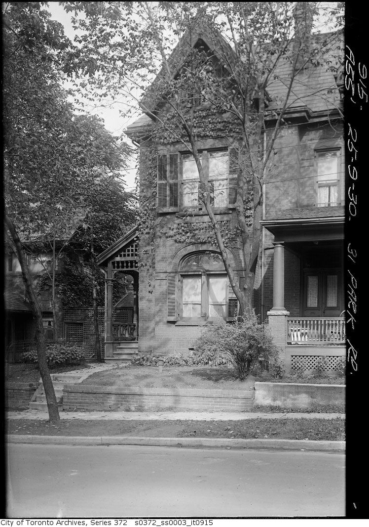
31 Park Road — Church Street Extension
31 Park Road — Church Street Extension, 1930. City of Toronto Archives, Fonds 200, Series 372, Subseries 3, Item 915. 81 m away.
29 Park Road — Church Street Extension
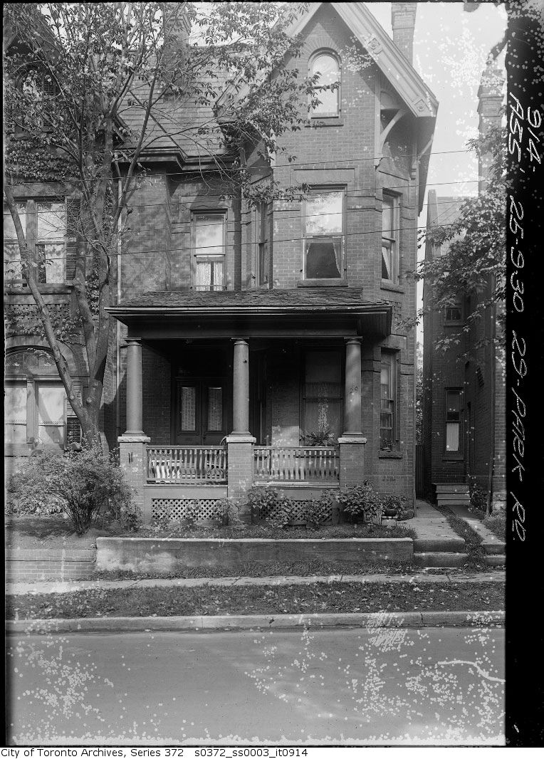
29 Park Road — Church Street Extension, 1930. City of Toronto Archives, Fonds 200, Series 372, Subseries 3, Item 914. 81 m away.
27 Park Road — Church Street Extension
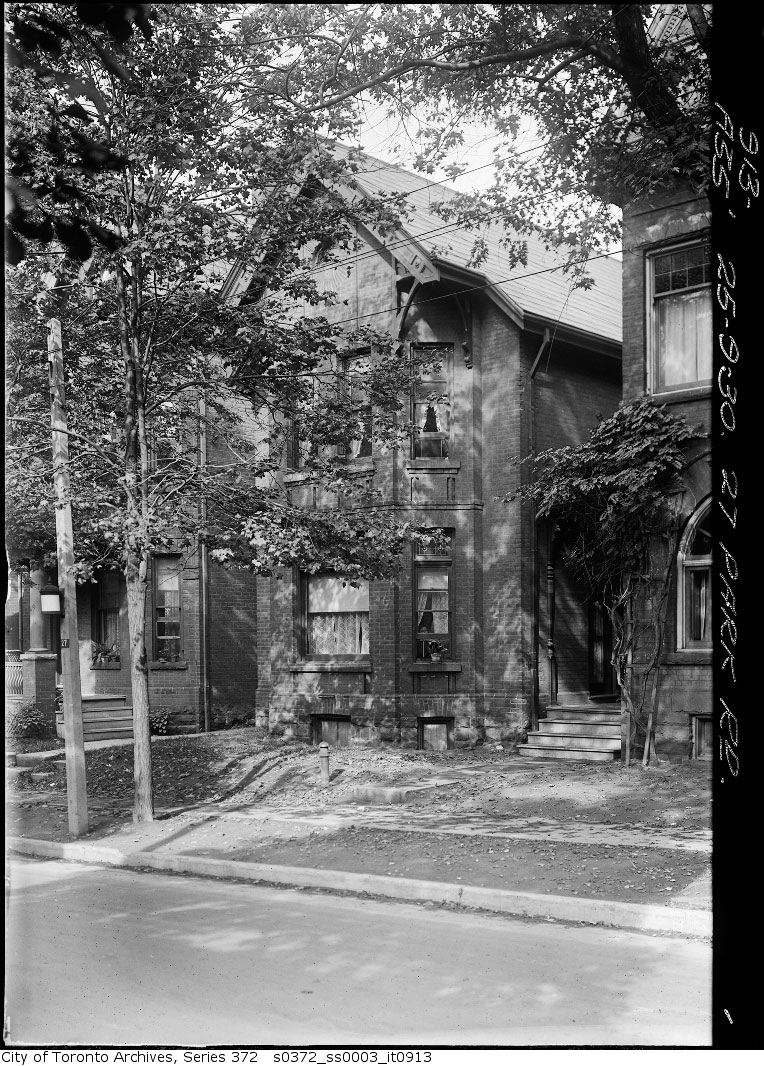
27 Park Road — Church Street Extension, 1930. City of Toronto Archives, Fonds 200, Series 372, Subseries 3, Item 913. 81 m away.
60-62 Asquith Avenue — Church Street Extension
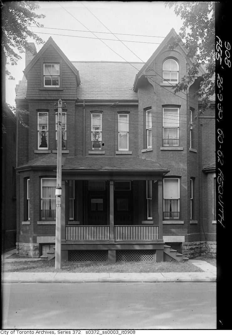
60-62 Asquith Avenue — Church Street Extension, 1930. City of Toronto Archives, Fonds 200, Series 372, Subseries 3, Item 908. 91 m away.
Church Street extension, wrecking on Asquith Avenue
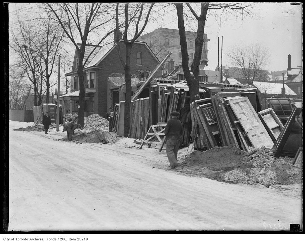
Church Street extension, wrecking on Asquith Avenue, 1931. City of Toronto Archives, Fonds 1266, Item 23219. 91 m away.
68-70 Asquith Avenue — Church Street Extension
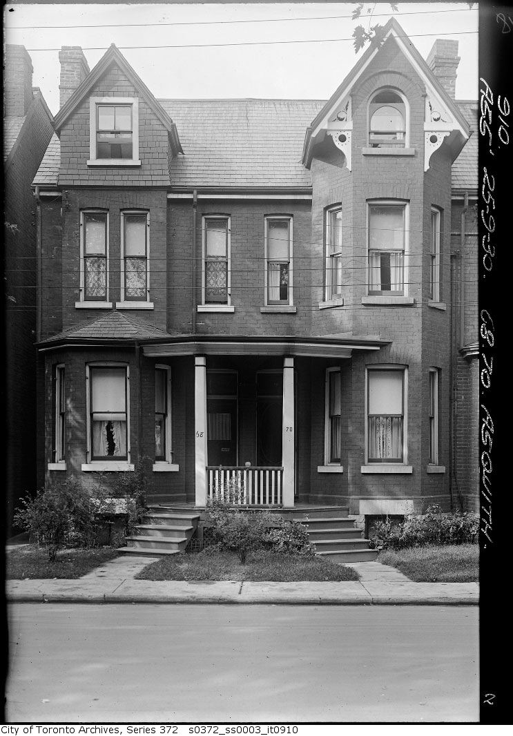
68-70 Asquith Avenue — Church Street Extension, 1930. City of Toronto Archives, Fonds 200, Series 372, Subseries 3, Item 910. 91 m away.
64-66 Asquith Avenue — Church Street Extension
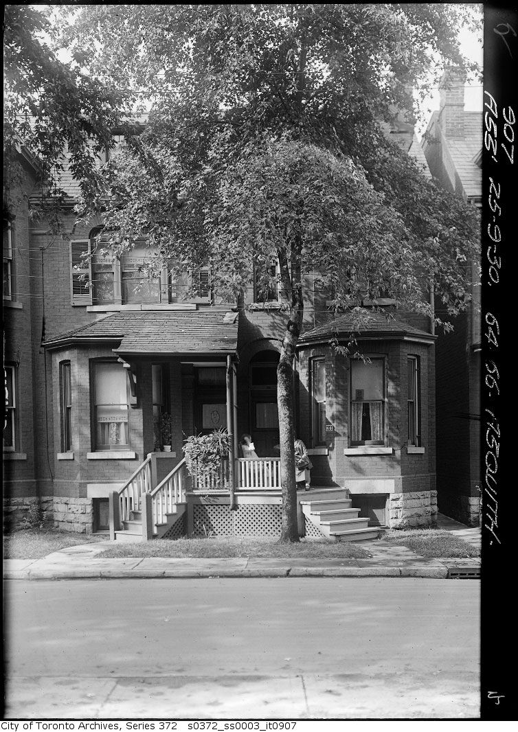
64-66 Asquith Avenue — Church Street Extension, 1930. City of Toronto Archives, Fonds 200, Series 372, Subseries 3, Item 907. 91 m away.
52-54 Asquith Avenue — Church Street Extension
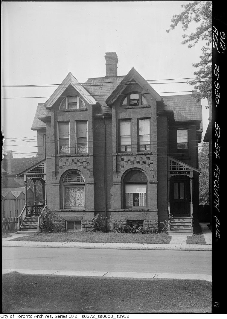
52-54 Asquith Avenue — Church Street Extension, 1930. City of Toronto Archives, Fonds 200, Series 372, Subseries 3, Item 912. 91 m away.
Church Street extension, wrecking on Asquith Avenue
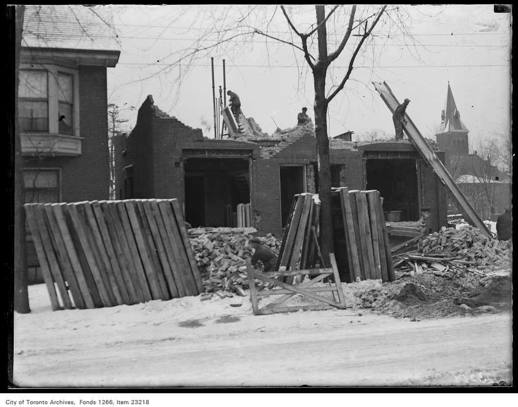
Church Street extension, wrecking on Asquith Avenue, 1931. City of Toronto Archives, Fonds 1266, Item 23218. 91 m away.

Photo locations are matched from each photo’s title against City street and address data, so some may be off. Report a wrong location

136 Collier St, Toronto — address report · My Address in Toronto