178 Queens Quay E
An address in St Lawrence-East Bayfront-The Islands, outside TRCA flood and shoreline hazard areas, with 15 active development applications within 250 metres.
Data as of Nov 8, 2026 · Every item lists its source
- Outside TRCA flood and shoreline hazard areas.
- 15 active development applications and 1 Committee of Adjustment application within 250 m.
01The building
Recent permits (8)
- Partial Permit - Shoring · Examiner's Notice Sent · Apr 14, 2023
Part Permit - PROPOSED: Construct a mixed-use building with 3 residential towers (19,15 and 23 storeys)situated over 4-levels below-grade parking and 6 storey podium .The West tower will be 19… · Permit 23 128918 SHO - Partial Permit - Structural Framing · Under Review · Apr 14, 2023
Part Permit - PROPOSED: Construct a mixed-use building with 3 residential towers (19,15 and 23 storeys)situated over 4-levels below-grade parking and 6 storey podium .The West tower will be 19… · Permit 23 128913 STR - Partial Permit - Structural Framing · Under Review · Apr 14, 2023
Part Permit - PROPOSED: Construct a mixed-use building with 3 residential towers (19,15 and 23 storeys)situated over 4-levels below-grade parking and 6 storey podium .The West tower will be 19… · Permit 23 128918 STR - Partial Permit - Foundation · Examiner's Notice Sent · Apr 14, 2023
Part Permit - PROPOSED: Construct a mixed-use building with 3 residential towers (19,15 and 23 storeys)situated over 4-levels below-grade parking and 6 storey podium .The West tower will be 19… · Permit 23 128918 FND - Partial Permit - Structural Framing · Under Review · Apr 14, 2023
Part Permit - PROPOSED: Construct a mixed-use building with 3 residential towers (19,15 and 23 storeys)situated over 4-levels below-grade parking and 6 storey podium .The West tower will be 19… · Permit 23 128885 STR - Building Permit Related (DR) · Refusal Notice · Apr 5, 2023
Drain - PROPOSED: Construct a mixed-use building with 3 residential towers (19,15 and 23 storeys)situated over 4-levels below-grade parking and 6 storey podium .The West tower will be 19 storeys,the… · Permit 23 128885 DRN - Building Permit Related (DR) · Refusal Notice · Apr 5, 2023
Drain - PROPOSED: Construct a mixed-use building with 3 residential towers (19,15 and 23 storeys)situated over 4-levels below-grade parking and 6 storey podium .The West tower will be 19 storeys,the… · Permit 23 128918 DRN - Building Permit Related (DR) · Refusal Notice · Apr 5, 2023
Drain - PROPOSED: Construct a mixed-use building with 3 residential towers (19,15 and 23 storeys)situated over 4-levels below-grade parking and 6 storey podium .The West tower will be 19 storeys,the… · Permit 23 128913 DRN
02Risks and the ground
TRCA mapping is for screening, not site-specific decisions. Lead results are voluntary samples from homes in the postal area, not this address.
03What’s changing nearby
- 1215 Lake Shore Blvd E · 146 m · Site Plan · NOAC IssuedSite Plan Application for Phase 1 of the 215 Lake Shore Boulevard E proposed development to permit two mixed use buildings with a total of three towers with heights of 54, 44, and 15 storeys, containing 1,261 units and 609.8 square metres…File 17 228459 STE 28 SA · submitted Sep 6, 2017 · City record
- 2215 Lake Shore Blvd E · 146 m · Subdivision · Amend Drft Plan AppDraft Plan of Subdivision to: establish and convey a portion of a new east-west local road to the City of Toronto; facilitate the realignment and widening of a section of Lower Sherbourne Street, and; divide the site into two lots for…File 17 180289 STE 28 SB · submitted Jun 14, 2017 · City record
- 3215 Lake Shore Blvd E · 146 m · Official Plan / Rezoning · Council ApprovedThe application for Phase 2 of 215 Lake Shore Boulevard E proposes to amend the Official Plan and Zoning By-law to permit a multi-tower mixed use development with a total of 1,383 residential dwelling units and 815 sq. metres of…File 21 110243 STE 10 OZ · submitted Jan 29, 2021 · City record
- 4180 Queens Quay E · 202 m · Subdivision · Draft Plan ApprovedINACTIVE Draft Plan of Subdivision application to facilitate dedication of a portion of the lands for road widening and realignmentFile 17 278451 STE 28 SB · submitted Dec 21, 2017 · City record
- 5180 Queens Quay E · 202 m · Site Plan · Under ReviewSite Plan Approval for two mixed-use buildings including three 15, 18 and 22 storey elements on 5-storey podiums with ground floor retail. The buildings are connected by a proposed mid-block Privately-Owned Publicly Accessibly Space…File 20 150180 STE 10 SA · submitted May 29, 2020 · City record
- 6180 Queens Quay E · 202 m · Official Plan / Rezoning · Under ReviewZoning By-law Amendment Application to lift the "H"" Holding Symbol that currently applies to the subject site.File 22 106787 STE 10 OZ · submitted Jan 24, 2022 · City record
- 7259 Lake Shore Blvd E · 204 m · Site Plan · Under ReviewSite plan application for Quayside Building 2, a 56 storey, 618 unit building to be delivered as part of the Quayside project. The proposed development includes a total GFA of 40,654 square metres (m2), comprised of 40,384 m2 of…File 25 231195 STE 10 SA · submitted Sep 26, 2025 · City record
- 8259 Lake Shore Blvd E · 204 m · Site Plan · Under Review"Master Site Plan Application" for Quayside Blocks 1 & 2 ground floor and below grade elements.This Master Site Plan Application addresses ground floor design and landscaping, including the community forest, as well as matters of parking,…File 23 167822 STE 10 SA · submitted Jun 29, 2023 · City record
- 9259 Lake Shore Blvd E · 204 m · Site Plan · Under ReviewSite Plan Control application for Quayside Building 1C Two proposed 12-storey (39 m) buildings containing a total of 397 units, all of which are affordable rental units. 886 m2 of ground-level retail and a 1877 community hub is also…File 23 167863 STE 10 SA · submitted Jun 29, 2023 · City record
- 10259 Lake Shore Blvd E · 204 m · Official Plan / Rezoning · Under ReviewZoning By-law Amendment - Lifting of the H Symbol for 23 167778 STE 10 OZ, 25 231179 STE 10 OZ, and 26 149454 STE 10 OZFile 26 117227 STE 10 OZ · submitted Feb 13, 2026 · City record
- 11259 Lake Shore Blvd E · 204 m · Part Lot Control · ApprovedProposed Part Lot Control Exemption for Blocks 1 & 2 of the Quayside development to enable various land divisions and land interests to support the development of these blocks.File 23 167867 STE 10 PL · submitted Jun 29, 2023 · City record
- 12259 Lake Shore Blvd E · 204 m · Subdivision · Under ReviewQuayside development - Proposed Draft Plan of Subdivision to establish eight blocks, including the Queens Quay East extension, a realigned Parliament Street, three development blocks (Blocks 3, 4 and 5 of the Quayside development), two…File 23 170161 STE 10 SB · submitted Jul 5, 2023 · City record
Development Applications; Committee of Adjustment Applications · 0 registered short-term rentals within 250 m.
04City services
05Quick answers about 178 Queens Quay E
Is 178 Queens Quay E in a flood plain?
No. It is outside TRCA's mapped flood and shoreline hazard areas. Source: TRCA Regulation mapping 2025.
What is being built near 178 Queens Quay E?
15 active development applications within 250 metres, the closest at 215 Lake Shore Blvd E (146 m). Source: Development Applications.
Answers are generated from the data on this page and update when the data changes.
06From the archives
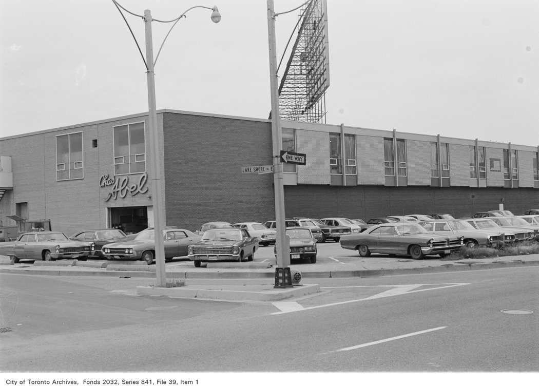
Photo locations are matched from each photo’s title against City street and address data, so some may be off. Report a wrong location