18 Sanderstead Ave
An address in Briar Hill-Belgravia, outside TRCA flood and shoreline hazard areas, with 6 active development applications within 250 metres.
Data as of Nov 8, 2026 · Every item lists its source
- Outside TRCA flood and shoreline hazard areas.
- 6 active development applications and 3 Committee of Adjustment applications within 250 m.
01The building
Recent permits (1)
- Porch · Closed · Jun 10, 2008
new front porch · Permit 08 168194 BLD
02Risks and the ground
TRCA mapping is for screening, not site-specific decisions. Lead results are voluntary samples from homes in the postal area, not this address.
03What’s changing nearby
- 1250 Bowie Ave · 55 m · Official Plan / Rezoning · Under ReviewOfficial Plan and Zoning By-law Amendment application to permit a four block, phased redevelopment containing 9 mixed-use midrise and tall buildings ranging from 3 to 55-storeys consisting of 2,390 residential units (including a…File 24 242246 NNY 08 OZ · submitted Nov 22, 2024 · City record
- 2250 Bowie Ave · 55 m · Subdivision · Under ReviewProposed Draft Plan of Subdivision contains 6 blocks including one street and public park.The file is associated with OPA & Rezoning file 2024 242246 NNY 16 OZ.File 24 235912 NNY 08 SB · submitted Nov 6, 2024 · City record
- 3670 Caledonia Rd · 108 m · Subdivision · Under ReviewProposed Draft Plan of Subdivision contains 6 blocks including one street and public park.The file is associated with OPA & Rezoning file 2024 242246 NNY 16 OZ.File 24 235912 NNY 08 SB · submitted Nov 6, 2024 · City record
- 4670 Caledonia Rd · 108 m · Official Plan / Rezoning · Under ReviewOfficial Plan and Zoning By-law Amendment application to permit a four block, phased redevelopment containing 9 mixed-use midrise and tall buildings ranging from 3 to 55-storeys consisting of 2,390 residential units (including a…File 24 242246 NNY 08 OZ · submitted Nov 22, 2024 · City record
- 5680 Caledonia Rd · 147 m · Official Plan / Rezoning · Under ReviewOfficial Plan and Zoning By-law Amendment application to permit a four block, phased redevelopment containing 9 mixed-use midrise and tall buildings ranging from 3 to 55-storeys consisting of 2,390 residential units (including a…File 24 242246 NNY 08 OZ · submitted Nov 22, 2024 · City record
- 6680 Caledonia Rd · 147 m · Subdivision · Under ReviewProposed Draft Plan of Subdivision contains 6 blocks including one street and public park.The file is associated with OPA & Rezoning file 2024 242246 NNY 16 OZ.File 24 235912 NNY 08 SB · submitted Nov 6, 2024 · City record
- 710 Croham Rd · 93 m · Committee of Adjustment · Minor variance · Hearing ScheduledTo construct a three storey multiplex building. Please note, this application was previously deferred Thursday, April 25, 2024.File A0091/24NY · submitted Feb 9, 2024
- 843 Sanderstead Ave · 102 m · Committee of Adjustment · Consent (severance) · DeferredTo obtain consent to sever the property into two undersized residential lots. The proposed lots are undersized in terms of lot frontage only.File B0012/16NY · submitted Mar 1, 2016
- 943 Sanderstead Ave · 102 m · Committee of Adjustment · Minor variance · DeferredTo construct a new detached two-storey dwelling. File Numbers B0012/6NY, A0221/16NY and A0222/16NY will be considered jointly.File A0222/16NY · submitted Mar 1, 2016
Development Applications; Committee of Adjustment Applications · 1 registered short-term rentals within 250 m.
04City services
05Quick answers about 18 Sanderstead Ave
Is 18 Sanderstead Ave in a flood plain?
No. It is outside TRCA's mapped flood and shoreline hazard areas. Source: TRCA Regulation mapping 2025.
What is being built near 18 Sanderstead Ave?
6 active development applications within 250 metres, the closest at 250 Bowie Ave (55 m). Source: Development Applications.
When is garbage day at 18 Sanderstead Ave?
Collection calendar Friday 2. Next garbage pickup: Nov 13, 2026. Source: Solid Waste Collection Schedule.
Answers are generated from the data on this page and update when the data changes.
06From the archives
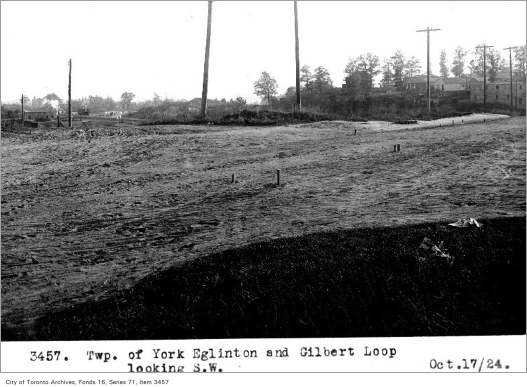
Photo locations are matched from each photo’s title against City street and address data, so some may be off. Report a wrong location