Skip to content
My Address in Toronto
Address report

187 Simpson Ave

187 Simpson Ave is in North Riverdale. It's outside TRCA flood hazard areas, with 2 planning applications within 250 metres.

Data as of Nov 8, 2026 · Every item lists its source

Follow this address
Key findings
  • Outside TRCA flood and shoreline hazard areas.
  • 1 active development application and 1 Committee of Adjustment application within 250 m.
Building permits3in the last 5 years
Applications nearby2active, within 250 m
Flood hazardOutsideTRCA mapping
HeritageNot listedCity Heritage Register
Gerrard StCarlaw AveLogan AveFirst AveBoston AveSimpson AvePape AveDe Grassi StHowland RdVictor AveLangley AveAustin AveBadgerow Ave12Map data: City of Toronto (Toronto Centreline)Gerrard StCarlaw AveRiverdale AveLangley AveLogan AveFirst AveThackeray StBoston AveSimpson AvePape AveVictor AveBadgerow AveTiverton Ave12Map data: City of Toronto (Toronto Centreline)
The red dot is 187 Simpson Ave. The circle shows 250 metres, about a 3-minute walk. Numbers match the applications in “What’s changing nearby”.

03The building

ItemFindingPrecisionSource
Building orders and noticesNone open (1 closed)This addressBuilding Construction/Demolition Violations
Building permits, last 5 years3 permitsThis addressBuilding Permits · 3 on record
Short-term rentalNot registeredThis addressShort Term Rentals Registration
Heritage statusNot on the Heritage RegisterThis addressHeritage Register
Most recent permits (3 of 3)
  • Accessory Building(s) · Revocation Pending · Nov 10, 2023
    Revision 02 - reduce the footing width and added a lintel detail · Permit 23 158196 BLD
  • Accessory Building(s) · Revocation Pending · Sep 13, 2023
    REV01: Multiple proposed changes to structure.Tree impact repairs to accessory structure · Permit 23 158196 BLD
  • Accessory Building(s) · Revocation Pending · Jul 7, 2023
    Tree impact repairs to accessory structure · Permit 23 158196 BLD

04Risks and the ground

ItemFindingPrecisionSource
River flood hazardOutsideThis addressTRCA Regulation mapping 2025
Lake shoreline hazardOutsideThis addressTRCA Regulation mapping 2025
TRCA regulated areaOutsideThis addressTRCA Regulation mapping 2025
Lead in tap-water tests, postal area M4K1.4% of tests above Ontario's limitYour area · M4KNon Regulated Lead Sample · 420 tests, Jan 2, 2014 to Oct 5, 2026

TRCA mapping is for screening, not site-specific decisions. Lead results are voluntary samples from homes in the postal area, not this address.

01What’s changing nearby

  1. 1
    165 Langley Ave · 188 m away
    Committee of Adjustment · Minor variance
    To alter the existing three-storey detached dwelling by constructing a rear two-storey addition with a ground floor deck and stairs,a rear and sides third storey addition with a rear third storey deck,a front basement walkout,a partial…
    File A0911/23TEY · submitted Oct 11, 2023
  2. 2
    425 Carlaw Ave · 203 m away
    Site Plan
    Site Plan Control Placeholder for Gerrard Station, one of the stations included in the Ontario Line Elevated Guideway and Stations contract.
    File 24 252705 STE 14 SA · submitted Dec 20, 2024 · City record
Short-term rentals nearby4 registered homesWithin 250 mShort Term Rentals Registration

Development Applications; Committee of Adjustment Applications; Short Term Rentals Registration.

02City services

ItemFindingPrecisionSource
Garbage dayNovember 19, 2026This addressSolid Waste Collection Schedule
City councillorPaula FletcherWard 14councillor_fletcher@toronto.ca · 416-392-4060

05Quick answers about 187 Simpson Ave

Is 187 Simpson Ave in a flood plain?

No. It is outside TRCA's mapped flood and shoreline hazard areas. Source: TRCA Regulation mapping 2025.

What is being built near 187 Simpson Ave?

1 active development application within 250 metres, the closest at 425 Carlaw Ave (203 m). Source: Development Applications.

When is garbage day at 187 Simpson Ave?

Collection calendar Thursday 1. Next garbage pickup: Nov 19, 2026. Source: Solid Waste Collection Schedule.

Answers are generated from the data on this page and update when the data changes.

06From the archives
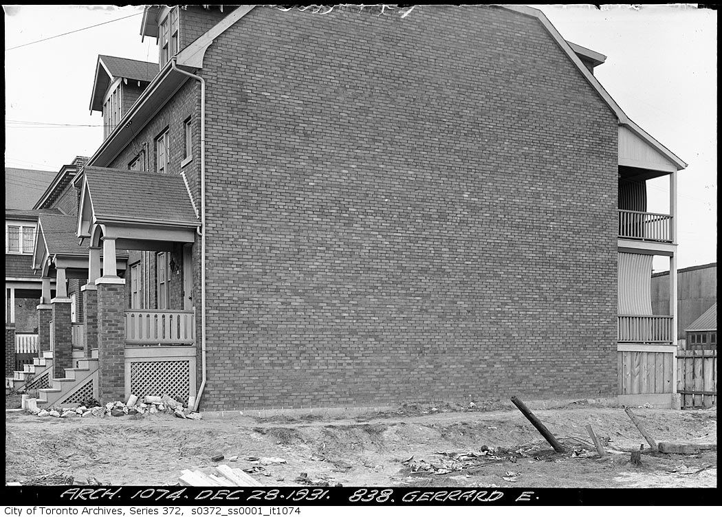
838 Gerrard Street East
1931 · 47 m away838 Gerrard Street EastCity of Toronto Archives, Fonds 200, Series 372, Subseries 1, Item 1074
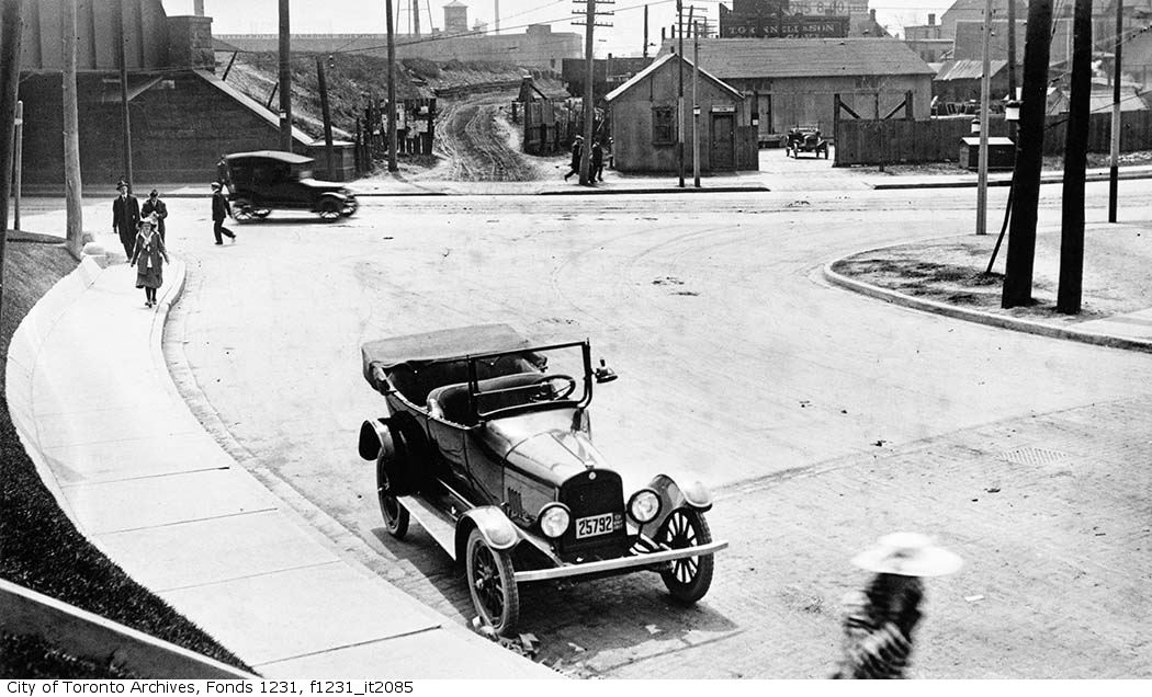
Carlaw Avenue and Gerrard Street intersection
1917 · 131 m awayCarlaw Avenue and Gerrard Street intersectionCity of Toronto Archives, Fonds 1231, Item 2085
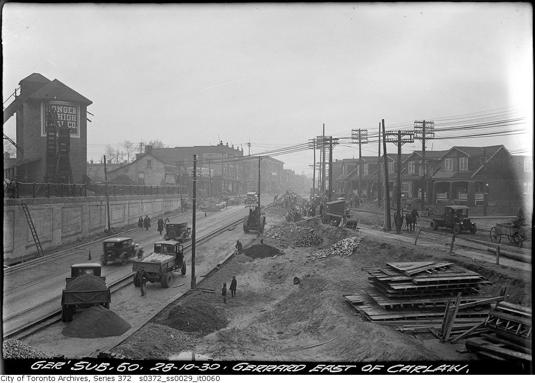
Gerrard Street east of Carlaw Avenue
1930 · 131 m awayGerrard Street east of Carlaw AvenueCity of Toronto Archives, Fonds 200, Series 372, Subseries 29, Item 60
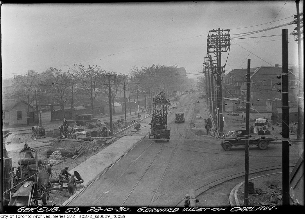
Gerrard Street west of Carlaw Avenue
1930 · 131 m awayGerrard Street west of Carlaw AvenueCity of Toronto Archives, Fonds 200, Series 372, Subseries 29, Item 59
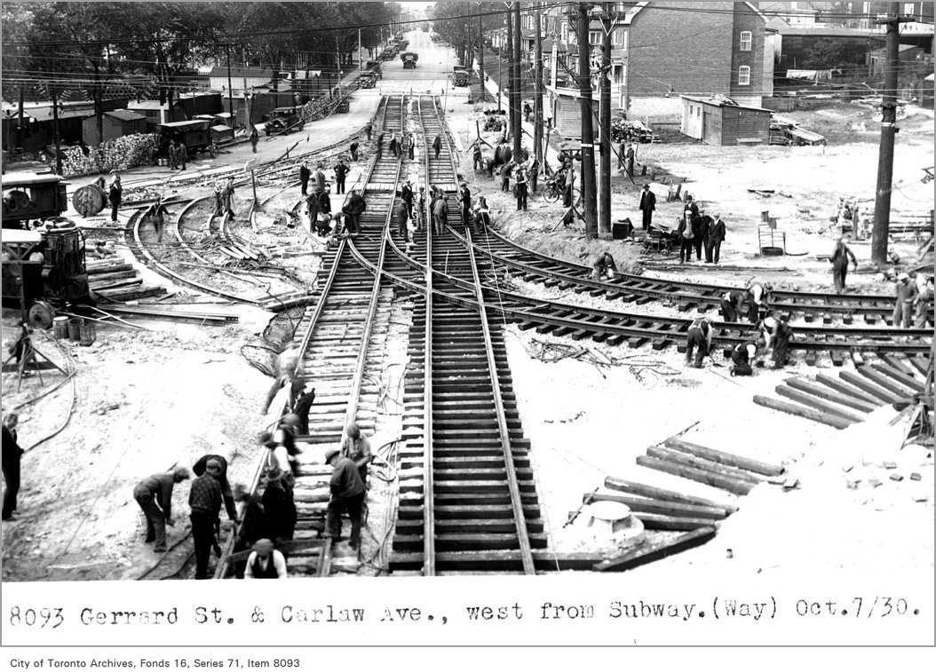
Gerrard St, and Carlaw Ave, west, from subway, (Way Department)
1930 · 131 m awayGerrard St, and Carlaw Ave, west, from subway, (Way Department)City of Toronto Archives, Fonds 16, Series 71, Item 8093
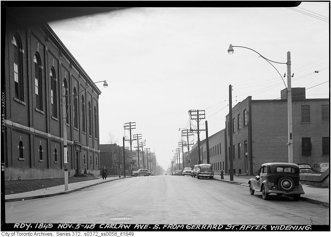
Carlaw Avenue after widening south from Gerrard
1948 · 131 m awayCarlaw Avenue after widening south from GerrardCity of Toronto Archives, Fonds 200, Series 372, Subseries 58, Item 1849
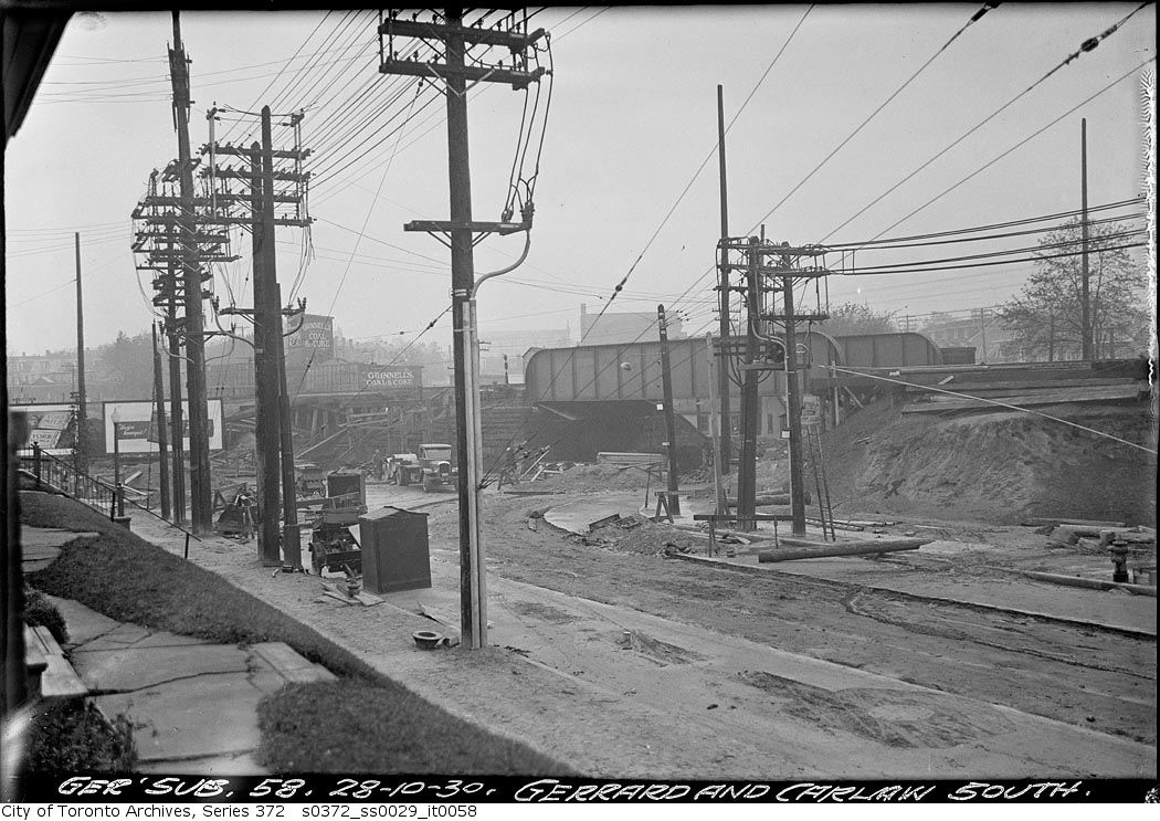
Gerrard Street and Carlaw Avenue South
1930 · 131 m awayGerrard Street and Carlaw Avenue SouthCity of Toronto Archives, Fonds 200, Series 372, Subseries 29, Item 58
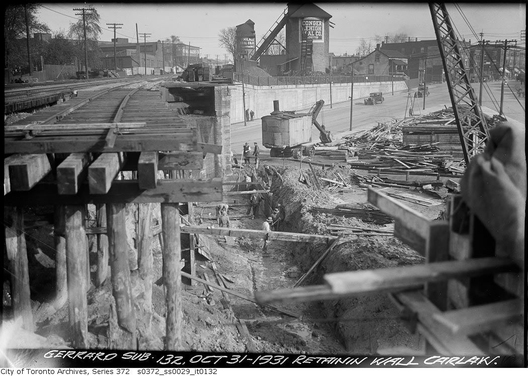
South retaining wall - Gerrard Street and Carlaw Avenue
1931 · 131 m awaySouth retaining wall - Gerrard Street and Carlaw AvenueCity of Toronto Archives, Fonds 200, Series 372, Subseries 29, Item 132
Fire Hall, Toronto, Gerrard St. E., n. side, w. of Carlaw Ave.
1952 · 131 m awayFire Hall, Toronto, Gerrard St. E., n. side, w. of Carlaw Ave. Courtesy of Toronto Public Library

Photo locations are matched from each photo’s title against City street and address data, so some may be off. Report a wrong location

187 Simpson Ave, Toronto M4K: permits, flood risk and what's planned nearby · My Address in Toronto