Skip to content
My Address in Toronto
Address report

202 St Patrick St

An address in Kensington-Chinatown, outside TRCA flood and shoreline hazard areas, with 4 active development applications within 250 metres.

Data as of Nov 8, 2026 · Every item lists its source

Follow this address
Key findings
  • Outside TRCA flood and shoreline hazard areas.
  • 4 active development applications and 3 Committee of Adjustment applications within 250 m.
RentSafe score—not a registered apartment building
Fire code violations—no inspection records
Applications7active within 250 m
Flood hazardOutsideTRCA mapping
Centre AveChestnut StEdward StElm StSimcoe StSt Patrick StBaldwin StD'Arcy StMcCaul StCecil StHenry StDundas St WUniversity AveBeverley St1234567Map data: City of Toronto (Toronto Centreline)
The red circle shows the 250-metre radius used for “Nearby” items. Numbers match the applications listed below.

01The building

ItemFindingPrecisionSource · as of
RentSafe evaluationNot a registered apartment buildingThis addressApartment Building Evaluation
Fire code inspectionsNo inspection recordsThis addressResidential Fire Inspection Results
Building orders and noticesNone on recordThis addressBuilding Construction/Demolition Violations
Building permits, last 5 years0 permitsThis addressBuilding Permits · 1 on record
Short-term rentalNot registeredThis addressShort Term Rentals Registration
Heritage statusNot on the Heritage RegisterThis addressHeritage Register
Recent permits (1)
  • Electromagnetic Locks · Inspection · Feb 3, 2017
    Installation of maglocks for 2 emergency doors. · Permit 16 271832 FSU

02Risks and the ground

ItemFindingPrecisionSource · as of
River flood hazardOutsideThis addressTRCA Regulation mapping 2025
Lake shoreline hazardOutsideThis addressTRCA Regulation mapping 2025
TRCA regulated areaOutsideThis addressTRCA Regulation mapping 2025
Basement flooding study areaBFA44Your areaBasement Flooding Study Areas · the City divides all of Toronto into study areas; this names yours, not a risk level
Lead in tap water samples, postal area M5T0 of 57 above 0.01 ppmYour area · M5TNon Regulated Lead Sample · Feb 20, 2014 to Sep 11, 2026

TRCA mapping is for screening, not site-specific decisions. Lead results are voluntary samples from homes in the postal area, not this address.

03What’s changing nearby

  1. 1
    700 University Ave · 177 m · Site Plan · Under Review
    Proposal for a 4-storey addition above the existing 19-storey office tower, and a 61-storey rental residential tower. The proposal consists of a total of 170712 square metres of gross floor area, including 114161 square metres of office…
    File 21 206959 STE 11 SA · submitted Sep 1, 2021 · City record
  2. 2
    522 University Ave · 206 m · Site Plan · Under Review
    Site Plan Control application to permit a 64-storey mixed-use building, comprised of a 51-storey residential tower atop a 15-storey office podium. The proposal consists of a total of approximately 54,983 square metres of gross floor area,…
    File 22 192155 STE 11 SA · submitted Aug 17, 2022 · City record
  3. 3
    522 University Ave · 206 m · Official Plan / Rezoning · Council Approved
    Zoning By-law Amendment application to permit a 64-storey mixed-use building, containing 579 dwelling units, 21,138 square metres to office and 354 square metres to retail gross floor area.
    File 22 192156 STE 11 OZ · submitted Aug 17, 2022 · City record
  4. 4
    240 Mc Caul St · 219 m · Site Plan · Under Review
    Proposed 18-storey Ronald McDonald House Charities (RMHC) building that would contain 200 suites comprised of 1- and 2-bedroom suites, office space for RMHC, and programming and amenity space for the temporary residents, including…
    File 22 155554 STE 11 SA · submitted Jun 1, 2022 · City record
  5. 5
    292 Dundas St W · 95 m · Committee of Adjustment · Consent (severance) · Conditional Consent
    To obtain consent to create new easements/rights-of-way.
    File B0010/26TEY · submitted Jan 26, 2026
  6. 6
    292 Dundas St W · 95 m · Committee of Adjustment · Minor variance · Approved with Conditions
    To alter the development standards for a 32-storey mixed-use building (as approved under Site Specific Zoning By-laws 441-2021 and 442-2021 (LPAT), and By-Laws 438-86 and 569-2013), to increase the gross floor area, the building height,…
    File A0944/23TEY · submitted Oct 31, 2023
  7. 7
    317 Dundas St W · 246 m · Committee of Adjustment · Consent (severance) · Postponed
    To obtain consent to sever a portion of land for the purpose of a lot addition, as well as to create and maintain easements/rights-of-way.
    File B0063/26TEY · submitted Oct 13, 2026

Development Applications; Committee of Adjustment Applications · 18 registered short-term rentals within 250 m.

04City services

ItemFindingPrecisionSource · as of
Garbage daySee calendarThis addressCollection calendar No Collection
City councillorDianne SaxeWard 11Councillor_Saxe@toronto.ca · 416-392-4009

05Quick answers about 202 St Patrick St

Is 202 St Patrick St in a flood plain?

No. It is outside TRCA's mapped flood and shoreline hazard areas. Source: TRCA Regulation mapping 2025.

What is being built near 202 St Patrick St?

4 active development applications within 250 metres, the closest at 700 University Ave (177 m). Source: Development Applications.

Answers are generated from the data on this page and update when the data changes.

06From the archives
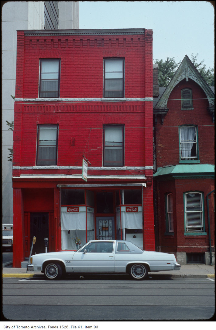
McCaul St, east side, opposite of D'Arcy St
McCaul St, east side, opposite of D'Arcy St, 1981. City of Toronto Archives, Fonds 1526, File 61, Item 93. 65 m away.
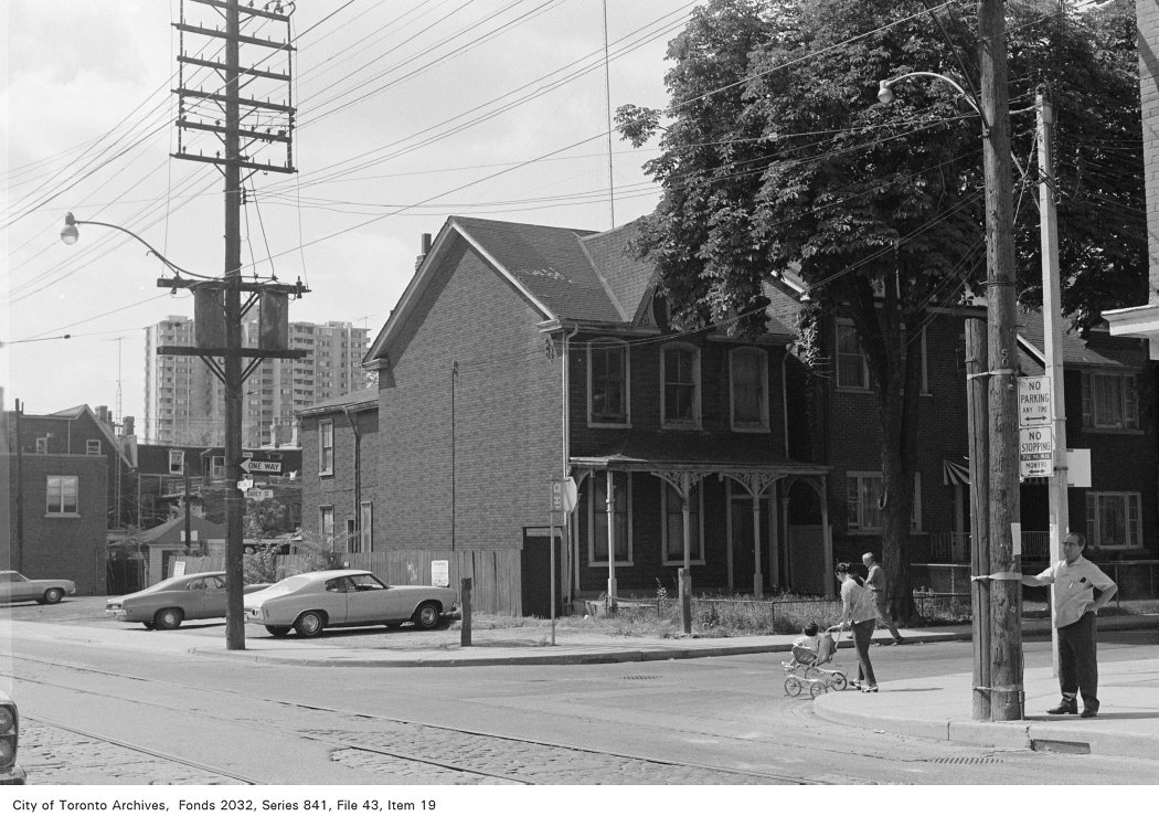
Corner of McCaul St. and D'Arcy St., looking south-west
Corner of McCaul St. and D'Arcy St., looking south-west, 1972. City of Toronto Archives, Fonds 2032, Series 841, File 43, Item 19. 65 m away.
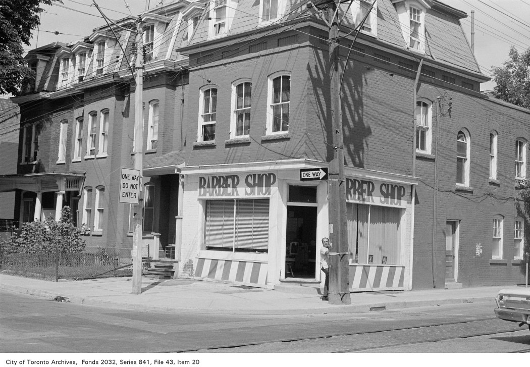
Corner of McCaul St. and D'Arcy St., looking north-west
Corner of McCaul St. and D'Arcy St., looking north-west, 1972. City of Toronto Archives, Fonds 2032, Series 841, File 43, Item 20. 65 m away.
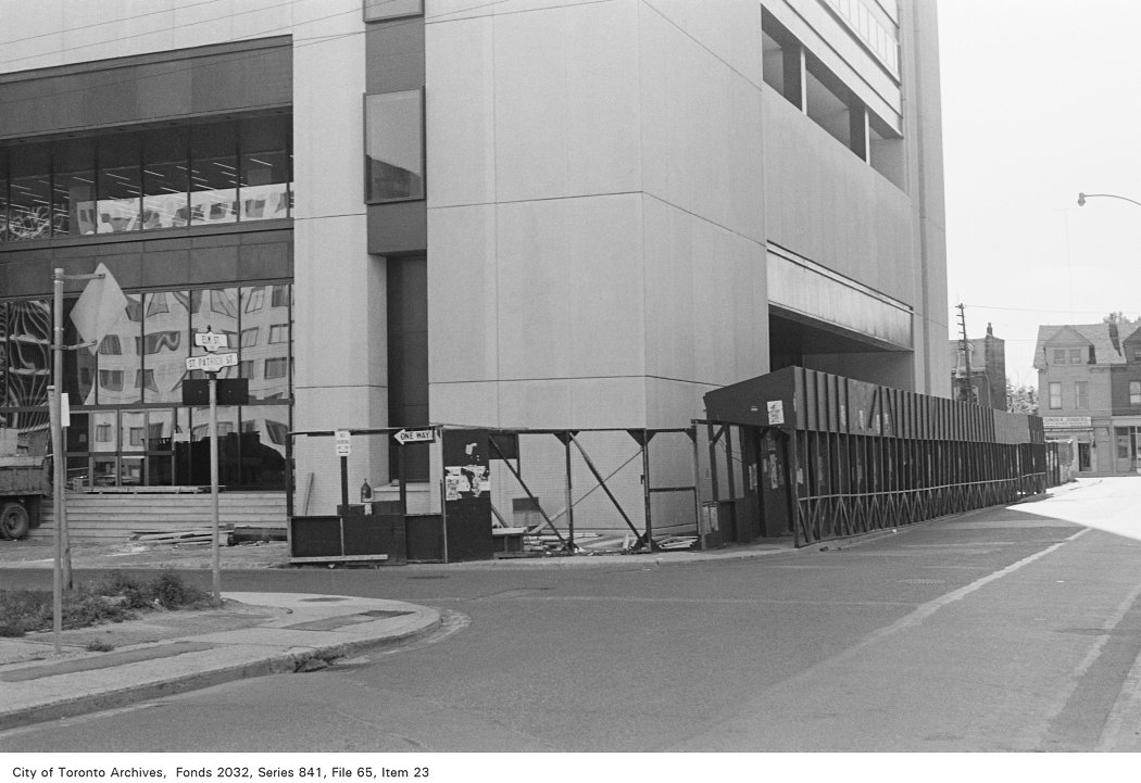
Corner of St. Patrick St. and Elm St., looking south-west
Corner of St. Patrick St. and Elm St., looking south-west, 1972. City of Toronto Archives, Fonds 2032, Series 841, File 65, Item 23. 67 m away.
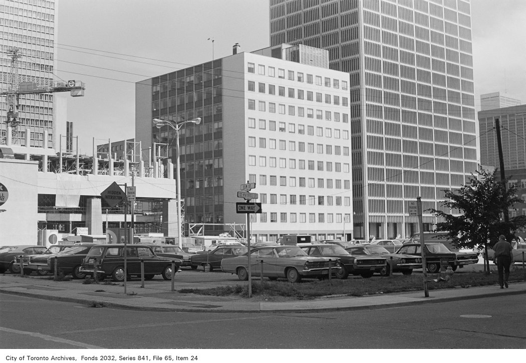
Corner of St. Patrick St. and Elm St., looking south-east
Corner of St. Patrick St. and Elm St., looking south-east, 1972. City of Toronto Archives, Fonds 2032, Series 841, File 65, Item 24. 67 m away.
St. Patrick's Roman Catholic Church (1870), St. Patrick St., w. side, betw. Dundas and Elm Sts.
St. Patrick's Roman Catholic Church (1870), St. Patrick St., w. side, betw. Dundas and Elm Sts. , 1907. Courtesy of Toronto Public Library. 67 m away.
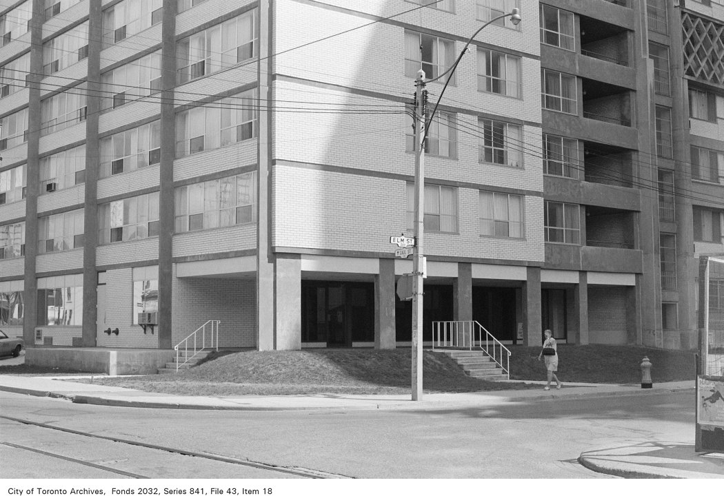
Corner of McCaul St. and Elm St., looking north-east
Corner of McCaul St. and Elm St., looking north-east, 1972. City of Toronto Archives, Fonds 2032, Series 841, File 43, Item 18. 89 m away.
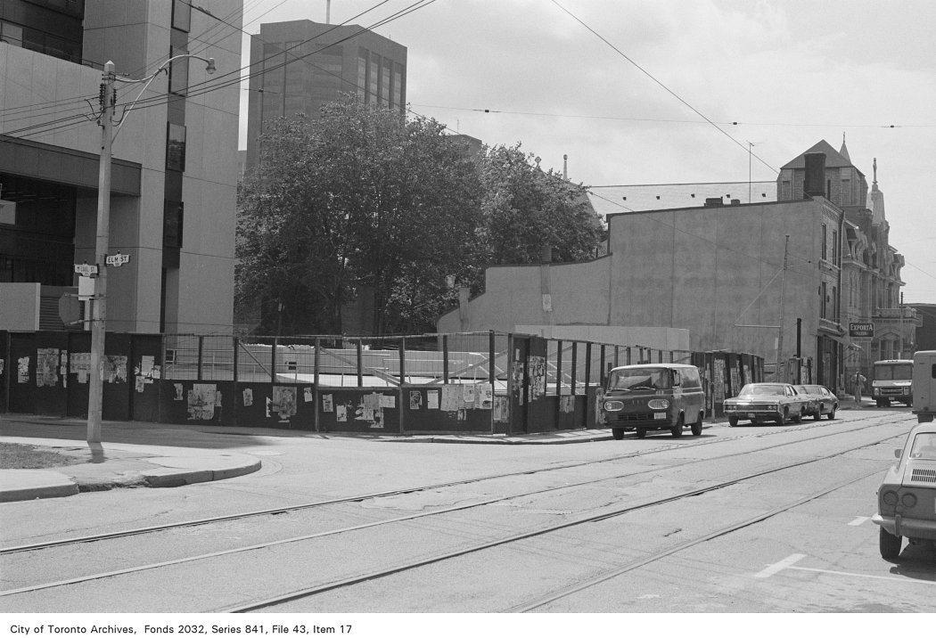
Corner of McCaul St. and Elm St., looking south-east
Corner of McCaul St. and Elm St., looking south-east, 1972. City of Toronto Archives, Fonds 2032, Series 841, File 43, Item 17. 89 m away.
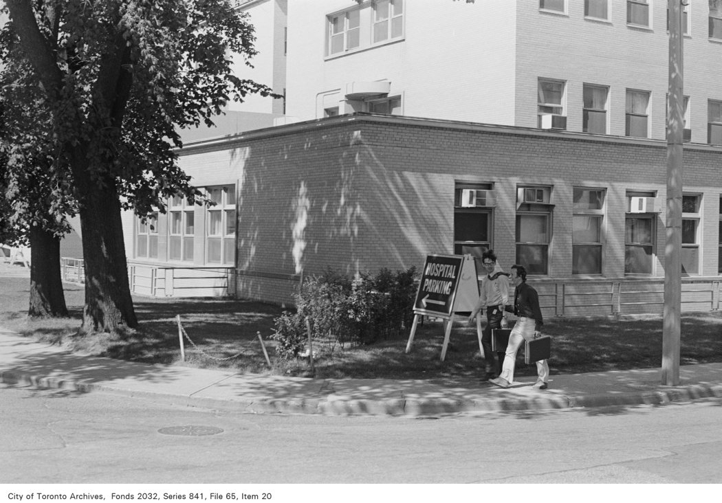
Corner of Murray St. and Elm St., looking north-east
Corner of Murray St. and Elm St., looking north-east, 1972. City of Toronto Archives, Fonds 2032, Series 841, File 65, Item 20. 94 m away.

Photo locations are matched from each photo’s title against City street and address data, so some may be off. Report a wrong location

202 St Patrick St, Toronto — address report · My Address in Toronto