A property on the Heritage Register (Part IV), outside TRCA flood and shoreline hazard areas, with no active development applications within 250 metres.
Data as of Nov 7, 2026 · Every item lists its source
Certified Tents · Closed · May 28, 2021 One 30' x 60' Temporary Tent to be used in conjunction with a COVID-19 Pop-Up Immunization Centre operated by Michael Garon Hospital. To be installed May 29 and removed May 31, 2021 · Permit 21 161922 TPS
02Risks and the ground
ItemFindingPrecisionSource · as of
River flood hazardOutsideThis addressTRCA Regulation mapping 2025
Lake shoreline hazardOutsideThis addressTRCA Regulation mapping 2025
Basement flooding study areaBFA32Your areaBasement Flooding Study Areas · the City divides all of Toronto into study areas; this names yours, not a risk level
Lead in tap water samples, postal area M4L10 of 592 above 0.01 ppmYour area · M4LNon Regulated Lead Sample · Jan 15, 2014 to Sep 18, 2026
TRCA mapping is for screening, not site-specific decisions. Lead results are voluntary samples from homes in the postal area, not this address.
03What’s changing nearby
1
95 Waverley Rd· 124 m · Committee of Adjustment · Minor variance · Approved
To legalize and to maintain the new two-storey semi-detached dwelling with a front porch, a rear ground floor deck, and a rear basement walkout, which is currently under construction.
File A0961/23TEY · submitted Nov 3, 2023
2
52 Wheeler Ave· 249 m · Committee of Adjustment · Minor variance · Closed
To alter the existing one-storey detached dwelling by constructing: a front porch; a two-storey addition above the existing dwelling; a two-storey rear addition; a third storey front and rear balcony; and a rear ground floor deck.
File A1032/21TEY · submitted Aug 10, 2021
Development Applications; Committee of Adjustment Applications · 6 registered short-term rentals within 250 m.
No. It is outside TRCA's mapped flood and shoreline hazard areas. Source: TRCA Regulation mapping 2025.
What is being built near 2075 Queen St E?
0 active development applications within 250 metres. Source: Development Applications.
When is garbage day at 2075 Queen St E?
Collection calendar Tuesday 1. Next garbage pickup: Nov 17, 2026. Source: Solid Waste Collection Schedule.
Answers are generated from the data on this page and update when the data changes.
06From the archives
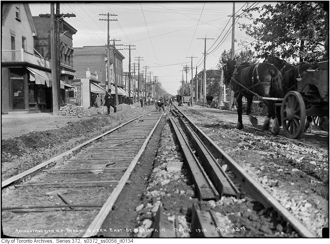
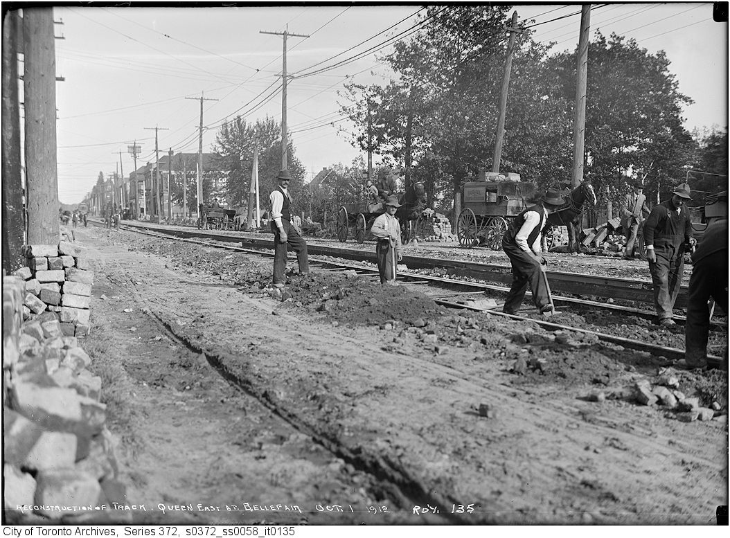
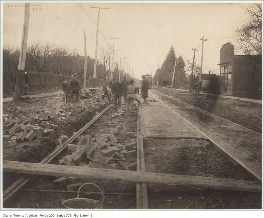
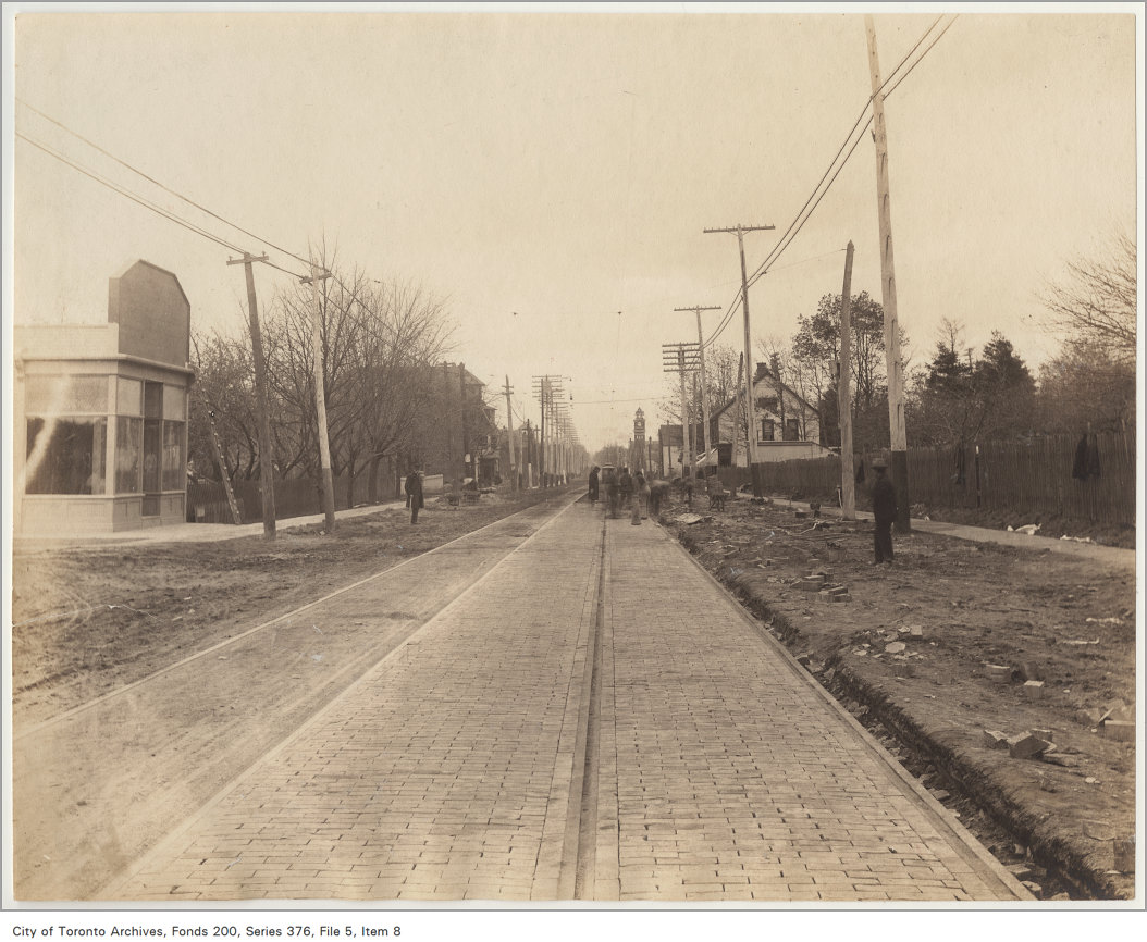
Kew Gardens, Queen St. E., s. side, between Waverley Rd. & Lee Ave. , 1910. Courtesy of Toronto Public Library. 22 m away.Kew Gardens, Queen St. E., s. side, between Waverley Rd. & Lee Ave. , 1924. Courtesy of Toronto Public Library. 22 m away.Queen Street East at Bellefair reconstruction of track, 1912. City of Toronto Archives, Fonds 200, Series 372, Subseries 58, Item 134. 44 m away.Queen Street East at Bellefair reconstruction of track, 1912. City of Toronto Archives, Fonds 200, Series 372, Subseries 58, Item 135. 44 m away.Queen Street east of Lee Avenue, 1906. City of Toronto Archives, Fonds 200, Series 376, File 5, Item 9. 118 m away.TD Bank & Trust, formerly Toronto-Dominion Bank, originally Dominion Bank, Queen Street East, no. 2169, southwest corner of Lee Avenue, Toronto, Ont. , 1995. Courtesy of Toronto Public Library. 118 m away.Toronto Public Library; Beaches Branch, Queen St. E., s. side, w. of Lee Ave.; INTERIOR, showing play presented by Beaches Library Drama League. , 1920. Courtesy of Toronto Public Library. 118 m away.Queen Street east of Lee Avenue, 1906. City of Toronto Archives, Fonds 200, Series 376, File 5, Item 8. 118 m away.Toronto Public Library; Beaches Branch, Queen St. E., s. side, w. of Lee Ave.; Interior, showing Book Lovers' Evening. , 1930. Courtesy of Toronto Public Library. 118 m away.
Photo locations are matched from each photo’s title against City street and address data, so some may be off. Report a wrong location
We use Google Analytics cookies to see which parts of the site help people. We never send the addresses you search. Privacy
2075 Queen St E, Toronto — address report · My Address in Toronto