Skip to content
My Address in Toronto
Address report

22 Brookmount Rd

22 Brookmount Rd is in The Beaches. It's outside TRCA flood hazard areas and there are no active planning applications nearby.

Data as of Nov 8, 2026 · Every item lists its source

Follow this address
Key findings
  • 5 building permits in the last 5 years.
  • Outside TRCA flood hazard areas.
Building permits5in the last 5 years
Applications nearby0active, within 250 m
Flood hazardOutsideTRCA mapping
Next collectionNov 10recycling and green bin
Kingston RdDundas StQueen StWoodbine AveEdgewood AveFitzgerald MewsDixon AveOrchard Park BlvdWinners CrclLark StHerbert AveBoardwalk DrElmer AveBrookmount RdJoseph Duggan RdLockwood RdSarah Ashbridge AveRainsford RdMap data: City of Toronto (Toronto Centreline)Kingston RdWoodbine AveQueen StColumbine AveDixon AveLark StBoardwalk DrBrookmount RdLockwood RdSarah Ashbridge AveRainsford RdWinners CrclMap data: City of Toronto (Toronto Centreline)
The red dot is 22 Brookmount Rd. The circle shows 250 metres, about a 3-minute walk. Numbers match the applications in “What’s changing nearby”.

03The building

ItemFindingPrecisionSource
Building orders and noticesNone on recordThis addressBuilding Construction/Demolition Violations
Building permits, last 5 years5 permitsThis addressBuilding Permits · 5 on record

5 building permits in the last 5 years, for 1 project. For comparison, about 1 in 10 Toronto addresses had any permit in that time. Permits show work the City approved; they don't show work done without a permit.

Short-term rentalNot registeredThis addressShort Term Rentals Registration
Heritage statusNot on the Heritage RegisterThis addressHeritage Register

It isn't listed or designated on the City's Heritage Register.

Permit history: 1 project from 5 permits
  • Building work · completed Nov 6, 2023
    REV-01: Alterations to original permit to include basement framing and bathroom rough-in, structural notes for basement stairs, powder room reconfiguration, third floor bathroom reconfiguration, and… · 5 permits in this project (such as building, plumbing and heating) · Permit 22 178491

04Risks and environment

ItemFindingPrecisionSource
River flood hazardOutsideThis addressTRCA Regulation mapping 2025
Lake shoreline hazardOutsideThis addressTRCA Regulation mapping 2025
TRCA regulated areaOutsideThis addressTRCA Regulation mapping 2025

TRCA's maps show this address is outside the areas that could flood from rivers in a major storm (TRCA plans for a storm like Hurricane Hazel in 1954) and outside lake shoreline hazards. Basement flooding from overloaded sewers can still happen anywhere in the city.

Lead in tap-water tests, postal area M4L1.5% of tests above Ontario's limitYour area · M4LNon Regulated Lead Sample · 667 tests, Jan 15, 2014 to Sep 18, 2026

In postal area M4L, 10 of 667 home tap-water samples (1.5%) tested above Ontario's limit for lead (10 micrograms per litre). Across Toronto, 2.0% of samples did, so M4L is about the same as the city overall. Health Canada recommends a stricter limit of 5 micrograms per litre: 40 samples here (6.0%) were above it. These are voluntary tests, mostly from older homes, so they don't tell you about this house. Lead comes from old pipes and plumbing, not the City's treatment plants. If your home was built before the mid-1950s, you can get a free test kit by calling 311.

TRCA mapping is for screening, not site-specific decisions. Lead results are voluntary samples from homes in the postal area, not this address.

01What’s changing nearby

No active planning applications within 250 m (about a 3-minute walk). Most Toronto addresses (64%) have at least one application nearby.

Short-term rentals nearby20 registered homesWithin 250 mShort Term Rentals Registration

20 homes within 250 m are registered with the City as short-term rentals (stays of less than 28 days, like Airbnb). That's more than at almost all Toronto addresses.

Development Applications; Committee of Adjustment Applications; Short Term Rentals Registration.

02City services

ItemFindingPrecisionSource
Garbage and recyclingTuesdaysThis addressSolid Waste Collection Schedule

Next: November 10: recycling and green bin. November 17: garbage, green bin and yard waste. Green bin goes out every week; garbage and recycling alternate.

City councillorBrad BradfordWard 19councillor_bradford@toronto.ca · 416-338-2755

05Quick answers about 22 Brookmount Rd

Is 22 Brookmount Rd in a flood plain?

No. TRCA maps it outside river flood and lake shoreline hazard areas. Basement flooding from sewers can still happen anywhere. Source: TRCA Regulation mapping 2025.

What is being built near 22 Brookmount Rd?

There are no active development or Committee of Adjustment applications within 250 metres. Source: Development Applications; Committee of Adjustment Applications.

Has 22 Brookmount Rd been renovated?

Yes. The City has 5 building permits on record, 5 in the last 5 years. Source: Building Permits.

Is 22 Brookmount Rd a heritage property?

No. It isn't listed or designated on the City's Heritage Register. Source: Heritage Register.

When is garbage day at 22 Brookmount Rd?

Collection is on Tuesdays. Green bin goes out every week; garbage and recycling alternate weeks. The next garbage pickup is Nov 17, 2026. Source: Solid Waste Collection Schedule.

Answers are generated from the data on this page and update when the data changes.

06From the archives
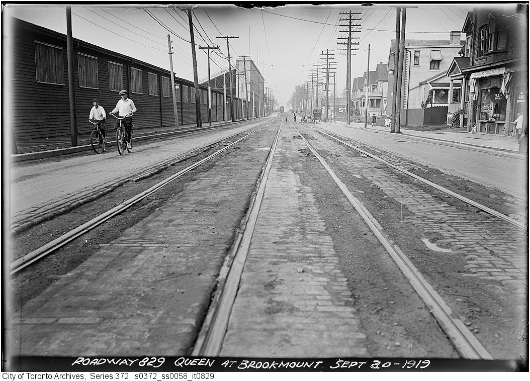
Queen St. at Brookmount - track
1919 · 119 m awayQueen St. at Brookmount - trackCity of Toronto Archives, Fonds 200, Series 372, Subseries 58, Item 829
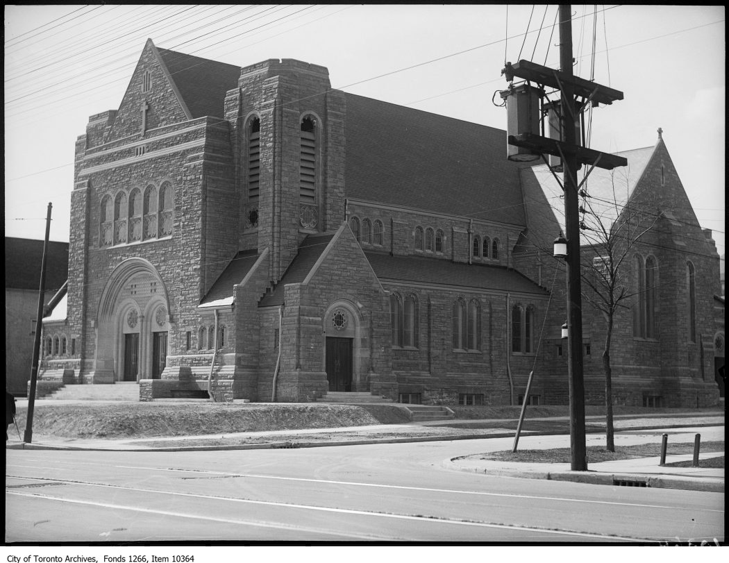
Corpus Christi Church, Lockwood Road & Queen Street East
1927 · 136 m awayCorpus Christi Church, Lockwood Road & Queen Street EastCity of Toronto Archives, Fonds 1266, Item 10364
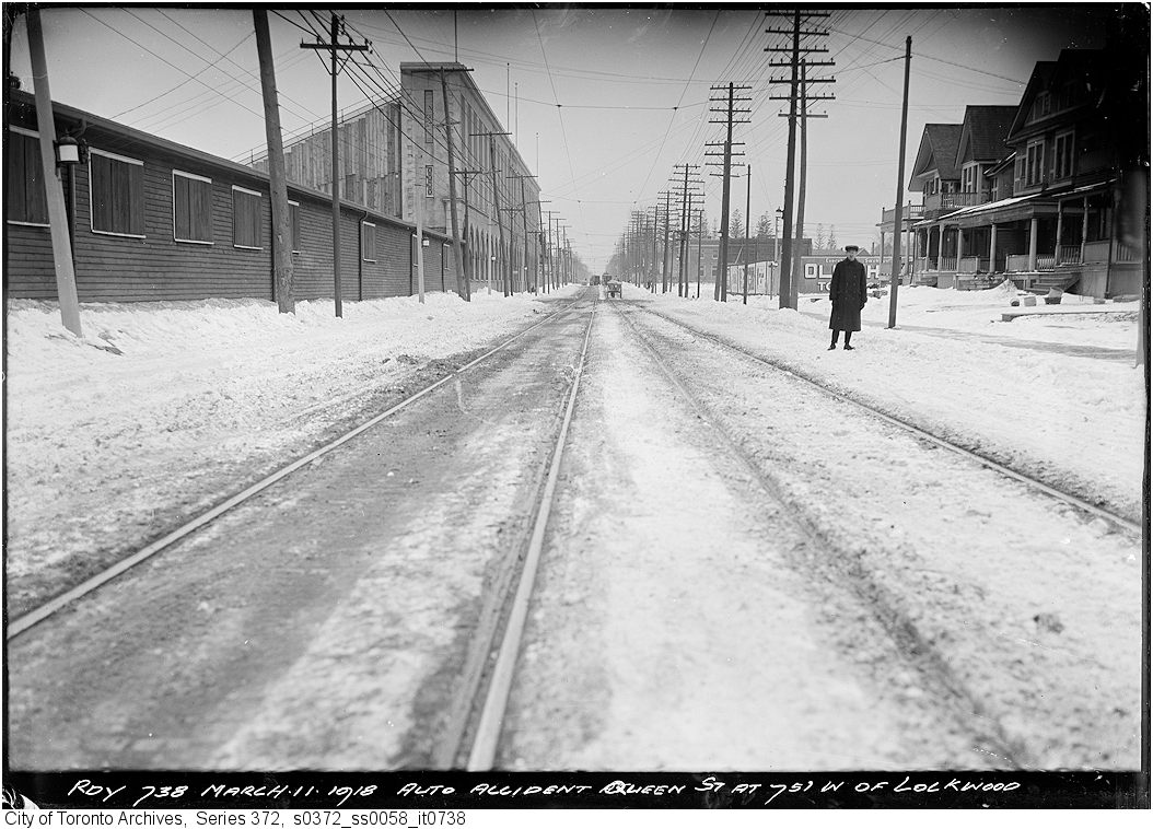
Auto accident on Queen St. 75 ft. west of Lockwood
1918 · 136 m awayAuto accident on Queen St. 75 ft. west of LockwoodCity of Toronto Archives, Fonds 200, Series 372, Subseries 58, Item 738
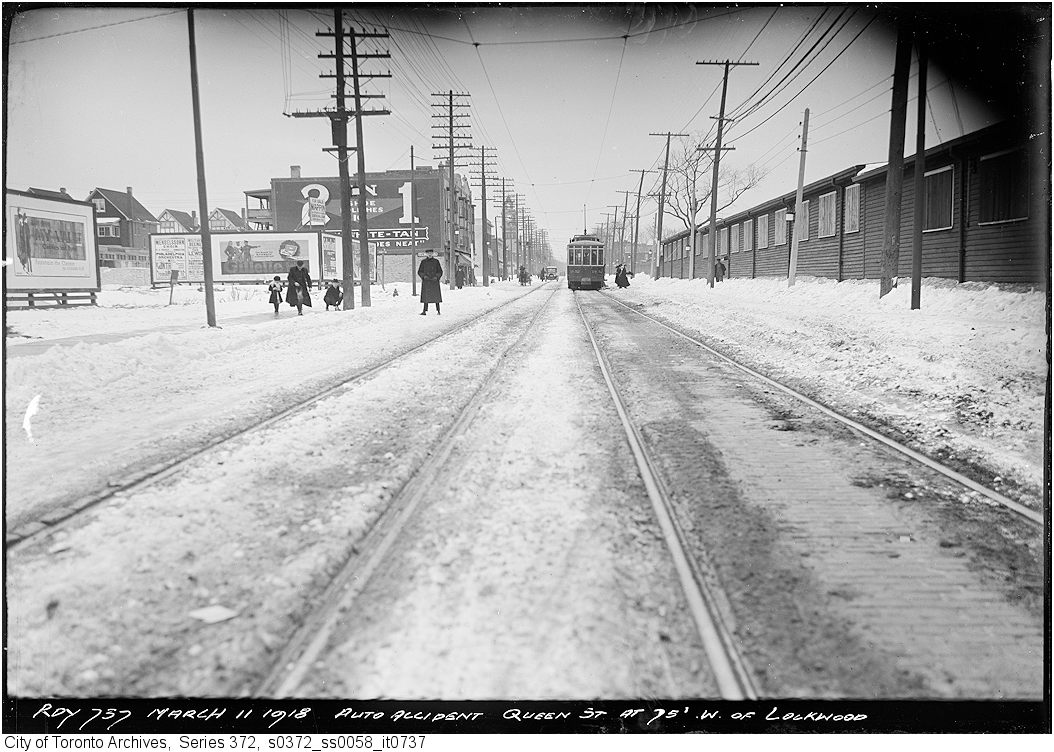
Auto accident on Queen St. 75 ft. west of Lockwood
1918 · 136 m awayAuto accident on Queen St. 75 ft. west of LockwoodCity of Toronto Archives, Fonds 200, Series 372, Subseries 58, Item 737
Greenwood Race Track, Queen St. E., s. side, between Eastern & Woodbine Aves.; looking w. on Queen St.
1953 · 165 m awayGreenwood Race Track, Queen St. E., s. side, between Eastern & Woodbine Aves.; looking w. on Queen St. Courtesy of Toronto Public Library
Greenwood Race Track, Queen St. E., s. side, between Eastern & Woodbine Aves.; looking w. on Queen St. from Rainsford Rd.
1955 · 165 m awayGreenwood Race Track, Queen St. E., s. side, between Eastern & Woodbine Aves.; looking w. on Queen St. from Rainsford Rd. Courtesy of Toronto Public Library
Greenwood Race Track, Queen St. E., s. side, between Eastern & Woodbine Aves. looking e. on Queen St. from w. of Orchard Park Blvd.
1953 · 165 m awayGreenwood Race Track, Queen St. E., s. side, between Eastern & Woodbine Aves. looking e. on Queen St. from w. of Orchard Park Blvd. Courtesy of Toronto Public Library
Greenwood Race Track, Queen St. E., s. side, between Eastern & Woodbine Aves.; looking n. to Queen St.
1923 · 165 m awayGreenwood Race Track, Queen St. E., s. side, between Eastern & Woodbine Aves.; looking n. to Queen St. Courtesy of Toronto Public Library
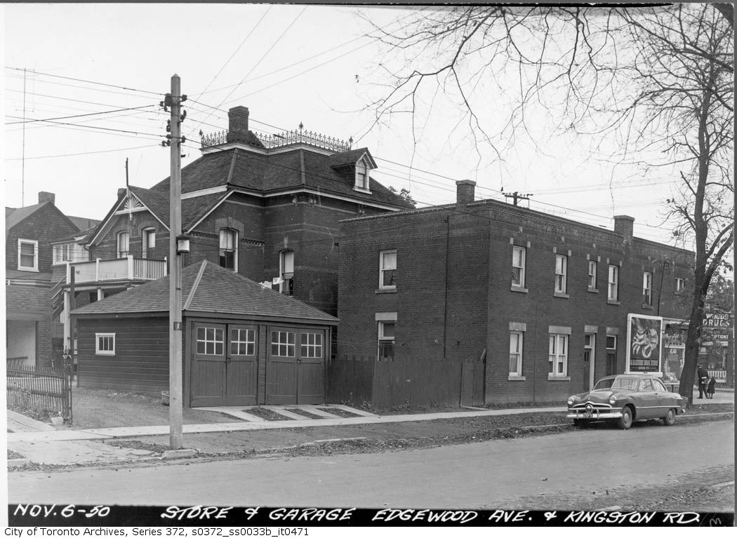
Store and garage Edgewood Ave. and Kingston Road
1950 · 212 m awayStore and garage Edgewood Ave. and Kingston RoadCity of Toronto Archives, Fonds 200, Series 372, Subseries 33b, Item 471

Photo locations are matched from each photo’s title against City street and address data, so some may be off. Report a wrong location

22 Brookmount Rd, Toronto M4L: permits, flood risk and what's planned nearby · My Address in Toronto