33 Centre Ave
An address in Newtonbrook East, outside TRCA flood and shoreline hazard areas, with 13 active development applications within 250 metres.
Data as of Nov 7, 2026 · Every item lists its source
- Outside TRCA flood and shoreline hazard areas.
- 13 active development applications and 0 Committee of Adjustment applications within 250 m.
01The building
Recent permits (1)
- Second Suite (New) · Cancelled · Aug 11, 2020
Proposal to legalize and maintain the 2nd suite in the basement of existing detached dwelling.See also 20 157201 WNP. · Permit 20 178950 BLD
02Risks and the ground
TRCA mapping is for screening, not site-specific decisions. Lead results are voluntary samples from homes in the postal area, not this address.
03What’s changing nearby
- 143 Centre Ave · 210 m · Site Plan · Under ReviewThe development proposal consists of 146 units within four, 4-storey buildings. Blocks A, B and C front onto Centre Avenue with Block D in the south portion of the site connected to the streetscape. The 4 new buildings would have a total…File 22 179762 NNY 18 SA · submitted Jul 20, 2022 · City record
- 241 Centre Ave · 216 m · Site Plan · Under ReviewThe development proposal consists of 146 units within four, 4-storey buildings. Blocks A, B and C front onto Centre Avenue with Block D in the south portion of the site connected to the streetscape. The 4 new buildings would have a total…File 22 179762 NNY 18 SA · submitted Jul 20, 2022 · City record
- 339 Centre Ave · 217 m · Site Plan · Under ReviewThe development proposal consists of 146 units within four, 4-storey buildings. Blocks A, B and C front onto Centre Avenue with Block D in the south portion of the site connected to the streetscape. The 4 new buildings would have a total…File 22 179762 NNY 18 SA · submitted Jul 20, 2022 · City record
- 437 Centre Ave · 218 m · Site Plan · Under ReviewThe development proposal consists of 146 units within four, 4-storey buildings. Blocks A, B and C front onto Centre Avenue with Block D in the south portion of the site connected to the streetscape. The 4 new buildings would have a total…File 22 179762 NNY 18 SA · submitted Jul 20, 2022 · City record
- 533 Centre Ave · 222 m · Site Plan · Under ReviewThe development proposal consists of 146 units within four, 4-storey buildings. Blocks A, B and C front onto Centre Avenue with Block D in the south portion of the site connected to the streetscape. The 4 new buildings would have a total…File 22 179762 NNY 18 SA · submitted Jul 20, 2022 · City record
- 69 Madawaska Ave · 224 m · Official Plan / Rezoning · Council ApprovedOfficial Plan and Zoning By-law Amendment to facilitate the redevelopment of the site for two 14-storey mixed-use buildings having a total gross floor area of 29.476 square metres. A total of 457 residential dwelling units are proposed.File 22 108032 NNY 18 OZ · submitted Jan 27, 2022 · City record
- 79 Madawaska Ave · 224 m · Site Plan · Under ReviewSite Plan Control Application to facilitate the redevelopment of the site for two 14-storey mixed-use buildings having a total gross floor area of 29.476 square metres. A total of 457 residential dwelling units are proposed.File 22 108031 NNY 18 SA · submitted Jan 27, 2022 · City record
- 811 Newton Dr · 225 m · Site Plan · OMB ApprovedTo convert an existing newly constructed building to a commercial use to be used as a medical office on a combined lot (11 Newton Drive and formerly 15 Newton Drive). Ten surface parking spaces are provided at the rear of the building.File 15 140428 NNY 24 SA · submitted Apr 14, 2015 · City record
- 920 Centre Ave · 225 m · Site Plan · Under ReviewProposal for a 12-storey mid-rise building with 510 residential units and 388 parking spaces. The development includes 37,910 square metres of residentia GFA and 81 square metres of retail GFA, for a total density of 4.54 FSI.File 22 140335 NNY 18 SA · submitted Apr 29, 2022 · City record
- 1010 Newton Dr · 231 m · Official Plan / Rezoning · Council ApprovedOfficial Plan and Zoning By-law Amendment to facilitate the redevelopment of the site for two 14-storey mixed-use buildings having a total gross floor area of 29.476 square metres. A total of 457 residential dwelling units are proposed.File 22 108032 NNY 18 OZ · submitted Jan 27, 2022 · City record
- 1110 Newton Dr · 231 m · Site Plan · Under ReviewSite Plan Control Application to facilitate the redevelopment of the site for two 14-storey mixed-use buildings having a total gross floor area of 29.476 square metres. A total of 457 residential dwelling units are proposed.File 22 108031 NNY 18 SA · submitted Jan 27, 2022 · City record
- 1218 Centre Ave · 239 m · Site Plan · Under ReviewProposal for a 12-storey mid-rise building with 510 residential units and 388 parking spaces. The development includes 37,910 square metres of residentia GFA and 81 square metres of retail GFA, for a total density of 4.54 FSI.File 22 140335 NNY 18 SA · submitted Apr 29, 2022 · City record
Development Applications; Committee of Adjustment Applications · 2 registered short-term rentals within 250 m.
04City services
05Quick answers about 33 Centre Ave
Is 33 Centre Ave in a flood plain?
No. It is outside TRCA's mapped flood and shoreline hazard areas. Source: TRCA Regulation mapping 2025.
What is being built near 33 Centre Ave?
13 active development applications within 250 metres, the closest at 43 Centre Ave (210 m). Source: Development Applications.
When is garbage day at 33 Centre Ave?
Collection calendar Friday 2. Next garbage pickup: Nov 13, 2026. Source: Solid Waste Collection Schedule.
Answers are generated from the data on this page and update when the data changes.
06From the archives
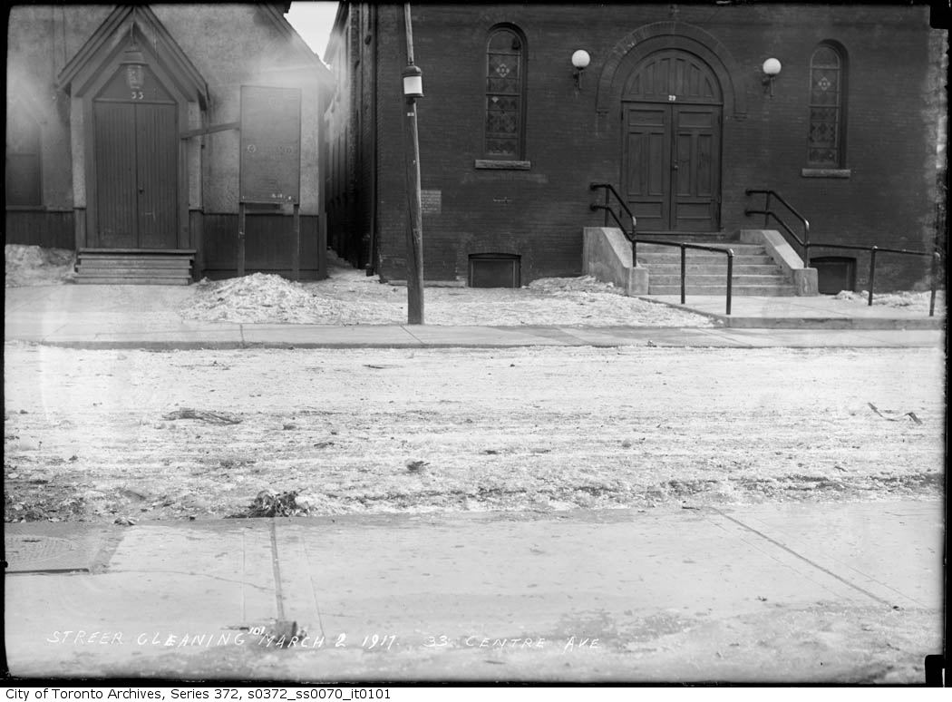
Photo locations are matched from each photo’s title against City street and address data, so some may be off. Report a wrong location