Skip to content
My Address in Toronto
Address report

358 Queen St E

A property on the Heritage Register (Listed), outside TRCA flood and shoreline hazard areas, with 7 active development applications within 250 metres.

Data as of Nov 7, 2026 · Every item lists its source

Follow this address
Key findings
  • On the Heritage Register (Listed).
  • Outside TRCA flood and shoreline hazard areas.
  • 7 active development applications and 1 Committee of Adjustment application within 250 m.
RentSafe score—not a registered apartment building
Fire code violations—no inspection records
Applications8active within 250 m
Flood hazardOutsideTRCA mapping
Bright StSumach StSackville StOntario StSeaton StBerkeley StMilan StTracy StPeaceful WaySt Paul StSydenham StPower StTrefann StWilkins AveQueen St EKing St EAdelaide St ERichmond St EShuter StParliament St12345678Map data: City of Toronto (Toronto Centreline)
The red circle shows the 250-metre radius used for “Nearby” items. Numbers match the applications listed below.

01The building

ItemFindingPrecisionSource · as of
RentSafe evaluationNot a registered apartment buildingThis addressApartment Building Evaluation
Fire code inspectionsNo inspection recordsThis addressResidential Fire Inspection Results
Building orders and noticesNone open (1 closed)This addressBuilding Construction/Demolition Violations
Building permits, last 5 years3 permitsThis addressBuilding Permits · 3 on record
Short-term rentalNot registeredThis addressShort Term Rentals Registration
Heritage statusListedThis addressHeritage Register
Recent permits (3)
  • Building Permit Related(PS) · Closed · Jun 2, 2023
    Plumbing - · Permit 23 125169 PLB
  • Interior Alterations · Closed · Apr 27, 2023
    Proposal for commercial interior fit-out. No change to building. · Permit 23 125169 BLD
  • Building Permit Related(MS) · Closed · Apr 26, 2023
    HVAC - Proposal for commercial interior fit-out. No change to building. · Permit 23 125169 HVA

02Risks and the ground

ItemFindingPrecisionSource · as of
River flood hazardOutsideThis addressTRCA Regulation mapping 2025
Lake shoreline hazardOutsideThis addressTRCA Regulation mapping 2025
TRCA regulated areaOutsideThis addressTRCA Regulation mapping 2025
Basement flooding study areaBFA62Your areaBasement Flooding Study Areas · the City divides all of Toronto into study areas; this names yours, not a risk level
Lead in tap water samples, postal area M5A4 of 104 above 0.01 ppmYour area · M5ANon Regulated Lead Sample · May 21, 2014 to Oct 15, 2026

TRCA mapping is for screening, not site-specific decisions. Lead results are voluntary samples from homes in the postal area, not this address.

03What’s changing nearby

  1. 1
    371 Queen St E · 242 m · Subdivision · Under Review
    Draft Plan of subdivision for 3 blocks.
    File 21 235160 STE 13 SB · submitted Nov 7, 2021 · City record
  2. 2
    371 Queen St E · 242 m · Site Plan · NOAC Issued
    Site Plan Application for a 28-storey mixed-use development with 526 units, 448 square metres of parkland, 1,350 square metres of non-residential gross floor area, and one level of underground parking.
    File 21 176821 STE 13 SA · submitted Jun 28, 2021 · City record
  3. 3
    373 Queen St E · 247 m · Site Plan · NOAC Issued
    Site Plan Application for a 28-storey mixed-use development with 526 units, 448 square metres of parkland, 1,350 square metres of non-residential gross floor area, and one level of underground parking.
    File 21 176821 STE 13 SA · submitted Jun 28, 2021 · City record
  4. 4
    373 Queen St E · 247 m · Subdivision · Under Review
    Draft Plan of subdivision for 3 blocks.
    File 21 235160 STE 13 SB · submitted Nov 7, 2021 · City record
  5. 5
    363 Queen St E · 248 m · Subdivision · Under Review
    Draft Plan of subdivision for 3 blocks.
    File 21 235160 STE 13 SB · submitted Nov 7, 2021 · City record
  6. 6
    363 Queen St E · 248 m · Site Plan · NOAC Issued
    Site Plan Application for a 28-storey mixed-use development with 526 units, 448 square metres of parkland, 1,350 square metres of non-residential gross floor area, and one level of underground parking.
    File 21 176821 STE 13 SA · submitted Jun 28, 2021 · City record
  7. 7
    500 Dundas St E · 250 m · Official Plan / Rezoning · Council Approved
    Proposed 35-storey mixed use building (122.2 metres, including mechanical penthouse), containing 413 dwelling units and a minimum of 200 square metres of non-residential gross floor area.
    File 26 122451 STE 13 OZ · submitted Feb 27, 2026 · City record
  8. 8
    285 Shuter St · 209 m · Committee of Adjustment · Minor variance · Postponed
    File A0445/26TEY · submitted May 22, 2026

Development Applications; Committee of Adjustment Applications · 15 registered short-term rentals within 250 m.

04City services

ItemFindingPrecisionSource · as of
Garbage dayNovember 18, 2026This addressCollection calendar Wednesday 1
Next recyclingNovember 11, 2026This addressSolid Waste Collection Schedule
City councillorChris MoiseWard 13Councillor_Moise@toronto.ca · 416-392-7903

05Quick answers about 358 Queen St E

Is 358 Queen St E in a flood plain?

No. It is outside TRCA's mapped flood and shoreline hazard areas. Source: TRCA Regulation mapping 2025.

What is being built near 358 Queen St E?

7 active development applications within 250 metres, the closest at 371 Queen St E (242 m). Source: Development Applications.

When is garbage day at 358 Queen St E?

Collection calendar Wednesday 1. Next garbage pickup: Nov 18, 2026. Source: Solid Waste Collection Schedule.

Answers are generated from the data on this page and update when the data changes.

06From the archives
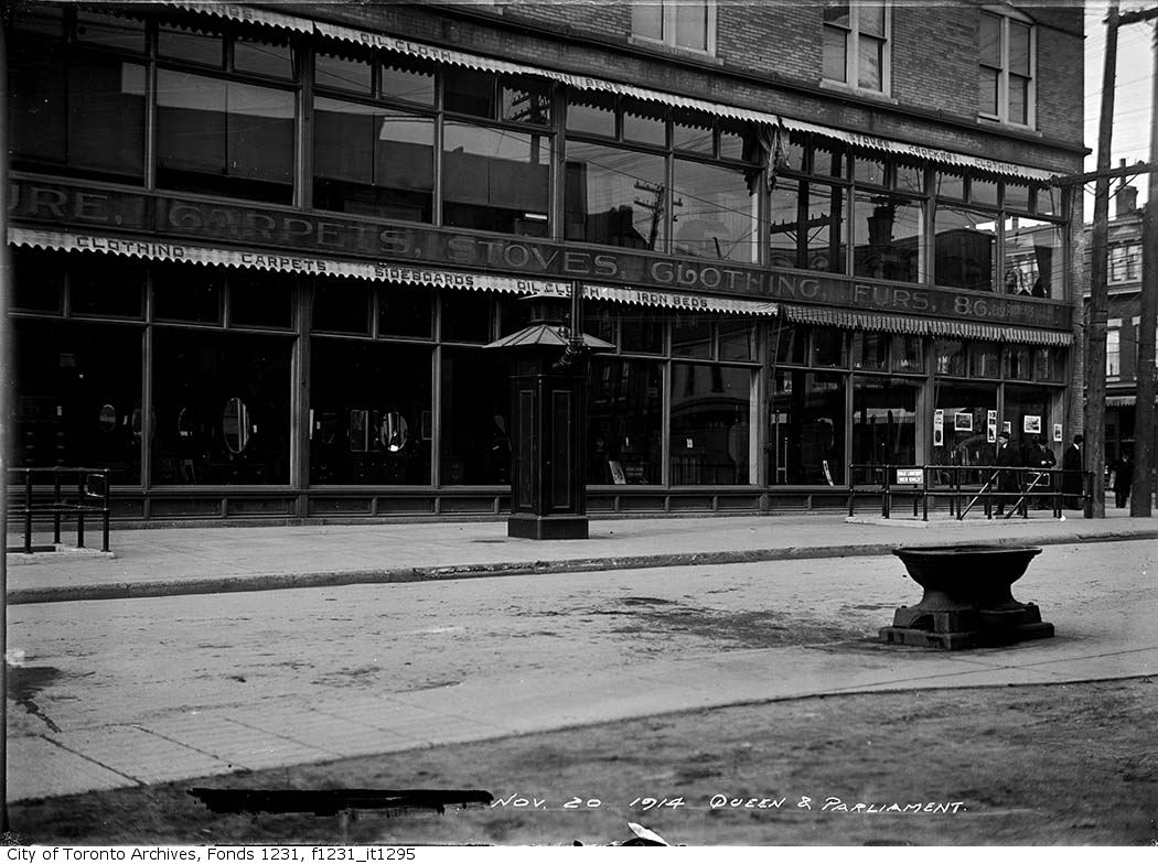
Queen Street and Parliament Street intersection, horse trough and public lavatory
Queen Street and Parliament Street intersection, horse trough and public lavatory, 1914. City of Toronto Archives, Fonds 1231, Item 1295. 43 m away.
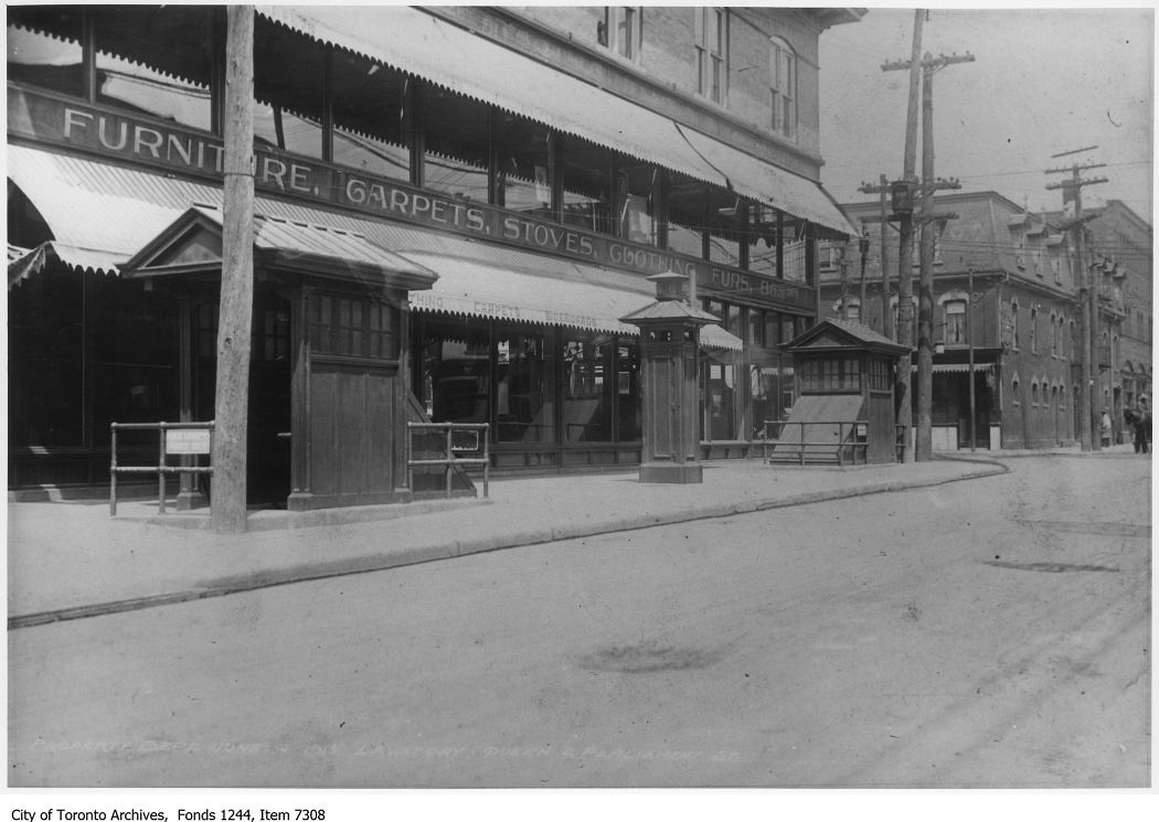
Parliament Street just south of Queen, southwest corner
Parliament Street just south of Queen, southwest corner, 1913. City of Toronto Archives, Fonds 1244, Item 7308. 43 m away.
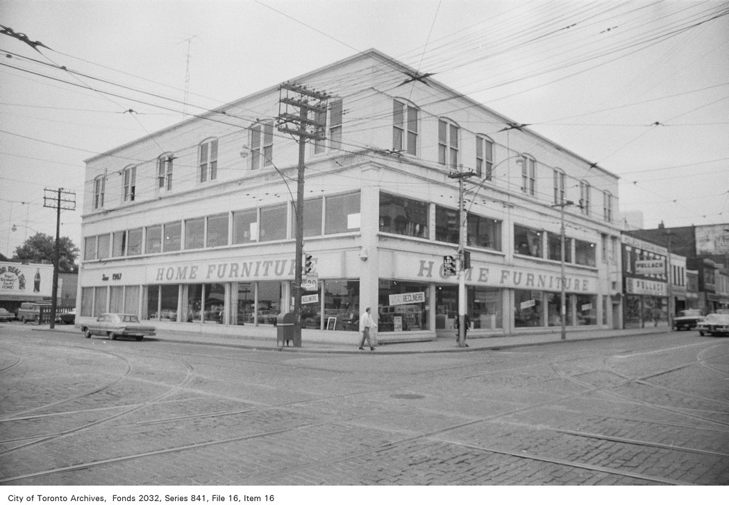
Corner of Parliament St. and Queen St., looking south-west
Corner of Parliament St. and Queen St., looking south-west, 1972. City of Toronto Archives, Fonds 2032, Series 841, File 16, Item 16. 43 m away.
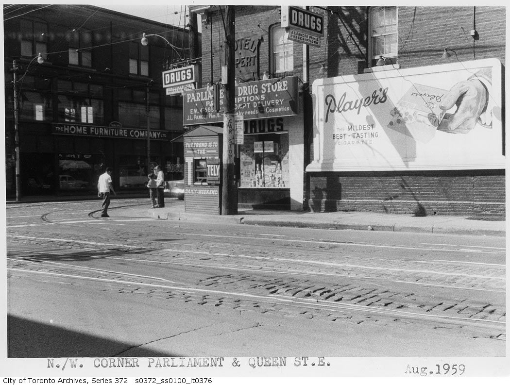
Northwest corner Parliament and Queen Streets
Northwest corner Parliament and Queen Streets, 1959. City of Toronto Archives, Fonds 200, Series 372, Subseries 100, Item 376. 43 m away.
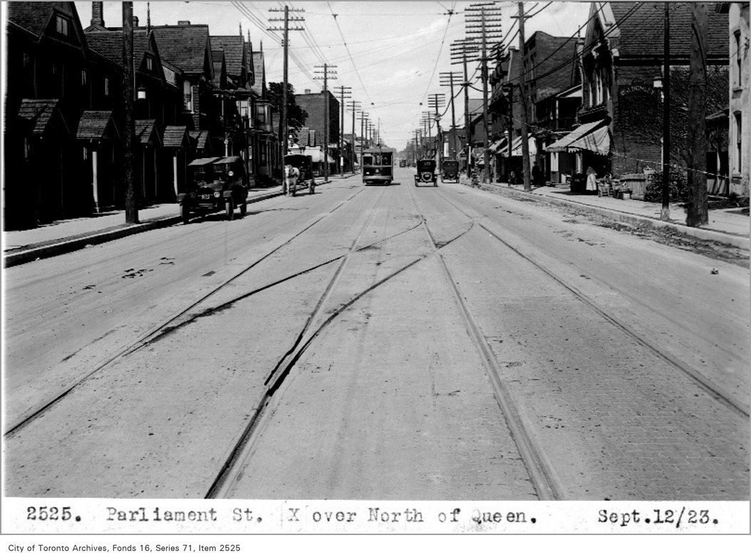
Parliament St cross-over, north of Queen
Parliament St cross-over, north of Queen, 1923. City of Toronto Archives, Fonds 16, Series 71, Item 2525. 43 m away.
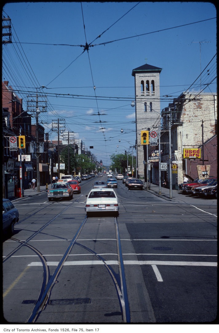
View of Queen Street East at Parliament Street
View of Queen Street East at Parliament Street, 1981. City of Toronto Archives, Fonds 1526, File 75, Item 17. 43 m away.
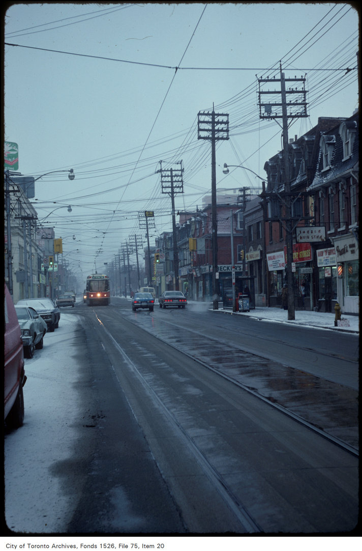
View of Queen Street East at Parliament Street, looking west
View of Queen Street East at Parliament Street, looking west, 1981. City of Toronto Archives, Fonds 1526, File 75, Item 20. 43 m away.
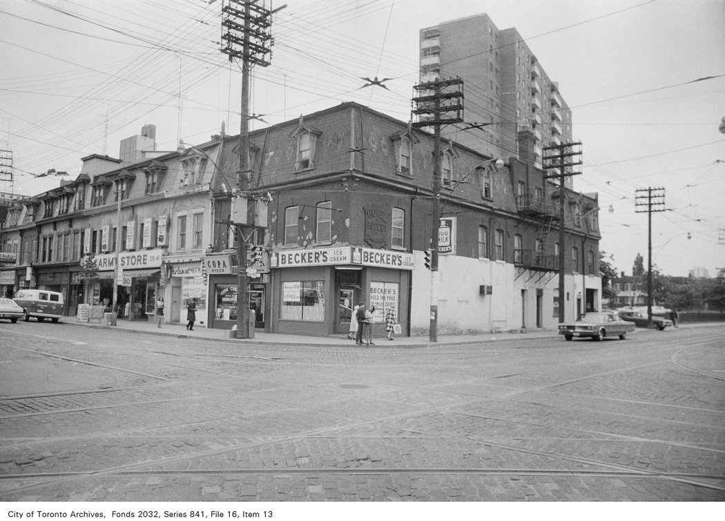
Corner of Parliament St. and Queen St., looking north-west
Corner of Parliament St. and Queen St., looking north-west, 1972. City of Toronto Archives, Fonds 2032, Series 841, File 16, Item 13. 43 m away.
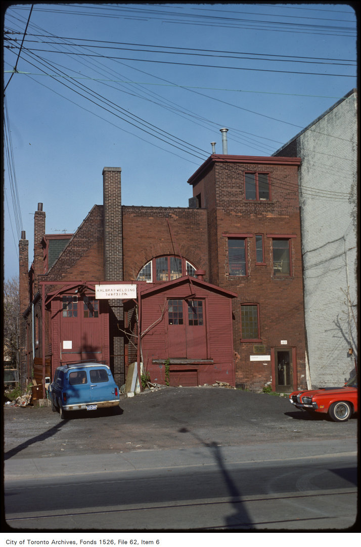
Parliament St, south of Queen
Parliament St, south of Queen, 1977. City of Toronto Archives, Fonds 1526, File 62, Item 6. 43 m away.

Photo locations are matched from each photo’s title against City street and address data, so some may be off. Report a wrong location

358 Queen St E, Toronto — address report · My Address in Toronto