Skip to content
My Address in Toronto
Address report

401 Bloor St E

401 Bloor St E is in North St.James Town. It's outside TRCA flood hazard areas, with 6 planning applications within 250 metres.

Data as of Nov 8, 2026 · Every item lists its source

Follow this address
Key findings
  • Outside TRCA flood and shoreline hazard areas.
  • 5 active development applications and 1 Committee of Adjustment application within 250 m.
Building permits1in the last 5 years
Applications nearby6active, within 250 m
Flood hazardOutsideTRCA mapping
HeritageNot listedCity Heritage Register
Bloor StMount Pleasant RdRosedale Valley RdSherbourne StTed Rogers WayHayden StLinden StHuntley StGlen RdAncroft PlSelby StHoward St123456Map data: City of Toronto (Toronto Centreline)Mount Pleasant RdRosedale Valley RdBloor StSherbourne StJarvis StLinden StHuntley StAncroft PlRachael StGlen Rd123456Map data: City of Toronto (Toronto Centreline)
The red dot is 401 Bloor St E. The circle shows 250 metres, about a 3-minute walk. Numbers match the applications in “What’s changing nearby”.

03The building

ItemFindingPrecisionSource
Building orders and noticesNone on recordThis addressBuilding Construction/Demolition Violations
Building permits, last 5 years1 permitThis addressBuilding Permits · 2 on record
Short-term rentalNot registeredThis addressShort Term Rentals Registration
Heritage statusNot on the Heritage RegisterThis addressHeritage Register
Most recent permits (2 of 2)
  • Sign Building Permit Related · Closed · Sep 20, 2022
    To erect and display three first party signs, displaying static copy, with the following details:- Sign E: an illuminated overhanging structure sign, with a face measuring 1.67m vertically by 5.91m… · Permit 22 179748 DST
  • Demolition · Closed · Mar 16, 2017
    Demolition of a 1 storey mix use / non residential building. · Permit 17 117384 DEM

04Risks and the ground

ItemFindingPrecisionSource
River flood hazardOutsideThis addressTRCA Regulation mapping 2025
Lake shoreline hazardOutsideThis addressTRCA Regulation mapping 2025
TRCA regulated areaOutsideThis addressTRCA Regulation mapping 2025
Lead in tap-water tests, postal area M4W1.7% of tests above Ontario's limitYour area · M4WNon Regulated Lead Sample · 58 tests, Apr 27, 2014 to Feb 1, 2026

TRCA mapping is for screening, not site-specific decisions. Lead results are voluntary samples from homes in the postal area, not this address.

01What’s changing nearby

  1. 1
    576 Sherbourne St · 182 m away
    Committee of Adjustment · Minor variance
    File A0297/26TEY · submitted Apr 22, 2026
  2. 2
    27 Sherbourne St N · 225 m away
    Part Lot Control
    Part Lot Control Exemption for 5 Lots.
    File 21 202763 STE 11 PL · submitted Aug 23, 2021 · City record
  3. 3
    27 Sherbourne St N · 225 m away
    Condominium
    Draft Plan of Common Elements Condominium to permit 5 separate Parcels of Tied Land (POTLs).
    File 21 202761 STE 11 CD · submitted Aug 23, 2021 · City record
  4. 4
    350 Bloor St E · 231 m away
    Site Plan
    Proposal to construct a 63-storey mixed-use building on the subject site. The existing six-storey office building will be replaced. Approximately 486 square metres of retail is proposed at grade, with approximately 8,259 square metres of…
    File 22 172659 STE 11 SA · submitted Jul 6, 2022 · City record
  5. 5
    29 Sherbourne St N · 245 m away
    Part Lot Control
    Part Lot Control Exemption for 5 Lots.
    File 21 202763 STE 11 PL · submitted Aug 23, 2021 · City record
  6. 6
    29 Sherbourne St N · 245 m away
    Condominium
    Draft Plan of Common Elements Condominium to permit 5 separate Parcels of Tied Land (POTLs).
    File 21 202761 STE 11 CD · submitted Aug 23, 2021 · City record
Short-term rentals nearby31 registered homesWithin 250 mShort Term Rentals Registration

Development Applications; Committee of Adjustment Applications; Short Term Rentals Registration.

02City services

ItemFindingPrecisionSource
Garbage dayNovember 18, 2026This addressSolid Waste Collection Schedule
City councillorChris MoiseWard 13Councillor_Moise@toronto.ca · 416-392-7903

05Quick answers about 401 Bloor St E

Is 401 Bloor St E in a flood plain?

No. It is outside TRCA's mapped flood and shoreline hazard areas. Source: TRCA Regulation mapping 2025.

What is being built near 401 Bloor St E?

5 active development applications within 250 metres, the closest at 27 Sherbourne St N (225 m). Source: Development Applications.

When is garbage day at 401 Bloor St E?

Collection calendar Wednesday 1. Next garbage pickup: Nov 18, 2026. Source: Solid Waste Collection Schedule.

Answers are generated from the data on this page and update when the data changes.

06From the archives
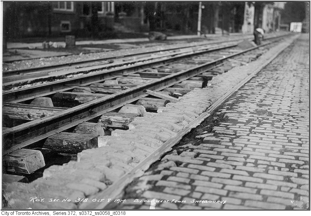
Track - Bloor St. west from Sherbourne to Huntley Sts
1914 · 51 m awayTrack - Bloor St. west from Sherbourne to Huntley StsCity of Toronto Archives, Fonds 200, Series 372, Subseries 58, Item 318
Bloor St. E., looking e. from Sherbourne St. towards Glen Rd. south bridge.
1916 · 54 m awayBloor St. E., looking e. from Sherbourne St. towards Glen Rd. south bridge. Courtesy of Toronto Public Library
Sherbourne St., bridge n. of Bloor St. E., looking n. from Bloor St. during demolition
1952 · 54 m awaySherbourne St., bridge n. of Bloor St. E., looking n. from Bloor St. during demolition Courtesy of Toronto Public Library
Sherbourne St., bridge n. of Bloor St. E., looking s. during demolition.
1952 · 54 m awaySherbourne St., bridge n. of Bloor St. E., looking s. during demolition. Courtesy of Toronto Public Library
Sherbourne St., bridge n. of Bloor St. E., looking s. showing remains of bridge.
1953 · 54 m awaySherbourne St., bridge n. of Bloor St. E., looking s. showing remains of bridge. Courtesy of Toronto Public Library
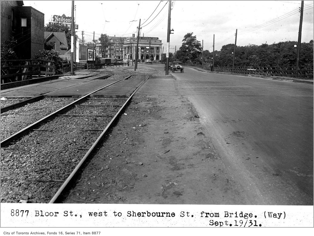
Bloor St, west, to Sherbourne St, from bridge, (Way Department)
1931 · 54 m awayBloor St, west, to Sherbourne St, from bridge, (Way Department)City of Toronto Archives, Fonds 16, Series 71, Item 8877
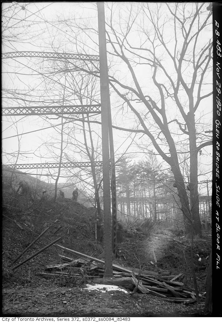
Bloor Street Fill - slide at Bloor fill - looking west to Sherbourne Street Bridge
1920 · 54 m awayBloor Street Fill - slide at Bloor fill - looking west to Sherbourne Street BridgeCity of Toronto Archives, Fonds 200, Series 372, Subseries 84, Item 483
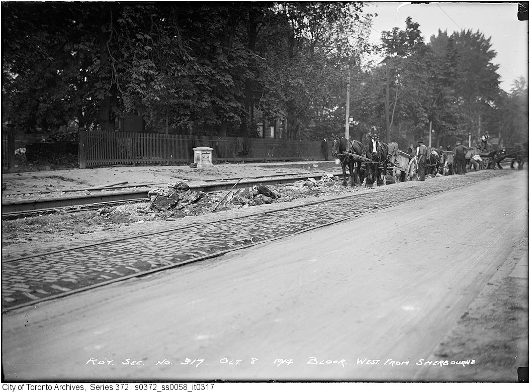
Track - Bloor St. west from Sherbourne
1914 · 54 m awayTrack - Bloor St. west from SherbourneCity of Toronto Archives, Fonds 200, Series 372, Subseries 58, Item 317
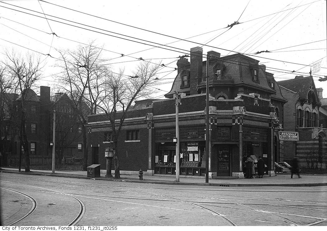
No. 207-209 Bloor St. East, southwest corner of Bloor and Sherbourne streets
1923 · 54 m awayNo. 207-209 Bloor St. East, southwest corner of Bloor and Sherbourne streetsCity of Toronto Archives, Fonds 1231, Item 255

Photo locations are matched from each photo’s title against City street and address data, so some may be off. Report a wrong location

401 Bloor St E, Toronto M4W: permits, flood risk and what's planned nearby · My Address in Toronto