Skip to content
My Address in Toronto
Address report

53 Highview Cres

An address in Corso Italia-Davenport, outside TRCA flood and shoreline hazard areas, with 4 active development applications within 250 metres.

Data as of Nov 8, 2026 · Every item lists its source

Follow this address
Key findings
  • Outside TRCA flood and shoreline hazard areas.
  • 4 active development applications and 3 Committee of Adjustment applications within 250 m.
RentSafe score—not a registered apartment building
Fire code violations—no inspection records
Applications7active within 250 m
Flood hazardOutsideTRCA mapping
Tyrrel AveGlenholme AveRosemount AveLauder AveMount Royal AveAlberta AveBiggar AveBurlington CresHighview CresSpringmount AveNorthcliffe BlvdThome CresBenson AveWinona DrSt Clair Ave WOakwood Ave1234567Map data: City of Toronto (Toronto Centreline)
The red circle shows the 250-metre radius used for “Nearby” items. Numbers match the applications listed below.

01The building

ItemFindingPrecisionSource · as of
RentSafe evaluationNot a registered apartment buildingThis addressApartment Building Evaluation
Fire code inspectionsNo inspection recordsThis addressResidential Fire Inspection Results
Building orders and noticesNone open (1 closed)This addressBuilding Construction/Demolition Violations
Building permits, last 5 years0 permitsThis addressBuilding Permits · 3 on record
Short-term rentalNot registeredThis addressShort Term Rentals Registration
Heritage statusNot on the Heritage RegisterThis addressHeritage Register
Recent permits (3)
  • Second Suite (New) · Closed · Aug 21, 2015
    REV 01 - to create a two unit dwelling and changes to interior alterationsand new steel steps · Permit 15 187943 BLD
  • Building Permit Related(PS) · Closed · Jul 27, 2015
    Plumbing - Proposal for interior alteration to all floors to convert the existing single family dwelling into a converted house with 2 units. · Permit 15 187943 PLB
  • Second Suite (New) · Closed · Jul 27, 2015
    Proposal for interior alteration to all floors. · Permit 15 187943 BLD

02Risks and the ground

ItemFindingPrecisionSource · as of
River flood hazardOutsideThis addressTRCA Regulation mapping 2025
Lake shoreline hazardOutsideThis addressTRCA Regulation mapping 2025
TRCA regulated areaOutsideThis addressTRCA Regulation mapping 2025
Basement flooding study areaBFA44Your areaBasement Flooding Study Areas · the City divides all of Toronto into study areas; this names yours, not a risk level
Lead in tap water samples, postal area M6H13 of 454 above 0.01 ppmYour area · M6HNon Regulated Lead Sample · Jan 6, 2014 to Oct 20, 2026

TRCA mapping is for screening, not site-specific decisions. Lead results are voluntary samples from homes in the postal area, not this address.

03What’s changing nearby

  1. 1
    916 St Clair Ave W · 139 m · Condominium · Draft Plan Approved
    Draft Plan of Standard Condominium for 173 units.
    File 21 230249 STE 09 CD · submitted Oct 25, 2021 · City record
  2. 2
    912 St Clair Ave W · 149 m · Condominium · Draft Plan Approved
    Draft Plan of Standard Condominium for 173 units.
    File 21 230249 STE 09 CD · submitted Oct 25, 2021 · City record
  3. 3
    910 St Clair Ave W · 154 m · Condominium · Draft Plan Approved
    Draft Plan of Standard Condominium for 173 units.
    File 21 230249 STE 09 CD · submitted Oct 25, 2021 · City record
  4. 4
    908 St Clair Ave W · 164 m · Condominium · Draft Plan Approved
    Draft Plan of Standard Condominium for 173 units.
    File 21 230249 STE 09 CD · submitted Oct 25, 2021 · City record
  5. 5
    5 Burlington Cres · 226 m · Committee of Adjustment · Minor variance · Postponed
    File A0718/26TEY · submitted Sep 28, 2026
  6. 6
    51 Springmount Ave · 240 m · Committee of Adjustment · Consent (severance) · Closed
    To obtain consent to sever a portion of the land for the purpose of a lot addition, resulting in the creation of a new lot in conjunction with Application Number B0044/17EYK. A total of three residential lots will be created.
    File B0043/17EYK · submitted May 29, 2017
  7. 7
    51 Springmount Ave · 240 m · Committee of Adjustment · Minor variance · Closed
    To construct a new detached dwelling with an attached garage.
    File A0479/17EYK · submitted May 29, 2017

Development Applications; Committee of Adjustment Applications · 4 registered short-term rentals within 250 m.

04City services

ItemFindingPrecisionSource · as of
Garbage dayNovember 19, 2026This addressCollection calendar Thursday 1
Next recyclingNovember 12, 2026This addressSolid Waste Collection Schedule
City councillorAlejandra BravoWard 9Councillor_Bravo@toronto.ca · 416-392-7012

05Quick answers about 53 Highview Cres

Is 53 Highview Cres in a flood plain?

No. It is outside TRCA's mapped flood and shoreline hazard areas. Source: TRCA Regulation mapping 2025.

What is being built near 53 Highview Cres?

4 active development applications within 250 metres, the closest at 916 St Clair Ave W (139 m). Source: Development Applications.

When is garbage day at 53 Highview Cres?

Collection calendar Thursday 1. Next garbage pickup: Nov 19, 2026. Source: Solid Waste Collection Schedule.

Answers are generated from the data on this page and update when the data changes.

06From the archives
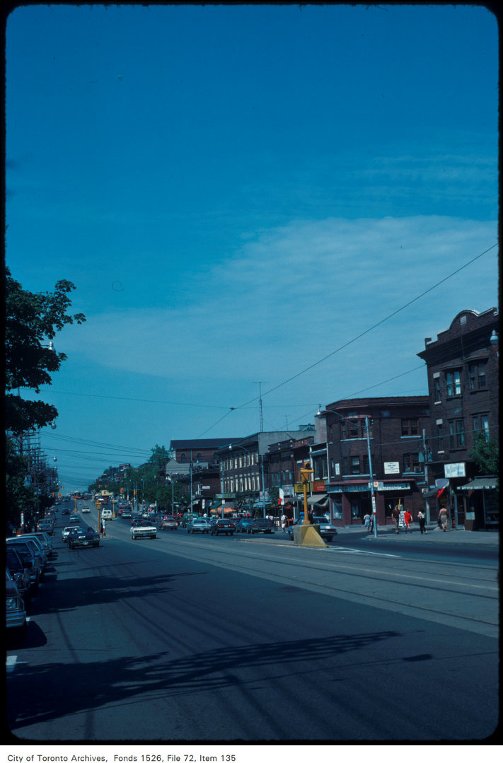
View of St. Clair Avenue West, looking east from Crang Avenue
View of St. Clair Avenue West, looking east from Crang Avenue, 1982. City of Toronto Archives, Fonds 1526, File 72, Item 135. 199 m away.
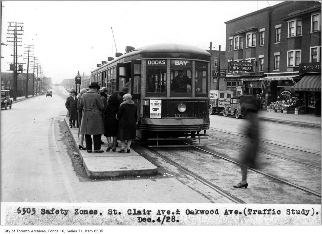
Safety zones, St Clair Ave and Oakwood Ave, (Traffic Study Department)
Safety zones, St Clair Ave and Oakwood Ave, (Traffic Study Department), 1928. City of Toronto Archives, Fonds 16, Series 71, Item 6505. 213 m away.
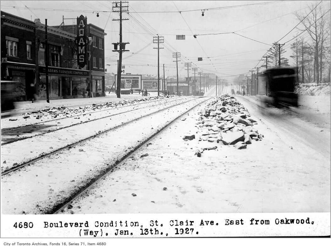
Boulevard condition, St Clair Ave, east, from Oakwood, (Way Department)
Boulevard condition, St Clair Ave, east, from Oakwood, (Way Department), 1927. City of Toronto Archives, Fonds 16, Series 71, Item 4680. 213 m away.
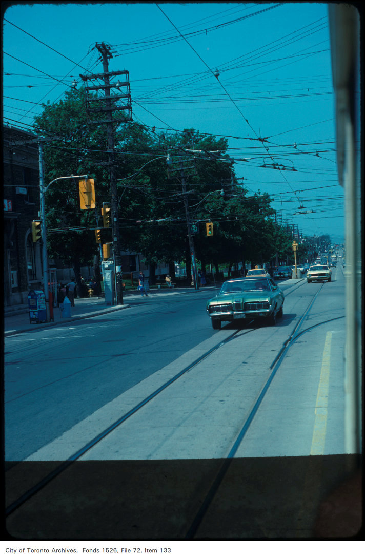
View of St. Clair Avenue West at Oakwood Avenue
View of St. Clair Avenue West at Oakwood Avenue, 1979. City of Toronto Archives, Fonds 1526, File 72, Item 133. 213 m away.
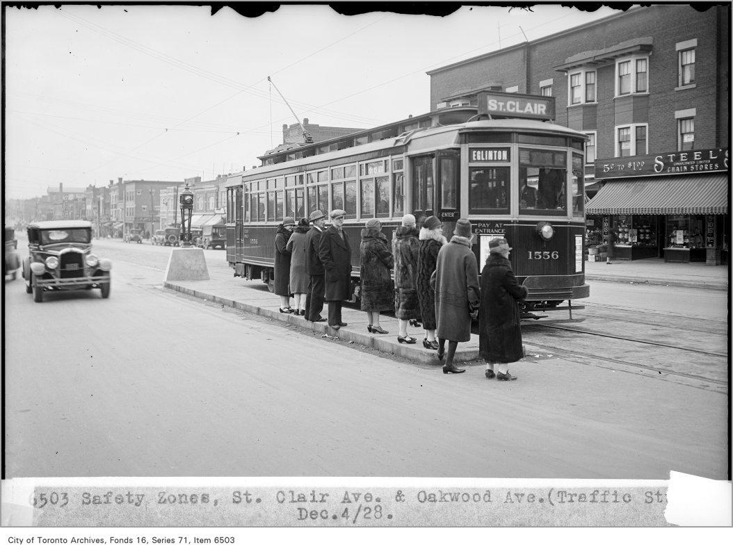
Safety zones, St Clair Ave and Oakwood Ave, (Traffic Study Department)
Safety zones, St Clair Ave and Oakwood Ave, (Traffic Study Department), 1928. City of Toronto Archives, Fonds 16, Series 71, Item 6503. 213 m away.
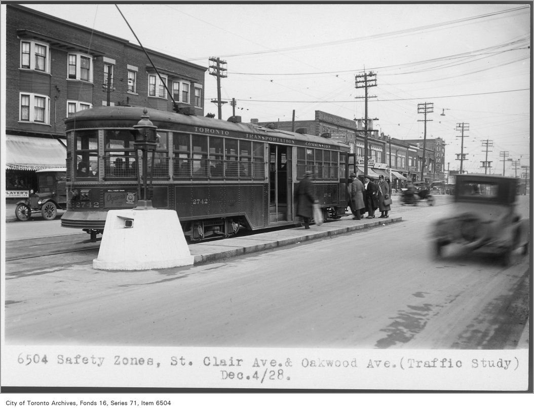
Safety zones, St Clair Ave and Oakwood Ave, (Traffic Study Department)
Safety zones, St Clair Ave and Oakwood Ave, (Traffic Study Department), 1928. City of Toronto Archives, Fonds 16, Series 71, Item 6504. 213 m away.
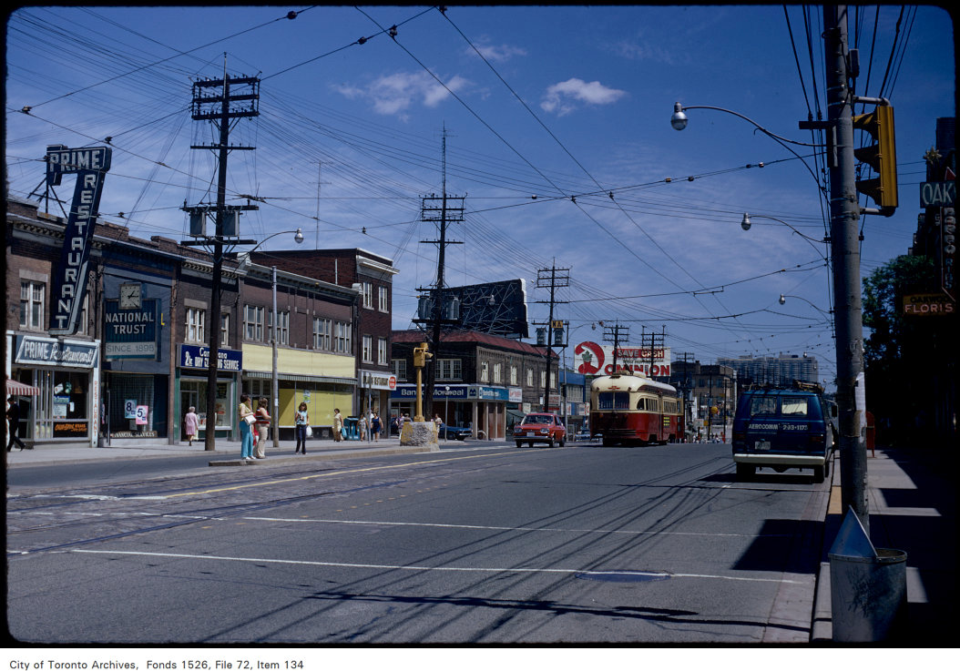
View of St. Clair Avenue West, looking east from Oakwood Avenue
View of St. Clair Avenue West, looking east from Oakwood Avenue, 1972. City of Toronto Archives, Fonds 1526, File 72, Item 134. 213 m away.
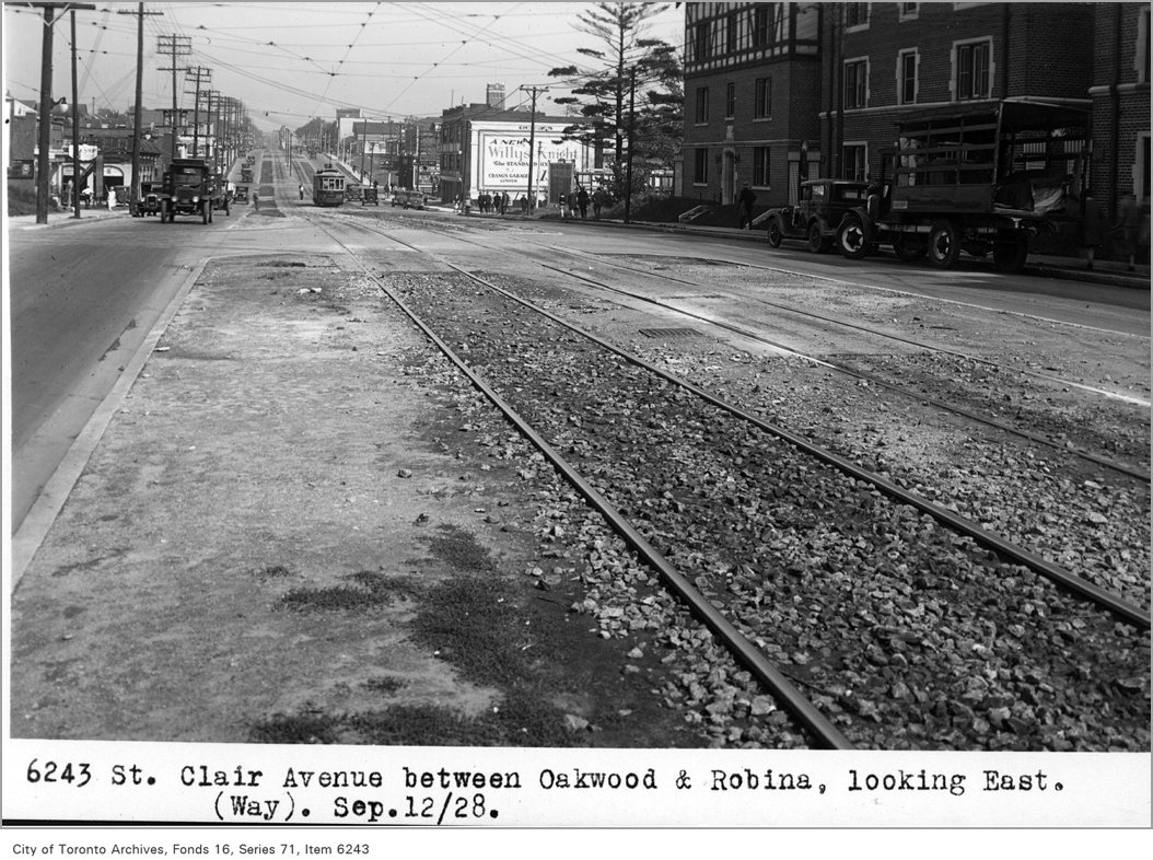
St Clair Avenue, between Oakwood and Robina, looking east, (Way Department)
St Clair Avenue, between Oakwood and Robina, looking east, (Way Department), 1928. City of Toronto Archives, Fonds 16, Series 71, Item 6243. 235 m away.

Photo locations are matched from each photo’s title against City street and address data, so some may be off. Report a wrong location

53 Highview Cres, Toronto — address report · My Address in Toronto