62 Fleming Cres
62 Fleming Cres is in Leaside-Bennington. It's outside TRCA flood hazard areas, with 15 planning applications within 250 metres.
Data as of Nov 8, 2026 · Every item lists its source
- Outside TRCA flood and shoreline hazard areas.
- 13 active development applications and 2 Committee of Adjustment applications within 250 m.
03The building
Most recent permits (3 of 3)
- Building Permit Related(PS) · Inspection · May 29, 2026
Plumbing - Proposal for interior alteration to all floors · Permit 26 167220 PLB - Interior Alterations · Inspection · May 29, 2026
Proposal for interior alteration to all floors · Permit 26 167220 BLD - Building Permit Related (DR) · Closed · May 29, 2026
Drain - Proposal for interior alteration to all floors · Permit 26 167220 DRN
04Risks and the ground
TRCA mapping is for screening, not site-specific decisions. Lead results are voluntary samples from homes in the postal area, not this address.
01What’s changing nearby
- 1278 Bessborough Dr · 42 m awaySite PlanSite Plan Control Application proposes the development of a 44-storey mixed-use building providing residential and commercial use at grade. The building will provide a total of 465 residential units, being a mix of studio, 1-bedroom,…File 25 266344 NNY 15 SA · submitted Dec 15, 2025 · City record
- 2278 Bessborough Dr · 42 m awayOfficial Plan / RezoningRezoning Application to permit a transit supportive mixed-use development featuring three towers of 32, 37 and 43 storeys, A total of 1,201 dwelling units and 419 parking spaces. Provision of both purpose-built rental and condominium…File 24 252497 NNY 15 OZ · submitted Dec 20, 2024 · City record
- 330 Parkhurst Blvd · 86 m awayCommittee of Adjustment · Minor varianceTo construct a new two-storey dwelling. The existing dwelling would be demolished.File A0988/16NY · submitted Nov 10, 2016
- 4660 Eglinton Ave E · 135 m awaySite PlanSite Plan Control Application proposes the development of a 44-storey mixed-use building providing residential and commercial use at grade. The building will provide a total of 465 residential units, being a mix of studio, 1-bedroom,…File 25 266344 NNY 15 SA · submitted Dec 15, 2025 · City record
- 5660 Eglinton Ave E · 135 m awayOfficial Plan / RezoningRezoning Application to permit a transit supportive mixed-use development featuring three towers of 32, 37 and 43 storeys, A total of 1,201 dwelling units and 419 parking spaces. Provision of both purpose-built rental and condominium…File 24 252497 NNY 15 OZ · submitted Dec 20, 2024 · City record
- 6660 Eglinton Ave E · 135 m awaySite PlanIn December 2014, RioCan made application for a Zoning By-law Amendment (file no. 14-267342 NNY 26 OZ) to permit a mix use development at the Property that was primarily mid-rise in scale, with two taller elements of 19 and 13 storeys…File 19 143856 NNY 15 SA · submitted Apr 24, 2019 · City record
- 71787 Bayview Ave · 184 m awaySite PlanProposal for 35-storey mixed use building containing a total of 373 dwelling units and 541 square metres of retail space. The development would have a total gross floor area (GFA) of 27,846 square metres, resulting in a density of 8.83 FSI.File 22 221902 NNY 15 SA · submitted Oct 25, 2022 · City record
- 81787 Bayview Ave · 184 m awayOfficial Plan / RezoningOfficial Plan and Zoning By-law Amendment for a 35-storey mixed use building containing a total of 373 dwelling units and 541 square metres of retail space. The development would have a total gross floor area (GFA) of 27,846 square…File 22 221903 NNY 15 OZ · submitted Oct 25, 2022 · City record
- 91783-1785 Bayview Ave · 213 m awaySite PlanProposal for 35-storey mixed use building containing a total of 373 dwelling units and 541 square metres of retail space. The development would have a total gross floor area (GFA) of 27,846 square metres, resulting in a density of 8.83 FSI.File 22 221902 NNY 15 SA · submitted Oct 25, 2022 · City record
- 101783-1785 Bayview Ave · 213 m awayOfficial Plan / RezoningOfficial Plan and Zoning By-law Amendment for a 35-storey mixed use building containing a total of 373 dwelling units and 541 square metres of retail space. The development would have a total gross floor area (GFA) of 27,846 square…File 22 221903 NNY 15 OZ · submitted Oct 25, 2022 · City record
- 111779-1781 Bayview Ave · 220 m awayOfficial Plan / RezoningOfficial Plan and Zoning By-law Amendment for a 35-storey mixed use building containing a total of 373 dwelling units and 541 square metres of retail space. The development would have a total gross floor area (GFA) of 27,846 square…File 22 221903 NNY 15 OZ · submitted Oct 25, 2022 · City record
- 121779-1781 Bayview Ave · 220 m awaySite PlanProposal for 35-storey mixed use building containing a total of 373 dwelling units and 541 square metres of retail space. The development would have a total gross floor area (GFA) of 27,846 square metres, resulting in a density of 8.83 FSI.File 22 221902 NNY 15 SA · submitted Oct 25, 2022 · City record
Development Applications; Committee of Adjustment Applications; Short Term Rentals Registration.
02City services
05Quick answers about 62 Fleming Cres
Is 62 Fleming Cres in a flood plain?
No. It is outside TRCA's mapped flood and shoreline hazard areas. Source: TRCA Regulation mapping 2025.
What is being built near 62 Fleming Cres?
13 active development applications within 250 metres, the closest at 278 Bessborough Dr (42 m). Source: Development Applications.
When is garbage day at 62 Fleming Cres?
Collection calendar Thursday 2. Next garbage pickup: Nov 12, 2026. Source: Solid Waste Collection Schedule.
Answers are generated from the data on this page and update when the data changes.
06From the archives

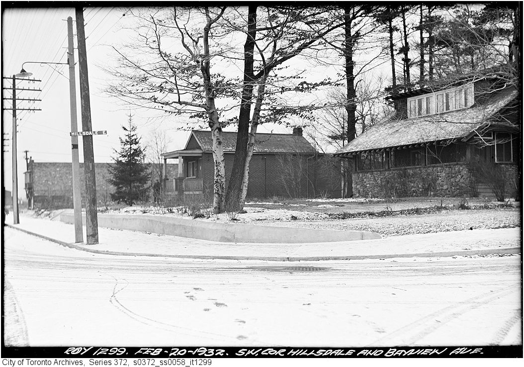


Photo locations are matched from each photo’s title against City street and address data, so some may be off. Report a wrong location