Skip to content
My Address in Toronto
My Address in Toronto · 21 Shallmar Blvd, Toronto · Data as of Nov 10, 2026
Address report · Ward 8 Eglinton-Lawrence

21 Shallmar Blvd

21 Shallmar Blvd is in Forest Hill North. An 8‑storey building with 69 homes is under review 96 m away.

Data as of Nov 10, 2026 · Every item lists its source

Key findings
  • An 8-storey building with 69 homes is under review, 96 m away.
Planning proposals1within 250 m
Major crimes44within 500 m, 12 months
Nearest transit87 mBus 7
ZoningRResidential · up to 21 m tall
Bathurst StElm Ridge DrOld Forest Hill RdVesta DrRidge Hill DrRoselawn AveChaplin CresShallmar BlvdHilltop RdMayfair AveManitou Blvd1Map data: City of Toronto (Toronto Centreline)Bathurst StOld Forest Hill RdVesta DrRidge Hill DrRoselawn AveChaplin CresShallmar BlvdCastlefield AveMayfair AveElm Ridge Dr1Map data: City of Toronto (Toronto Centreline)
The red dot is 21 Shallmar Blvd. The circle shows 250 metres, about a 3-minute walk. Numbers match the proposals in section 01.

01What’s planned near 21 Shallmar Blvd

1 planning proposal within 250 m (about a 3‑minute walk): one in progress. Some cover several addresses; each proposal is listed once. That's about typical for Toronto (the typical address has 1).

In progress

  1. 1
    8-storey building · 69 homes
    515 Chaplin Cres and 1 more address · 96 m away
    Site plan: City review of the design and layout of a new building
    69 homes

    City planners are reviewing it. Residents can comment before a decision is made.

    INACTIVE The subject property contains two 8 storey residential apartment buildings that are linked by a below grade garage. The proposal is to construct an addition to the southern building (515 Chaplin) by adding 69 new units to the…
    All 2 addresses

    515 Chaplin Cres · 525 Chaplin Cres

    File 12 112660 NNY 16 SA · submitted Jan 26, 2012 · City record and how to comment

Development Applications and Committee of Adjustment Applications, City of Toronto. A proposal that covers several addresses is listed once. Decided: development files submitted in the last 4 years; Committee of Adjustment decisions in the last 2 years.

02Street work near 21 Shallmar Blvd

9 City road or sidewalk projects are planned within 500 m. The closest: road resurfacing on Chaplin Cres, near Roselawn Ave, Q1 2028 to Q4 2032.

Road resurfacing
Chaplin Cres, near Roselawn Ave 176 m
Planned: Q1 2028 to Q4 2032
Road resurfacing
Old Forest Hill Rd, Darwin Rd to Bathurst St 182 m
Planned for Q2 2024 to Q3 2025; carried over and still listed.
Road resurfacing
Roselawn Ave, near Chaplin Cres 182 m
Planned: Q1 2028 to Q4 2032
Road resurfacing
Chaplin Cres, Roselawn Ave to Castlefield Ave 210 m
Planned: Q1 2028 to Q4 2032
Show 8 more projects
Road resurfacing
Chaplin Cres, Spadina Rd ( to ) | To: Roselawn Ave 230 m
Planned: Q1 2028 to Q4 2032
Road resurfacing
Manitou Blvd, Elm Ridge Dr to Forest Ridge Dr 235 m
Planned for Q2 2024 to Q3 2025; carried over and still listed.
Road resurfacing
Chaplin Cres, Castlefield Ave to St Clements Ave 289 m
Planned: Q1 2028 to Q4 2032
Road resurfacing
Old Forest Hill Rd, Eglin to N Ave W | To: Darwin Rd 291 m
Planned for Q2 2024 to Q3 2025; carried over and still listed.
Road rebuild
Ridelle Ave, Bathurst St to Manitou Blvd 355 m
Planned: Q2 2026 to Q4 2027
Sidewalk work
Ridelle Ave, Old Park Rd to Bathurst St 364 m
Planned: Q2 2026 to Q4 2027
Road resurfacing
Chaplin Cres, St Clements Ave to Briar Hill Ave 366 m
Planned: Q1 2028 to Q4 2032
Road resurfacing
Bathurst St, Rosemary Lane to Eglinton Ave W 379 m
Planned: Q2 2025 to Q2 2026

Utility digs within 250 m

  • Toronto Water · Chamber repair at 645 Castlefield Ave · 240 m · Jun 16, 2026 to Dec 16, 2026

Source: City of Toronto Road Reconstruction, Road Resurfacing and Sidewalk Construction programs (planned work within 500 m), and Utility Cut Permits. Dates are the City’s plan and can move. “Carried over” means the work was due earlier and is still listed.

03Safety near 21 Shallmar Blvd

Police recorded 44 major crimes within 500 m of this address from Oct 2025 to Sep 2026. That's about typical for Toronto (the typical address has 39). The table compares the neighbourhood's rates with Toronto's.

Major crime Near this addresswithin 500 m, last 12 monthsForest Hill North compared with Torontorate per 100,000 residents, 2025
Break-ins8 near this address16% lower159 vs 190 per 100,000
Thefts over $5,0003 near this address17% lower51 vs 61 per 100,000
Assaults23 near this address46% lower412 vs 768 per 100,000
Car thefts7 near this address68% lower72 vs 225 per 100,000
Robberies3 near this address91% lower7 vs 79 per 100,000

Source: Toronto Police Service Public Safety Data Portal, Major Crime Indicators (Oct 3, 2025 to Sep 30, 2026) and Neighbourhood Crime Rates. Reported incidents only; police place each incident at the nearest intersection. Five-year trends for Forest Hill North

Traffic safety

3 collisions killed or seriously injured someone within 500 m since 2021; 1 involved pedestrians and 1 involved cyclists. Most were on Eglinton Ave W and Bathurst St. Forest Hill North ranks 105th in Toronto for these collisions per resident.

  • Eglinton Ave W at Old Forest Hill Rd · Pedestrian, seriously injured · Nov 6, 2025 · 344 m
  • Bathurst St at Eglinton Ave W · Driver, seriously injured · Oct 9, 2024 · 343 m
  • Bathurst St at Eglinton Ave W · Cyclist, seriously injured · Jul 15, 2022 · 356 m
School safety zone
EGLINTON AVE W EB - MAP 2755 · 50 km/h 396 m
Near S/S OF EGLINTON AVE W FRONTING NO.717 · Weekdays from 7 a.m. to 9 p.m. Fines are higher inside the zone.
Traffic calming
Shallmar Blvd
2 speed humps installed by the City.

Source: Toronto Police Service, collisions in which someone was killed or seriously injured (since 2021, within 500 m); City of Toronto School Safety Zones and Traffic Calming Database.

Other crimes near this address

Last 12 monthsWithin 500 mForest Hill North, per 100,000 residentsCompared with other neighbourhoods
Shootings and firearm discharges00Lower than most
Bicycle thefts541About typical
Thefts from vehicles673Lower than most

Toronto Police Service: Shootings and Firearm Discharges, Bicycle Thefts and Theft From Motor Vehicle, June 2025 to June 2026. Police place each incident at the nearest intersection.

04Getting around from 21 Shallmar Blvd

The nearest subway station is Cedarvale Station (Line 1), about a 16‑minute walk (1.0 km). Within a 5‑minute walk there are 16 TTC stops served by the 5 streetcar and the 7, 33, 14 and 34 buses, with about 2,202 departures on a typical weekday. The nearest GO train station is Mount Dennis GO, 5.3 km away, with 66 train stops on a weekday.

Nearest subway station
Cedarvale Station 1.0 km

Source: TTC · Line 1 · about 16 min walk

Bus
7 Bathurst 87 m
Nearest stop: Bathurst St at Ridge Hill Dr, plus 3 more stops for this route within 250 m.
Bus
33 Forest Hill 108 m
Nearest stop: Bathurst St at Vesta Dr, plus 2 more stops for this route within 250 m.
Bus
14 Glencairn 132 m
Nearest stop: Roselawn Ave at Bathurst St East Side, plus 3 more stops for this route within 250 m.
Streetcar
5 Line 5 Eglinton 315 m
Nearest stop: Forest Hill Station Westbound Platform.
Bus
34 Eglinton 322 m
Nearest stop: Eglinton Ave West at Bathurst St.
Nearest GO train station
Mount Dennis GO 5.3 km

Source: GO Transit · 66 train stops on a weekday

Bike Share stations
Chiltern Hill Rd / Eglinton Ave W 445 m
17 docks. Also: Beltline Trail / Chaplin Cres (453 m), Old Park Rd / Eglinton Ave W (639 m).
Cycling routes
Kay Gardiner Beltline Trl · multi-use trail 74 m
Also: Roselawn Ave, signed bike route (142 m); Elm Ridge Dr, signed bike route (146 m).

TTC and GO Transit schedules for a typical weekday (Nov 11, 2026). Walking times are estimates. Bike Share Toronto station data; City of Toronto Cycling Network and Permit Parking Areas.

How reliable are your routes?

RouteDelays reportedPer 1,000 tripsCompared with other TTC routes
793210.2more than most routes
33962.5fewer than most routes
141795.6more than most routes
3469416.5more than most routes

TTC Bus and Streetcar Delay Data, September 2025 to September 2026: incidents the TTC logged as delaying service. Per 1,000 trips uses each route’s weekday schedule, so busy routes aren’t penalized for running more vehicles. A typical route: 4.0.

Charging and bike parking

  • EV charging: 168 Chiltern Hill Rd
    City-run (Green P): 4 Level 2 ports. Next: 75 Holly St, 2.4 km.
    475 m

City of Toronto: City-operated EV charging stations (private chargers aren’t included); indoor bike stations, shown within 1.5 km.

05Schools and child care near 21 Shallmar Blvd

The closest public and Catholic schools. They may not be the ones assigned to this address; check with the Toronto District School Board (TDSB) or Toronto Catholic District School Board (TCDSB).

Elementary schools

Share of Grade 6 students meeting the provincial standard. Toronto: 87% reading, 54% math.

North Preparatory Junior Public School
454 m · TDSB · grades JK-6 · 230 students
90%above Toronto38%below Toronto
West Preparatory Junior Public School
641 m · TDSB · grades JK-6 · 530 students
87%about the same as Toronto57%above Toronto
Cedarvale Community School
987 m · TDSB · grades JK-8 · 295 students
97%above Toronto69%above Toronto

Secondary schools

Share of students who passed the Grade 10 literacy test on their first try. Toronto: 84%.

Forest Hill Collegiate Institute
349 m · TDSB · grades 9-12 · 825 students
93%above Toronto
Marshall McLuhan Catholic Secondary School
1.3 km · TCDSB · grades 9-12 · 1,050 students
89%above Toronto

The red tick on each bar is the Toronto average. Private schools within 1 km: Alive Montessori And Private School, The Village Shul Synagogue & Supplmentary School, Eitz Chaim School (Bathurst), Torah Emeth Jewish Centre & Eitz Chaim Hebrew School, Bialik Hebrew Day School and 1 more. Source: Ontario Ministry of Education (2026), EQAO results.

Within 500 m (about a 6‑minute walk): three licensed child care centres and no EarlyON centres.

Licensed child care
Alive Montessori & Private School 251 m
2 Wembley Rd · 47 spaces · preschool, kindergarten · in the $10-a-day program
Last health inspection Feb 19, 2026: pass.
Licensed child care
Holland-Bloorview Kids Rehab. - (Play & Learn Nursery) 430 m
666 Eglinton Ave W · 34 spaces · toddler, preschool · in the $10-a-day program · fee subsidies
Last health inspection Oct 2, 2026: pass.
Licensed child care
Alternative Primary School Parent Group 444 m
1100 Spadina Rd · 68 spaces · preschool, kindergarten, school age · in the $10-a-day program · fee subsidies
Last health inspection Jan 20, 2026: pass.

Source: City of Toronto Licensed Child Care Centres, EarlyON Child and Family Centres, and ChildCareSafe (Toronto Public Health inspections).

06Parks, trees and libraries near 21 Shallmar Blvd

There are 4 parks and 1 community centre within 500 m. The nearest pool is North Toronto Memorial Community Centre, 1.7 km away.

Nearest of each
Playground 640 m · Cortleigh ParketteSplash pad 2.5 km · Glen Long Community CentreWading pool 1.7 km · Eglinton ParkWashroom 383 m · Memorial Park-North YorkBasketball 1.9 km · Walter Saunders Memorial ParkTennis 1.0 km · Viewmount ParkPickleball 1.4 km · Cedarvale ParkTable tennis 1.4 km · Cedarvale ParkOutdoor fitness 1.8 km · Cedarvale RavineIndoor pool 1.7 km · North Toronto Memorial Community Centre

Parks and community centres within 500 m

Show 5 more

Pools, courts and more

Outdoor pool
200 Eglinton Ave W · 27 drop-in swims this week (Adapted Leisure Swim, Lane Swim, Leisure Swim). Last health inspection Jul 15, 2026: pass.
Indoor pool
529 Vaughan Rd · 10 drop-in swims this week (Lane Swim, Leisure Swim). Last health inspection Sep 24, 2026: pass.
Tennis courts
Cedarvale Park 1.4 km
443 Arlington Ave · 4 courts · lit at night. The nearest courts, at Viewmount Park (1.0 km), are run by a club (Viewmount Park Tennis Club).
Outdoor rink
Cedarvale Park 1.5 km
443 Arlington Ave · lit at night. Usually open December to March.
Indoor arena
Larry Grossman Forest Hill Memorial Arena 419 m
340 Chaplin Cres · 2 ice pads
Public washroom
Memorial Park-North York 383 m
Open · 9 a.m. to 10 p.m..
Off-leash dog area
Cedarvale Park 1.3 km
443 Arlington Ave · fenced · separate area for small dogs

Also nearby

Street trees
41 on Shallmar Blvd (1–41)
In front of this address: catalpa, northern. Most common: maple and elm. Forest Hill North ranks 75th in Toronto for street trees per resident.
Public library
700 Eglinton Avenue West · today: Tue 9 a.m. to 8:30 p.m.

Source: City of Toronto Parks and Recreation Facilities, Registered Programs and Drop-In Programs, Tennis Courts, Outdoor and Indoor Ice Rinks, Washroom Facilities, Off-Leash Areas, Street Tree Data; Toronto Public Health SwimSafe and Beach Water Quality; Toronto Public Library branches.

Park space

Park and open space8.9%of the land within 500 m (a typical Toronto neighbourhood: 7.8%)
Nearest large parkKay Gardner Beltline Park20.5 hectares · 70 m away
Smaller parks nearby2Shallmar Parkette (0.2 ha), Castlefield Parkette (0 ha)

Park projects nearby

  • New Park at 2788 Bathurst Street
    A new 1250 m2 park is coming to 2788 Bathurst St. as a result of a mixed-use development project.
    In progress · 887 m
  • York Beltline Trail Extension
    The City is extending the York Beltline Trail. Learn more about the project and how you can get involved.
    In progress · 1.2 km
  • Cedarvale Park Playground Improvements
    The City is improving the playground in Cedarvale Park as part of an ongoing program to enhance playgrounds and play spaces across the city.
    In progress · 1.5 km

City of Toronto: Green Spaces (parks, natural areas and conservation land; hydro corridors, golf courses, cemeteries and road verges aren’t counted); Park and Recreation Facility Projects within 1.5 km.

07The building at 21 Shallmar Blvd

No building permits, building orders, by-law investigations, heritage listing or short-term rental registration on record for 21 Shallmar Blvd.

The lot

Lot area6,456 m²about 69,492 sq ft

Measured from the City’s property boundary map. It’s compiled from records of varying age, so treat these as approximate; a survey is the legal measure.

Green roof and solar permits

No green roof or solar hot water permits at this address. Within 500 m: 3 with a green roof and 1 with solar hot water.

City of Toronto Building Permits: Green Roofs, and Solar Hot Water Heaters.

08What can be built at 21 Shallmar Blvd

R (Residential) zoning allows houses, townhouses and some low-rise apartment buildings, depending on the lot. The numbers below are the main limits; the full rules depend on the lot.

Zone
R · Residential
Full zone label: R (d2.0) (x546)

Source: Zoning By-law 569-2013, chapter 10

Height limit
21 m
About 6 storeys.

Source: Height overlay

Density
2 times the lot area
All floors together can add up to 2 times the area of the lot.

Source: Zone label (d)

Site-specific exception
Exception 546
Extra rules apply to this area. They are listed under exception 546 in the zoning by-law (article 10.10) and can loosen or tighten the limits above.

Source: Zone label (x)

Special areas

Major transit station area
Forest Hill
A protected major transit station area: the City sets minimum densities to encourage more homes and jobs near transit.

Source: City of Toronto Zoning By-law 569-2013 (zone, height and lot coverage overlays), Heritage Conservation Districts, Major Transit Station Areas, Secondary Plans and Archaeological Potential. This is a summary, not a zoning review. Read the by-law and see the City’s map.

09Around the block

Short-term rentals0registered within 250 m

Stays of less than 28 days, like Airbnb. Most Toronto addresses (73%) have at least one short-term rental nearby.

Licensed rooming houses0within 250 m

Houses that rent individual rooms with shared kitchens or bathrooms. The City licenses them to enforce safety standards.

New storefront businesses1licensed in Forest Hill North, last 90 days

Viet Caphe (restaurant or bar).

Public spaces (POPS)0privately owned, open to the public, within 500 m
Rental homes demolished6approved within 500 m · 7 to be replaced

The City requires most demolished rental homes to be replaced at similar rents.

Shelters and respite sites0within 500 m
Rental demolitions approved within 500 m (1)
  • 2004, 2006 and 2008 Bathurst Street · 6 rental homes to be demolished, 7 replaced · 470 m · approved Mar 25, 2026 · City report

Source: Affordable Housing Pipeline, Rental Housing Demolition and Conversion applications, Short Term Rentals Registration, Multi-Tenant (Rooming) House Licences, Business Licences and Permits (storefront types; owners’ personal names are never shown), POPS, and Daily Shelter Occupancy (Nov 8, 2026). Confidential shelter locations are not published.

Traffic on your street

There’s no recent count on this street. The nearest, on a similar street:

Vehicles a dayabout 4,900Mayfair Ave, Eglinton Ave W to Vesta Dr (321 m away)
Speed37 km/h85% of drivers went this speed or slower
CountedOct 2017The City’s latest count here

City of Toronto Transportation Services: speed, volume and classification counts since 2016.

Parking tickets on this block

259 tickets in 2025 on Shallmar Blvd between numbers 0 and 71: 115 for parking at prohibited times, 68 for standing where it’s not allowed.

City of Toronto Parking Tickets, 2025. Placed by the street address the officer recorded.

Main street business area

Upper Village BIA, about 230 m away. Business Improvement Areas are local business associations that run street events and improvements.

City of Toronto Business Improvement Areas, within 400 m.

What neighbours report to 311

In the last 12 months, 3,827 service requests came from postal area M5N, which includes 21 Shallmar Blvd. The most common:

Tree emergency clean-up
267
Damaged bin lids
254
Tree pruning
146
Sidewalk snow clearing
136
Potholes and road damage
108
Property standards
101

City of Toronto 311 Service Requests, October 2025 to October 2026. 311 publishes only the first three characters of the postal code, so this covers the wider postal area. Counts reflect how often people call as well as how often problems happen.

10Risks and environment at 21 Shallmar Blvd

Flood and shoreline hazards
Outside This address
TRCA's maps show this address is outside the areas that could flood from rivers in a major storm (TRCA plans for a storm like Hurricane Hazel in 1954) and outside lake shoreline hazards. Basement flooding from overloaded sewers can still happen anywhere in the city.

Source: TRCA Regulation mapping 2025

Lead in tap-water tests, postal area M5N
1.3% of tests above Ontario's limit Your area · M5N
In postal area M5N, 2 of 152 home tap-water samples (1.3%) tested above Ontario's limit for lead (10 micrograms per litre). Across Toronto, 2.0% of samples did, so M5N is lower than the city overall. Health Canada recommends a stricter limit of 5 micrograms per litre: 5 samples here (3.3%) were above it. These are voluntary tests, mostly from older homes, so they don't tell you about this house. Lead comes from old pipes and plumbing, not the City's treatment plants. If your home was built before the mid-1950s, you can get a free test kit by calling 311.

Source: Non Regulated Lead Sample · 152 tests, Jan 22, 2014 to Aug 5, 2026

Air quality now
2 · Low risk Your area
Air Quality Health Index from Environment and Climate Change Canada's Toronto Downtown station, 3.9 km away, measured 5:00 PM EST Tuesday 10 November 2026. Forecast high for the next 24 hours: 3 (low risk). The scale runs from 1 to 10+; 1 to 3 is low risk.

Source: Environment and Climate Change Canada · hourly

TRCA mapping is for screening, not site-specific decisions. Lead results are voluntary samples from homes in the postal area, not this address.

11The neighbourhood: Forest Hill North

Forest Hill North had 12,290 residents in 2021. The median household income was $90,000, about the same as the typical Toronto neighbourhood ($85,000). 65% of households rent (typical neighbourhood: 46%). 39% of renters spend 30% or more of their income on housing. 30% of workers commuted by transit and 9% walked or cycled (typical neighbourhood: 26% and 5%). The most common first languages other than English and French are Pilipino, Filipino (6.9%), Spanish (4.1%) and Hebrew (3.8%). Source: 2021 Census; the next census was taken in 2026.

Residents (2021)12,290Forest Hill North
Median household income$90,000typical neighbourhood $85,000
Households that rent65%typical neighbourhood 46%
Commute by transit30%typical neighbourhood 26%

Rents aren't published for single neighbourhoods. Across central Toronto (the old City of Toronto, before the 1998 amalgamation), a two-bedroom in a purpose-built rental building averaged $2,457 a month in October 2025, up 6% from a year earlier. The Toronto average was $2,055. The vacancy rate was 3.2%. These averages include long-term tenants; new listings usually cost more.

Average rent, October 2025Central TorontoChange in a yearToronto
Studio$1,526+2%$1,499
1 bedroom$1,914+4%$1,763
2 bedrooms$2,457+6%$2,055
3 bedrooms or more$3,1950%$2,361

Source: CMHC, Rental Market Survey (October 2025), purpose-built rental apartments, central Toronto (the old City of Toronto, before the 1998 amalgamation). CMHC doesn’t publish rents for single neighbourhoods. Adapted by My Address in Toronto.

How Forest Hill North compares with the rest of Toronto →

12Quick answers about 21 Shallmar Blvd

What is being built near 21 Shallmar Blvd?

There is 1 planning proposal within 250 metres (one in progress). The largest is an 8-storey building with 69 homes at 515 Chaplin Cres, 96 m away (under review). Source: Development Applications; Committee of Adjustment Applications, as of Nov 10, 2026.

Is the area around 21 Shallmar Blvd safe?

Police recorded 44 major crimes within 500 m from Oct 2025 to Sep 2026: 23 assaults, 8 break-ins, 7 car thefts, 3 robberies and 3 thefts over $5,000. That's about typical for Toronto (the typical address has 39). Per resident, in Forest Hill North in 2025, assaults, car thefts and robberies were below it. Police place each incident at the nearest intersection, so these figures describe the area, not this address. Source: Toronto Police Service, as of Nov 10, 2026.

How do you get around from 21 Shallmar Blvd?

The nearest subway station is Cedarvale Station (Line 1), 1.0 km away (about a 16-minute walk). Nearby: the 7 Bathurst bus (stop at Bathurst St and Ridge Hill Dr, 87 m); the 33 Forest Hill bus (stop at Bathurst St and Vesta Dr, 108 m); the 14 Glencairn bus (stop at Roselawn Ave and Bathurst St East Side, 132 m). Source: TTC and GO Transit schedules, as of Nov 10, 2026.

What schools are near 21 Shallmar Blvd?

The closest are North Preparatory Junior Public School, West Preparatory Junior Public School and Forest Hill Collegiate Institute. These may not be the assigned schools; check with the school board. Source: Ontario Ministry of Education school information, as of Nov 10, 2026.

What neighbourhood is 21 Shallmar Blvd in?

21 Shallmar Blvd is in Forest Hill North, one of the City of Toronto's 158 official neighbourhoods, in Ward 8 Eglinton-Lawrence. Forest Hill North had 12,290 residents in 2021, with a median household income of $90,000. Source: City of Toronto neighbourhoods; 2021 Census, as of Nov 10, 2026.

What is rent like near 21 Shallmar Blvd?

Rents aren't published for single neighbourhoods. In October 2025, a two-bedroom in a purpose-built rental building across central Toronto (the old City of Toronto, before the 1998 amalgamation) averaged $2,457 a month. That's an average across all tenants, including long-term ones; new listings usually cost more. Source: CMHC Rental Market Survey, as of Nov 10, 2026.

Is 21 Shallmar Blvd in a flood plain?

No. TRCA maps it outside river flood and lake shoreline hazard areas. Basement flooding from sewers can still happen anywhere. Source: TRCA Regulation mapping 2025, as of Nov 10, 2026.

Is 21 Shallmar Blvd a heritage property?

No. It isn't listed or designated on the City's Heritage Register. Source: Heritage Register, as of Nov 10, 2026.

Who is the city councillor for 21 Shallmar Blvd?

Mike Colle, councillor for Ward 8 Eglinton-Lawrence. Email councillor_colle8@toronto.ca or call 416-338-2500. Source: City of Toronto elected officials, as of Nov 10, 2026.

When is garbage day at 21 Shallmar Blvd?

Collection is on Thursdays. Green bin goes out every week; garbage and recycling alternate weeks. The next garbage pickup is Nov 12, 2026. Source: Solid Waste Collection Schedule, as of Nov 10, 2026.

Answers are generated from the data on this page and update when the data changes.

Archive photos from near this address: myaddressintoronto.com/address/21-shallmar-blvd#sec-history
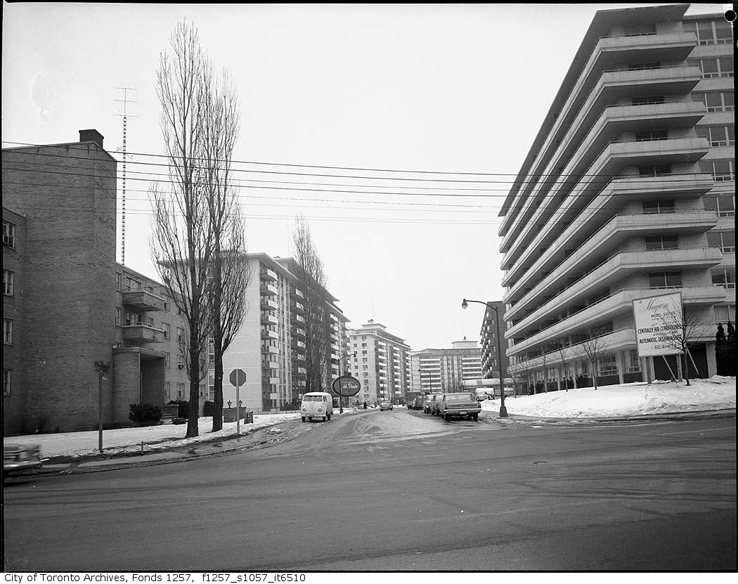
13From the archives

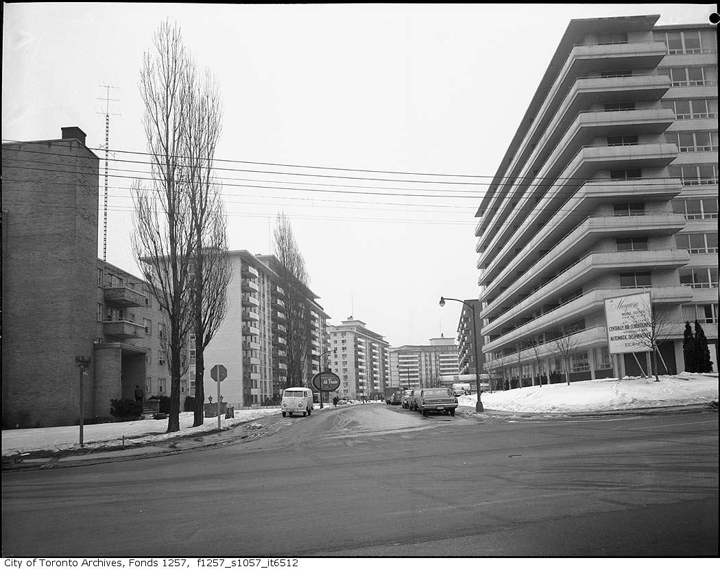
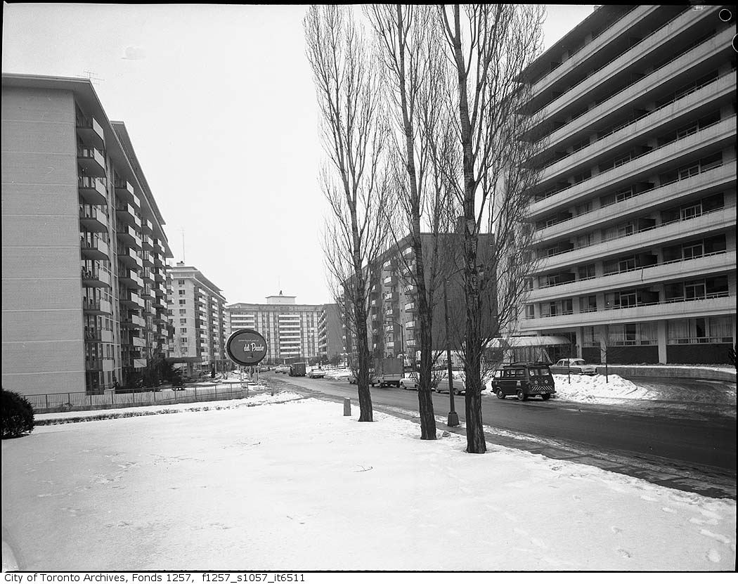
Marquesa and Del Prado apartments, Bathurst Street and Shallmar Boulevard
1960 · 62 m awayMarquesa and Del Prado apartments, Bathurst Street and Shallmar BoulevardCity of Toronto Archives, Fonds 1257, Series 1057, Item 6511
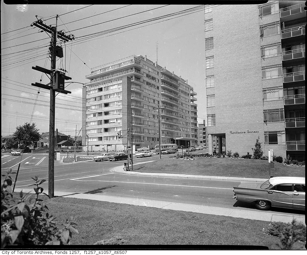
Marquesa and Del Prado apartments, Bathurst Street and Shallmar Boulevard
1960 · 62 m awayMarquesa and Del Prado apartments, Bathurst Street and Shallmar BoulevardCity of Toronto Archives, Fonds 1257, Series 1057, Item 6510
Marquesa and Del Prado apartments, Bathurst Street and Shallmar Boulevard
1960 · 62 m awayMarquesa and Del Prado apartments, Bathurst Street and Shallmar BoulevardCity of Toronto Archives, Fonds 1257, Series 1057, Item 6512
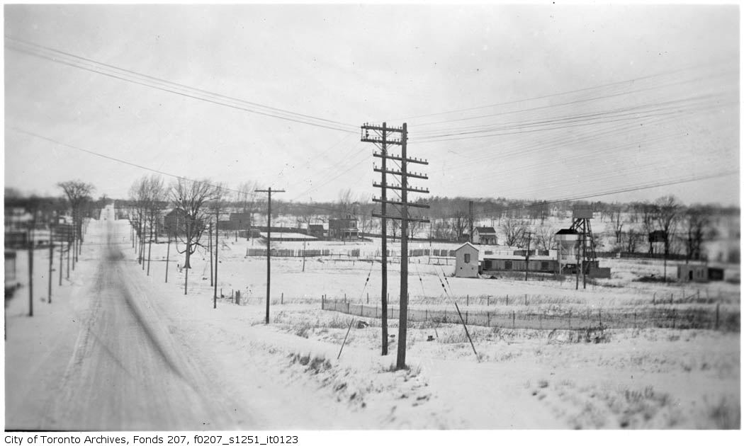
In arbitration, Tomsett and Forest Hill Exhibit 41 : view looking north-easterly showing properties in the neighbourhood of Bathurst St. and Roselawn Ave., taken from top of new concrete bridge on Old Forest Hill Rd.
1935 · 146 m awayIn arbitration, Tomsett and Forest Hill Exhibit 41 : view looking north-easterly showing properties in the neighbourhood of Bathurst St. and Roselawn Ave., taken from top of new concrete bridge on Old Forest Hill Rd.City of Toronto Archives, Fonds 207, Series 1251, Item 123
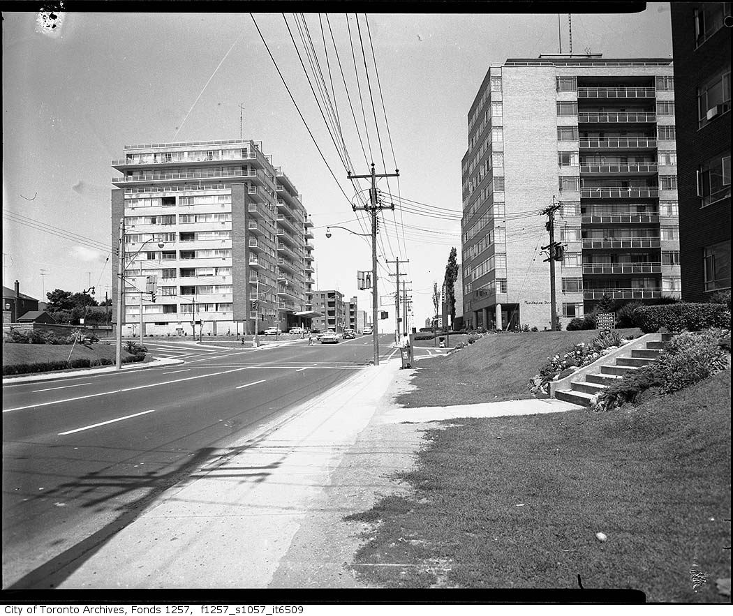
Apartment buildings, Bathurst Street and Roselawn Avenue
1960 · 146 m awayApartment buildings, Bathurst Street and Roselawn AvenueCity of Toronto Archives, Fonds 1257, Series 1057, Item 6509
Apartment buildings, Bathurst Street and Roselawn Avenue
1960 · 146 m awayApartment buildings, Bathurst Street and Roselawn AvenueCity of Toronto Archives, Fonds 1257, Series 1057, Item 6507
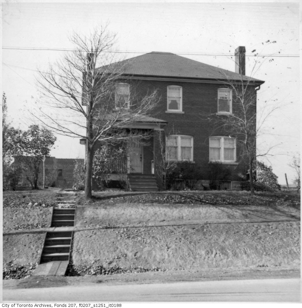
View of Bathurst St., vicinity of Roselawn Ave. : Mr. Tomsett's residence
1934 · 146 m awayView of Bathurst St., vicinity of Roselawn Ave. : Mr. Tomsett's residenceCity of Toronto Archives, Fonds 207, Series 1251, Item 188
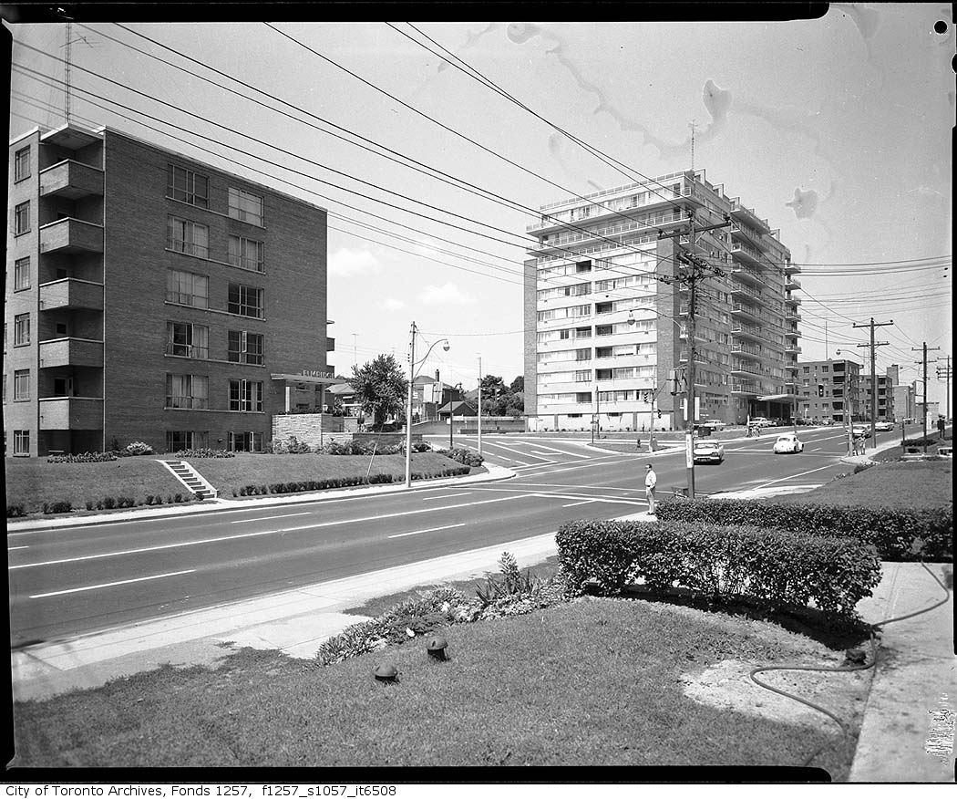
Apartment buildings, Bathurst Street and Roselawn Avenue
1960 · 146 m awayApartment buildings, Bathurst Street and Roselawn AvenueCity of Toronto Archives, Fonds 1257, Series 1057, Item 6508
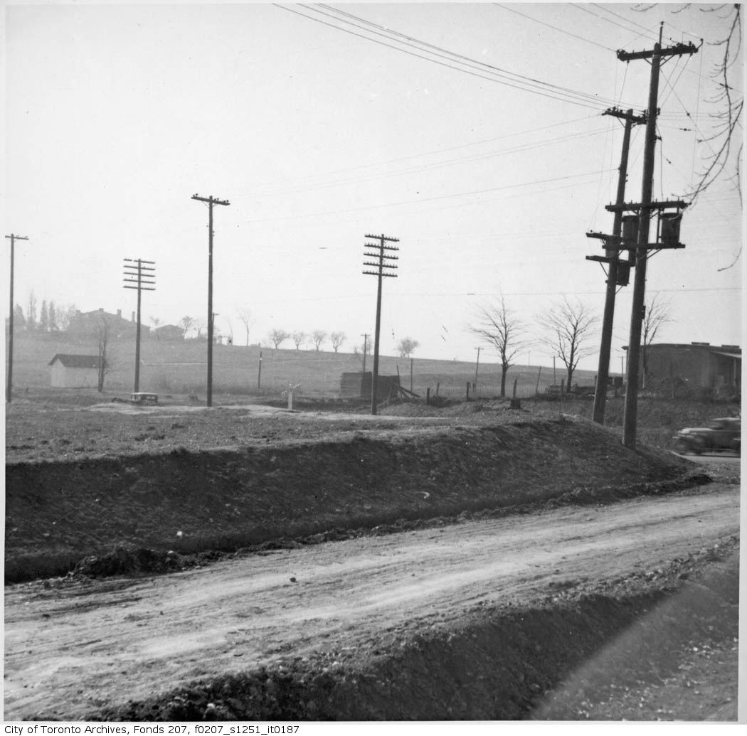
View of Bathurst St., vicinity of Roselawn Ave. : looking south-westerly towards new railway crossing from Roselawn Ave., east of Bathurst St.
1934 · 146 m awayView of Bathurst St., vicinity of Roselawn Ave. : looking south-westerly towards new railway crossing from Roselawn Ave., east of Bathurst St.City of Toronto Archives, Fonds 207, Series 1251, Item 187

Photo locations are matched from each photo’s title against City street and address data, so some may be off. Report a wrong location

myaddressintoronto.com/address/21-shallmar-blvd · Information from public sources; not a substitute for a home inspection, legal advice or a TRCA site review.
21 Shallmar Blvd, Toronto M5N (Forest Hill North): development nearby, crime, transit and schools · My Address in Toronto