Skip to content
My Address in Toronto
My Address in Toronto · 22 Earl St, Toronto · Data as of Nov 8, 2026
Address report · Ward 13 Toronto Centre

22 Earl St

22 Earl St is in North St.James Town, on the City's Heritage Register. There are 13 planning proposals within 250 m, including a 60‑storey building with 1,362 homes (under review). Sherbourne Station is a 6‑minute walk.

Data as of Nov 8, 2026 · Every item lists its source

Key findings
  • It is listed on the Heritage Register, which flags heritage value without full designation.
  • A 60-storey building with 1,362 homes is under review, 187 m away (30 Huntley St and 11 more addresses).
  • Assaults in North St.James Town were above the Toronto rate in 2025.
  • Sherbourne Station (Line 2) is about a 6-minute walk.
  • The nearest elementary school is Our Lady of Lourdes Catholic School, 338 m away.
Planning proposals12within 250 m
Major crimes536within 500 m, 12 months
Nearest transit387 mSherbourne station
Garbage dayWednesdaynext: Nov 11
Church StSherbourne StWellesley StJarvis StHayden StLinden StMonteith StIsabella StBleecker StOntario StHuntley StEarl PlEarl StGloucester StLourdes LaneHomewood Ave123456789101112Map data: City of Toronto (Toronto Centreline)Sherbourne StWellesley StJarvis StLinden StHuntley StEarl PlEarl StGloucester StLourdes LaneHomewood Ave123456789101112Map data: City of Toronto (Toronto Centreline)
The red dot is 22 Earl St. The circle shows 250 metres, about a 3-minute walk. Numbers match the proposals in section 01.

01What’s planned near 22 Earl St

13 planning proposals within 250 m (about a 3‑minute walk): 11 in progress and two decided recently. Some cover several addresses; each proposal is listed once. That's more than at almost all Toronto addresses.

In progress

  1. 1
    69-storey building · 872 homes
    29 Linden St and 9 more addresses · 18 m away
    Rezoning: a request to change the Official Plan or zoning so something new can be built

    It has been appealed to the Ontario Land Tribunal (formerly the OMB), which will make the final decision.

    Official Plan Amendment & Rezoning for a 69-storey residential building that will contain 872 residential dwelling units (including rental replacement units).
    All 10 addresses

    29 Linden St · 31 Linden St · 33 Linden St · 37 Linden St · 566 Sherbourne St · 568 Sherbourne St · 570 Sherbourne St · 572 Sherbourne St · 574 Sherbourne St · 576 Sherbourne St

    File 23 138754 STE 13 OZ · submitted Apr 27, 2023 · City record and how to comment
  2. 2
    61-storey building · 716 homes
    576 Sherbourne St · 27 m away
    Site plan: City review of the design and layout of a new building

    City planners are reviewing it. Residents can comment before a decision is made.

    Site Plan Application for a 61-storey residential building that will contain 716 residential dwelling units (including 45 replacement rental units).
    File 23 138753 STE 13 SA · submitted Apr 27, 2023 · City record and how to comment
  3. 3
    59-storey building with shops
    8 A Linden St and 21 more addresses · 59 m away
    Rezoning: a request to change the Official Plan or zoning so something new can be built

    It has been appealed to the Ontario Land Tribunal (formerly the OMB), which will make the final decision.

    Proposed Official Plan and Zoning By-law Amendment for 59-storey (west tower) and 48-storey (east tower) mixed-use buildings that will include: affordable rental units, rental replacement units, community spaces, retail, a daycare…
    All 22 addresses

    8 A Linden St · 47 Huntley St · 49 Huntley St · 51 Huntley St · 53 Huntley St · 55 Huntley St · 57 Huntley St · 59 Huntley St · 61 Huntley St · 63 Huntley St · 65 Huntley St · 12 Linden St · 16 Linden St · 18 Linden St · 24 Linden St · 26 Linden St · 1 Selby St · 3 Selby St · 5 Selby St · 7 Selby St · 9 Selby St · 11 Selby St

    File 21 227527 STE 13 OZ · submitted Oct 19, 2021 · City record and how to comment
Show 8 more in progress
  1. 4
    Split the lot
    10 Huntley St · 109 m away
    Committee of Adjustment · Consent: permission to split a lot or change property lines

    The hearing was postponed. A new date hasn't been published yet.

    To obtain consent to sever the property into two residential lots with a stratified severance, as well as to create new easements/rights-of-ways. This is currently under the review of Site Plan Control (File Number 22 192523 STE 13 SA).
    File B0022/25TEY · submitted Mar 24, 2025
  2. 5
    59-storey building with shops
    47 Huntley St · 137 m away
    Site plan: City review of the design and layout of a new building

    City planners are reviewing it. Residents can comment before a decision is made.

    59-storey (west tower) and 48-storey (east tower) mixed-use buildings that will include: affordable rental units, rental replacement units, community space, retail, a daycare facility, on-site parkland dedication, as well as 4 levels of…
    File 22 139878 STE 13 SA · submitted Apr 29, 2022 · City record and how to comment
  3. 6
    69-storey building · 823 homes
    137 Isabella St and 1 more address · 158 m away
    Rezoning: a request to change the Official Plan or zoning so something new can be built

    It has been appealed to the Ontario Land Tribunal (formerly the OMB), which will make the final decision.

    Zoning By-law Amendment for a 69-storey residential building containing 823 dwelling units. The existing 7-storey apartment building and 3-storey single detached dwelling on the site would be demolished. The 61 demolished rental units…
    All 2 addresses

    137 Isabella St · 141 Isabella St

    File 24 119153 STE 13 OZ · submitted Feb 26, 2024 · City record and how to comment
  4. 7
    60-storey building · 1,362 homes
    30 Huntley St and 11 more addresses · 187 m away
    Site plan: City review of the design and layout of a new building

    City planners are reviewing it. Residents can comment before a decision is made.

    To permit the construction of two buildings, with building heights of 56 and 60 storeys and approximately 1,362 dwelling units, and a POPS. The project retains portions of the existing heritage listed buildings at 122-124 Isabella Street,…
    All 12 addresses

    30 Huntley St · 32 Huntley St · 34 Huntley St · 38 Huntley St · 40 Huntley St · 112 Isabella St · 114 Isabella St · 116 Isabella St · 118 Isabella St · 120 Isabella St · 122 Isabella St · 124 Isabella St

    File 25 265168 STE 13 SA · submitted Dec 11, 2025 · City record and how to comment
  5. 8
    69-storey building · 770 homes
    135 Isabella St · 189 m away
    Site plan: City review of the design and layout of a new building

    City planners are reviewing it. Residents can comment before a decision is made.

    Proposed 69 storey residential building with 770 units.
    File 23 164025 STE 13 SA · submitted Jun 21, 2023 · City record and how to comment
  6. 9
    Minor variance
    576 Sherbourne St · 210 m away
    Committee of Adjustment · Minor variance: permission to bend a zoning rule, such as height, size or setbacks

    The hearing was postponed. A new date hasn't been published yet.

    File A0297/26TEY · submitted Apr 22, 2026
  7. 10
    63-storey building
    8 Earl St and 1 more address · 240 m away
    Site plan: City review of the design and layout of a new building

    City planners are reviewing it. Residents can comment before a decision is made.

    Site Plan Application to permit a 63-storey residential building including a total of 50,580.8 square metres of residential gross floor area which will result in a total of 730 total dwelling units.The proposal includes two (2)…
    All 2 addresses

    8 Earl St · 5 Huntley St

    File 24 216579 STE 13 SA · submitted Sep 23, 2024 · City record and how to comment
  8. 11
    63-storey building with shops
    350 Bloor St E · 247 m away
    Site plan: City review of the design and layout of a new building

    City planners are reviewing it. Residents can comment before a decision is made.

    Proposal to construct a 63-storey mixed-use building on the subject site. The existing six-storey office building will be replaced. Approximately 486 square metres of retail is proposed at grade, with approximately 8,259 square metres of…
    File 22 172659 STE 11 SA · submitted Jul 6, 2022 · City record and how to comment

Decided recently

  1. 12
    Split the lot
    10 Earl St · 40 m away
    Committee of Adjustment · Consent: permission to split a lot or change property lines

    The Committee of Adjustment approved it on Apr 15, 2026.

    To obtain consent to sever the lot into two stratified parcels for the purpose of conveying the air rights above the existing two-storey semi-detached dwelling, as per City Council¿s direction to secure the tower separation on the lands…
    File B0008/26TEY · submitted Jan 19, 2026

Development Applications and Committee of Adjustment Applications, City of Toronto. A proposal that covers several addresses is listed once. Decided: development files submitted in the last 4 years; Committee of Adjustment decisions in the last 2 years.

02Safety near 22 Earl St

Police recorded 536 major crimes within 500 m of this address from Oct 2025 to Sep 2026. That's more than at almost all Toronto addresses. The table compares the neighbourhood's rates with Toronto's.

Major crimeNear this addressreported within 500 m, last 12 monthsNorth St.James Townper 100,000 residents, 2025Torontoper 100,000 residents, 2025
Assaults3911,282768North St.James Town is higher
Break-ins83154190North St.James Town is about the same
Car thefts1585225North St.James Town is lower
Robberies367779North St.James Town is about the same
Thefts over $5,000113861North St.James Town is lower

Thick bar: North St.James Town. Thin grey bar: Toronto. Source: Toronto Police Service Public Safety Data Portal, Major Crime Indicators (Oct 1, 2025 to Sep 30, 2026) and Neighbourhood Crime Rates. Reported incidents only; police place each incident at the nearest intersection. Five-year trends for North St.James Town

03Getting around from 22 Earl St

The nearest subway station is Sherbourne Station (Line 2), about a 6‑minute walk (0.4 km). Within a 5‑minute walk there are 8 TTC stops served by routes 75 and 94, with about 1,501 departures on a typical weekday. The nearest GO train station is Union Station GO, 2.6 km away, with 354 train stops on a weekday.

Nearest subway station
Sherbourne Station 387 m

Source: TTC · Line 2 · about 6 min walk

Bus
75 Sherbourne 124 m

Nearest stop: Sherbourne St at Earl St North Side, plus 2 more stops for this route within 250 m.

Bus
94 Wellesley 256 m

Nearest stop: Wellesley St East at Sherbourne St.

Nearest GO train station
Union Station GO 2.6 km

Source: GO Transit · 354 train stops on a weekday

TTC and GO Transit schedules for a typical weekday (Nov 11, 2026). Walking times are estimates.

04Schools and child care near 22 Earl St

These are the closest public and Catholic schools by distance. They may not be the schools assigned to this address: school boards set their own attendance areas, so check with the Toronto District School Board or Toronto Catholic District School Board.

Elementary schools

Share of Grade 6 students meeting the provincial standard. Toronto: 87% reading, 54% math.

Our Lady of Lourdes Catholic School
338 m · TCDSB · grades JK-8 · 555 students
80%below Toronto43%below Toronto
St Martin Catholic School(OL of Lourdes
349 m · TCDSB · grades 6-8
Results not published for this school.
Rose Avenue Junior Public School
375 m · TDSB · grades JK-6 · 680 students
67%below Toronto14%below Toronto

Secondary schools

Share of students who passed the Grade 10 literacy test on their first try. Toronto: 84%.

Msgr Fraser College (Isabella Campus)
109 m · TCDSB · grades 9-12 · 345 students
Results not published for this school.
Jarvis Collegiate Institute
328 m · TDSB · grades 9-12 · 610 students
80%below Toronto

The red tick on each bar is the Toronto average. Private schools within 1 km: The Abelard Centre For Education, National Ballet School - The Shoe Room, National Ballet School - Maison Staines House & Salle Currie Hall, National Ballet School - Betty Oliphant Theatre, National Ballet School and 5 more. Source: Ontario Ministry of Education (2026), EQAO results.

Within 500 m (about a 6‑minute walk): four licensed child care centres, two EarlyON centres, no privately owned public spaces and four shelters or respite sites.

Licensed child care
Wellesley Early Learning Centre - Earlscourt Creche CDI 206 m

495 Sherbourne St · 62 spaces · infant, toddler, preschool · in the $10-a-day program · fee subsidies

Licensed child care
The Neighbourhood Group Community Services Our Lady Of Lourdes 342 m

444 Sherbourne St · 117 spaces · kindergarten, school age · in the $10-a-day program · fee subsidies

Licensed child care
George Brown - Rose Avenue Child Care Centre 374 m

675 Ontario St · 171 spaces · infant, toddler, preschool, kindergarten, school age · in the $10-a-day program · fee subsidies

EarlyON centre
Rose Avenue EarlyON Child and Family Centre 374 m

675 Ontario St · free programs for children up to 6 and their caregivers

EarlyON centre
The 519 EarlyON Child and Family Centre 405 m

519 Church St · free programs for children up to 6 and their caregivers

Show 1 more child care centre
Licensed child care
The Munchkin Manor Daycare & Early Learning Centre 428 m

525 Bloor St E · 49 spaces · toddler, preschool · in the $10-a-day program

Source: City of Toronto Licensed Child Care Centres and EarlyON Child and Family Centres.

05The building at 22 Earl St

Building orders and notices
None on record This address

Source: Building Construction/Demolition Violations

Building permits, last 5 years
0 permits This address

The City has no building permits on record for this address. About 9 in 10 Toronto addresses also had none in the last 5 years.

Source: Building Permits · 0 on record

Heritage status
Listed This address

It is listed on the Heritage Register, which flags heritage value without full designation. Owners must give the City 60 days' notice before demolition.

Source: Heritage Register

06Around the block

Short-term rentals69registered within 250 m

Stays of less than 28 days, like Airbnb. That's more than at almost all Toronto addresses.

Licensed rooming houses4within 250 m

Houses that rent individual rooms with shared kitchens or bathrooms. The City licenses them to enforce safety standards.

Public spaces (POPS)0privately owned, open to the public, within 500 m
Shelters and respite sites4within 500 m

St. Simon's Clubbe House (159 m), Fife House Sherbourne St (170 m), Fred Victor Mary Sheffield House (228 m), and 1 more.

Source: Short Term Rentals Registration, Multi-Tenant (Rooming) House Licences, Business Licences and Permits (storefront types; owners’ personal names are never shown), POPS, and Daily Shelter Occupancy (Nov 6, 2026). Confidential shelter locations are not published.

07Risks and environment at 22 Earl St

Flood and shoreline hazards
Outside This address

TRCA's maps show this address is outside the areas that could flood from rivers in a major storm (TRCA plans for a storm like Hurricane Hazel in 1954) and outside lake shoreline hazards. Basement flooding from overloaded sewers can still happen anywhere in the city.

Source: TRCA Regulation mapping 2025

Lead in tap-water tests, postal area M4Y
0% of tests above Ontario's limit Your area · M4Y

In postal area M4Y, 0 of 23 home tap-water samples (0%) tested above Ontario's limit for lead (10 micrograms per litre). That's too few samples to compare with the rest of the city. Health Canada recommends a stricter limit of 5 micrograms per litre: 0 samples here (0%) were above it. These are voluntary tests, mostly from older homes, so they don't tell you about this house. Lead comes from old pipes and plumbing, not the City's treatment plants. If your home was built before the mid-1950s, you can get a free test kit by calling 311.

Source: Non Regulated Lead Sample · 23 tests, May 22, 2014 to Sep 20, 2024

Air quality now
2 · Low risk Your area

Air Quality Health Index from Environment and Climate Change Canada's Toronto Downtown station, 1.8 km away, measured 11:00 PM EST Sunday 8 November 2026. Forecast high for the next 24 hours: 2 (low risk). The scale runs from 1 to 10+; 1 to 3 is low risk.

Source: Environment and Climate Change Canada · hourly

TRCA mapping is for screening, not site-specific decisions. Lead results are voluntary samples from homes in the postal area, not this address.

08The neighbourhood: North St.James Town

North St. James Town had 18,535 residents in 2021. The median household income was $59,200, lower than the typical Toronto neighbourhood ($85,000). 89% of households rent (typical neighbourhood: 46%). 36% of renters spend 30% or more of their income on housing. 46% of workers commuted by transit and 24% walked or cycled (typical neighbourhood: 26% and 5%). The most common first languages other than English and French are Pilipino, Filipino (6.7%), Tamil (4.2%) and Spanish (3.0%). Source: 2021 Census; the next census was taken in 2026.

Residents (2021)18,535North St. James Town
Median household income$59,200typical neighbourhood $85,000
Households that rent89%typical neighbourhood 46%
Commute by transit46%typical neighbourhood 26%

In October 2025, the average rent for a two-bedroom in a purpose-built rental building in the former City of Toronto was $2,457, up 6% from a year earlier. Across Toronto: $2,055. 3.2% of these apartments were vacant. These are averages paid by all tenants, including long-term ones, across a large area; new listings usually cost more.

Average rent, October 2025Central TorontoChange in a yearToronto
Studio$1,526+2%$1,499
1 bedroom$1,914+4%$1,763
2 bedrooms$2,457+6%$2,055
3 bedrooms or more$3,1950%$2,361

Source: CMHC, Rental Market Survey (October 2025), purpose-built rental apartments, central Toronto (the old City of Toronto, before the 1998 amalgamation). CMHC doesn’t publish rents for single neighbourhoods. Adapted by My Address in Toronto.

How North St.James Town compares with Toronto’s 158 neighbourhoods →

09Quick answers about 22 Earl St

What is being built near 22 Earl St?

There are 13 planning proposals within 250 metres (11 in progress and two decided recently). The largest is a 60-storey building with 1,362 homes at 30 Huntley St, 187 m away (under review). Source: Development Applications; Committee of Adjustment Applications, as of Nov 8, 2026.

Is the area around 22 Earl St safe?

Police recorded 536 major crimes within 500 m from Oct 2025 to Sep 2026: 391 assaults, 83 break-ins, 36 robberies, 15 car thefts and 11 thefts over $5,000. That's more than at almost all Toronto addresses. Per resident, in North St.James Town in 2025, assaults were above the Toronto rate; car thefts and thefts over $5,000 were below it. Police place each incident at the nearest intersection, so these figures describe the area, not this address. Source: Toronto Police Service, as of Nov 8, 2026.

How do you get around from 22 Earl St?

The nearest subway station is Sherbourne Station (Line 2), 0.4 km away (about a 6-minute walk). Nearby: 75 Sherbourne at Sherbourne St at Earl St North Side, 124 m; 94 Wellesley at Wellesley St East at Sherbourne St, 256 m. Source: TTC and GO Transit schedules, as of Nov 8, 2026.

What schools are near 22 Earl St?

The closest are Our Lady of Lourdes Catholic School, St Martin Catholic School(OL of Lourdes and Msgr Fraser College (Isabella Campus). These may not be the assigned schools; check with the school board. Source: Ontario Ministry of Education school information, as of Nov 8, 2026.

What neighbourhood is 22 Earl St in?

22 Earl St is in North St.James Town, one of the City of Toronto's 158 official neighbourhoods, in Ward 13 Toronto Centre. North St.James Town had 18,535 residents in 2021, with a median household income of $59,200. Source: City of Toronto neighbourhoods; 2021 Census, as of Nov 8, 2026.

What is rent like near 22 Earl St?

In October 2025, a two-bedroom in a purpose-built rental building in the former City of Toronto averaged $2,457 a month. That's an average across all tenants, including long-term ones; new listings usually cost more. Source: CMHC Rental Market Survey, as of Nov 8, 2026.

Is 22 Earl St in a flood plain?

No. TRCA maps it outside river flood and lake shoreline hazard areas. Basement flooding from sewers can still happen anywhere. Source: TRCA Regulation mapping 2025, as of Nov 8, 2026.

Is 22 Earl St a heritage property?

Yes. It is listed on the Heritage Register, which flags heritage value without full designation. Owners must give the City 60 days' notice before demolition. Source: Heritage Register, as of Nov 8, 2026.

Who is the city councillor for 22 Earl St?

Chris Moise, councillor for Ward 13 Toronto Centre. Email Councillor_Moise@toronto.ca or call 416-392-7903. Source: City of Toronto elected officials, as of Nov 8, 2026.

When is garbage day at 22 Earl St?

Collection is on Wednesdays. Green bin goes out every week; garbage and recycling alternate weeks. The next garbage pickup is Nov 18, 2026. Source: Solid Waste Collection Schedule, as of Nov 8, 2026.

Answers are generated from the data on this page and update when the data changes.

Archive photos from near this address: myaddressintoronto.com/address/22-earl-st#sec-history
10From the archives

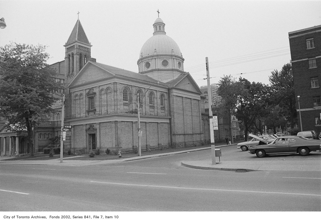
Corner of Sherbourne St. and Earl St., looking south-west : 520 Sherbourne St.
1972 · 121 m awayCorner of Sherbourne St. and Earl St., looking south-west : 520 Sherbourne St.City of Toronto Archives, Fonds 2032, Series 841, File 7, Item 10
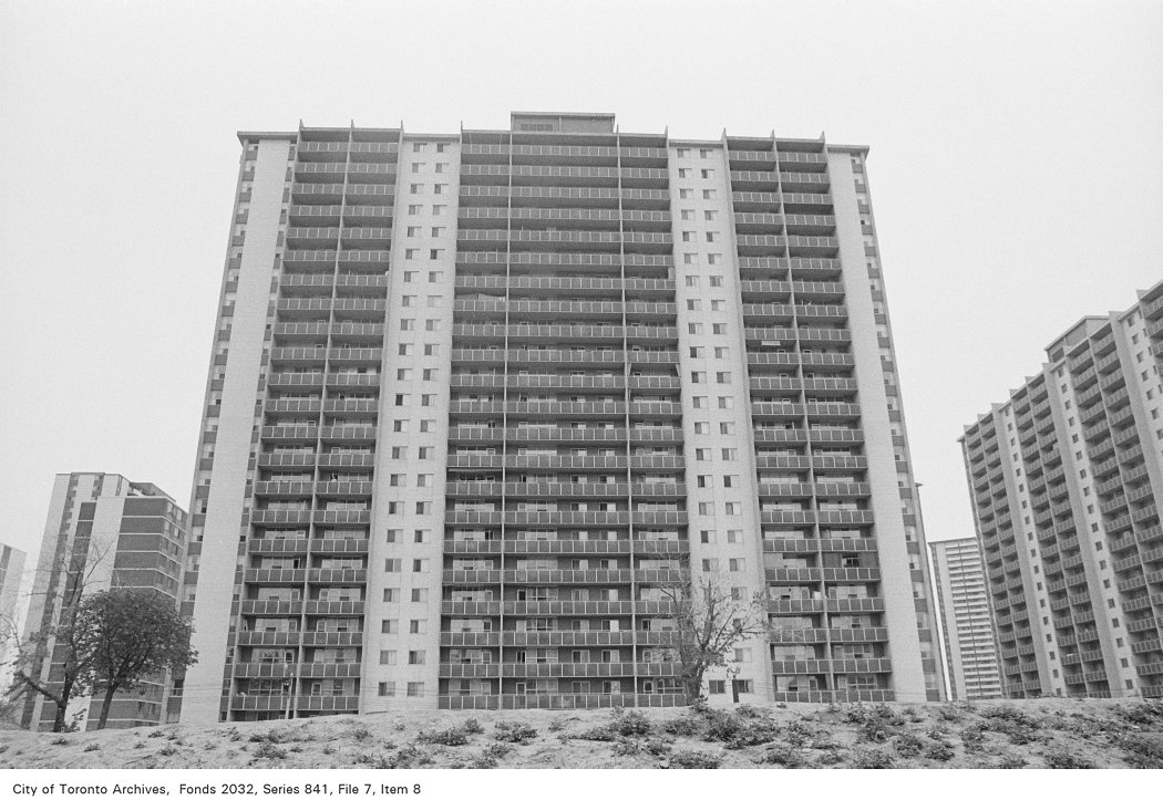
Corner of Sherbourne St. south of Isabella St., looking east
1972 · 140 m awayCorner of Sherbourne St. south of Isabella St., looking eastCity of Toronto Archives, Fonds 2032, Series 841, File 7, Item 8
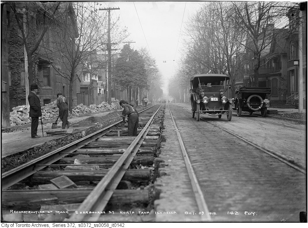
Sherbourne Street north from Isabella - reconstruction of track
1912 · 140 m awaySherbourne Street north from Isabella - reconstruction of trackCity of Toronto Archives, Fonds 200, Series 372, Subseries 58, Item 142
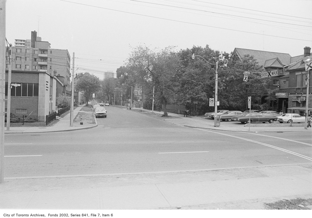
Corner of Sherbourne St. and Isabella St., looking west
1972 · 140 m awayCorner of Sherbourne St. and Isabella St., looking westCity of Toronto Archives, Fonds 2032, Series 841, File 7, Item 6
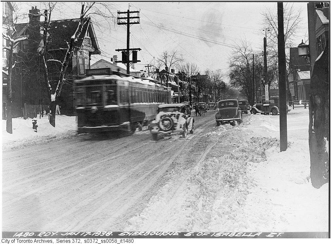
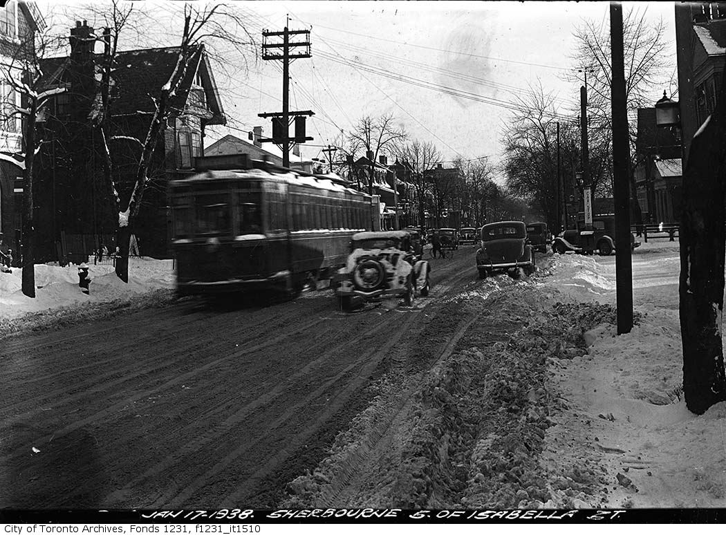
Sherbourne Street south of Isabella Street
1938 · 140 m awaySherbourne Street south of Isabella StreetCity of Toronto Archives, Fonds 200, Series 372, Subseries 58, Item 1480
Sherbourne Street south of Isabella Street
1938 · 140 m awaySherbourne Street south of Isabella StreetCity of Toronto Archives, Fonds 1231, Item 1510
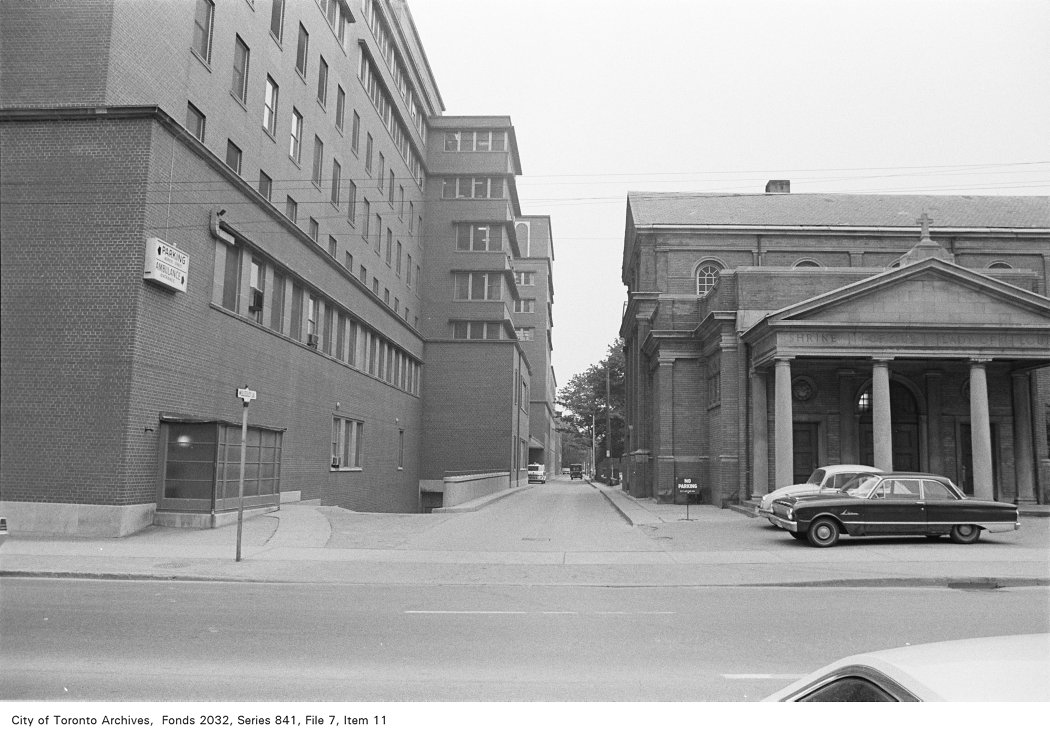
Corner of Sherbourne St. and Wellesley Lane, looking west, showing Shrine of our Lady of Lourdes
1972 · 146 m awayCorner of Sherbourne St. and Wellesley Lane, looking west, showing Shrine of our Lady of LourdesCity of Toronto Archives, Fonds 2032, Series 841, File 7, Item 11
Our Lady Of Lourdes Roman Catholic Church, Sherbourne St., s.w. cor. Earl St.
1900 · 146 m awayOur Lady Of Lourdes Roman Catholic Church, Sherbourne St., s.w. cor. Earl St. Courtesy of Toronto Public Library
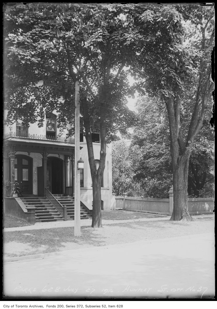
37 Huntley Street
1916 · 178 m away37 Huntley StreetCity of Toronto Archives, Fonds 200, Series 372, Subseries 52, Item 628

Photo locations are matched from each photo’s title against City street and address data, so some may be off. Report a wrong location

myaddressintoronto.com/address/22-earl-st · Information from public sources; not a substitute for a home inspection, legal advice or a TRCA site review.
22 Earl St, Toronto M4Y (North St.James Town): development nearby, crime, transit and schools · My Address in Toronto