1 planning proposal within 250 m: one decided recently.
Buses 127 and 168 stop 42 m away; the nearest subway is 1.4 km.
The nearest elementary school is École élémentaire Charles-Sauriol, 280 m away.
Nothing is on record for the building itself: no permits, orders or heritage listing.
Lead in tap-water samples is higher than average in postal area M6N.
Planning proposals1within 250 m
Major crimes68within 500 m, 12 months
Nearest transit42 mBus 127, 168
The red dot is 577 Perth Ave. The circle shows 250 metres, about a 3-minute walk. Numbers match the proposals in section 01.
01What’s planned near 577 Perth Ave
1 planning proposal within 250 m (about a 3‑minute walk): one decided recently. That's about typical for Toronto (the typical address has 1).
Decided recently
1
New house
50 Laughton Ave · 177 m away
Committee of Adjustment · Minor variance: permission to bend a zoning rule, such as height, size or setbacks
The Committee of Adjustment approved it on Nov 4, 2026.
To legalize and to maintain the front porch with stairs and rear ground floor two-level deck with stairs, which were constructed without an authorized building permit on the existing two-storey semi-detached dwelling.
Development Applications and Committee of Adjustment Applications, City of Toronto. A proposal that covers several addresses is listed once. Decided: development files submitted in the last 4 years; Committee of Adjustment decisions in the last 2 years.
02Safety near 577 Perth Ave
Police recorded 68 major crimes within 500 m of this address from Oct 2025 to Sep 2026. That's more than at most Toronto addresses (the typical address has 40). The table compares the neighbourhood's rates with Toronto's.
Major crime
Near this addresswithin 500 m, last 12 months
Weston-Pelham Park compared with Torontorate per 100,000 residents, 2025
◄ LowerTorontoHigher ►
Break-ins
12 near this address
About the same190 vs 190 per 100,000
Assaults
47 near this address
20% lower611 vs 768 per 100,000
Robberies
4 near this address
26% lower58 vs 79 per 100,000
Car thefts
4 near this address
45% lower124 vs 225 per 100,000
Thefts over $5,000
1 near this address
59% lower25 vs 61 per 100,000
Source: Toronto Police Service Public Safety Data Portal, Major Crime Indicators (Oct 2, 2025 to Sep 30, 2026) and Neighbourhood Crime Rates. Reported incidents only; police place each incident at the nearest intersection. Five-year trends for Weston-Pelham Park
03Getting around from 577 Perth Ave
The nearest subway station is Dundas West Station (Line 2), about a 23‑minute walk (1.4 km). Within a 5‑minute walk there are 7 TTC stops served by the 168 and 127 buses, with about 828 departures on a typical weekday. The nearest GO train station is Bloor GO, 1.5 km away, with 68 train stops on a weekday.
Nearest subway station
Dundas West Station1.4 km
Source: TTC · Line 2 · about 23 min walk
Buses
127 Davenport, 168 Symington42 m
Nearest stop: Davenport Rd at Symington Ave, plus 3 more stops for these routes within 250 m.
Nearest GO train station
Bloor GO1.5 km
Source: GO Transit · 68 train stops on a weekday
TTC and GO Transit schedules for a typical weekday (Nov 11, 2026). Walking times are estimates.
04Schools and child care near 577 Perth Ave
The closest public and Catholic schools. They may not be the ones assigned to this address; check with the Toronto District School Board (TDSB) or Toronto Catholic District School Board (TCDSB).
Elementary schools
Share of Grade 6 students meeting the provincial standard. Toronto: 87% reading, 54% math.
The red tick on each bar is the Toronto average. Source: Ontario Ministry of Education (2026), EQAO results.
Within 500 m (about a 6‑minute walk): two licensed child care centres and two EarlyON centres.
Licensed child care
Davenport Perth Early Learning & Child Care Centre105 m
1900 Davenport Rd · 36 spaces · infant, toddler, preschool · in the $10-a-day program · fee subsidies
Licensed child care
Centre De La Petite Enfance - Les Amis Du Monde302 m
55 Pelham Ave · 279 spaces · infant, toddler, preschool, kindergarten, school age · in the $10-a-day program · fee subsidies
EarlyON centre
Healthy Beginnings EarlyON Child and Family Centre70 m
1884 Davenport Rd · free programs for children up to 6 and their caregivers
EarlyON centre
Davenport EarlyON Child and Family Centre105 m
1900 Davenport Rd · free programs for children up to 6 and their caregivers
Source: City of Toronto Licensed Child Care Centres, EarlyON Child and Family Centres, and ChildCareSafe (Toronto Public Health inspections).
05The building at 577 Perth Ave
No building permits, building orders, by-law investigations, heritage listing or short-term rental registration on record for 577 Perth Ave.
06Around the block
Short-term rentals8registered within 250 m
Stays of less than 28 days, like Airbnb. That's more than at most Toronto addresses (the typical address has 2).
Licensed rooming houses0within 250 m
Houses that rent individual rooms with shared kitchens or bathrooms. The City licenses them to enforce safety standards.
New storefront businesses4licensed in Weston-Pelham Park, last 90 days
Mr. Convenience (take-out or food shop), Latte Licious Cafe (restaurant or bar), Casa Da Comida (sidewalk café), and 1 more.
Public spaces (POPS)0privately owned, open to the public, within 500 m
Shelters and respite sites0within 500 m
All new business licences in Weston-Pelham Park (4)
Mr. Convenience · Take-out or food shop · 1863 Davenport Rd · 56 m · licensed Oct 26, 2026
Latte Licious Cafe · Restaurant or bar · 1683 St Clair Ave W · 585 m · licensed Oct 21, 2026
Casa Da Comida · Sidewalk café · 1686 St Clair Ave W · 630 m · licensed Oct 8, 2026
Vers Cafe · Restaurant or bar · 15 Adrian Ave · 351 m · licensed Aug 21, 2026
Source: Short Term Rentals Registration, Multi-Tenant (Rooming) House Licences, Business Licences and Permits (storefront types; owners’ personal names are never shown), POPS, and Daily Shelter Occupancy (Nov 6, 2026). Confidential shelter locations are not published.
07Risks and environment at 577 Perth Ave
Flood and shoreline hazards
OutsideThis address
TRCA's maps show this address is outside the areas that could flood from rivers in a major storm (TRCA plans for a storm like Hurricane Hazel in 1954) and outside lake shoreline hazards. Basement flooding from overloaded sewers can still happen anywhere in the city.
Source: TRCA Regulation mapping 2025
Lead in tap-water tests, postal area M6N
5.6% of tests above Ontario's limitYour area · M6N
In postal area M6N, 17 of 306 home tap-water samples (5.6%) tested above Ontario's limit for lead (10 micrograms per litre). Across Toronto, 2.0% of samples did, so M6N is higher than the city overall. Health Canada recommends a stricter limit of 5 micrograms per litre: 21 samples here (6.9%) were above it. These are voluntary tests, mostly from older homes, so they don't tell you about this house. Lead comes from old pipes and plumbing, not the City's treatment plants. If your home was built before the mid-1950s, you can get a free test kit by calling 311.
Source: Non Regulated Lead Sample · 306 tests, Jan 14, 2014 to Aug 13, 2026
Air quality now
1 · Low riskYour area
Air Quality Health Index from Environment and Climate Change Canada's Toronto Downtown station, 4.6 km away, measured 2:00 PM EST Monday 9 November 2026. Forecast high for the next 24 hours: 2 (low risk). The scale runs from 1 to 10+; 1 to 3 is low risk.
Source: Environment and Climate Change Canada · hourly
TRCA mapping is for screening, not site-specific decisions. Lead results are voluntary samples from homes in the postal area, not this address.
08The neighbourhood: Weston-Pelham Park
Weston-Pelham Park had 10,680 residents in 2021. The median household income was $81,000, about the same as the typical Toronto neighbourhood ($85,000). 41% of households rent (typical neighbourhood: 46%). 29% of renters spend 30% or more of their income on housing. 29% of workers commuted by transit and 9% walked or cycled (typical neighbourhood: 26% and 5%). The most common first languages other than English and French are Portuguese (16.8%), Spanish (6.6%) and Vietnamese (3.5%). Source: 2021 Census; the next census was taken in 2026.
Residents (2021)10,680Weston-Pelham Park
Median household income$81,000typical neighbourhood $85,000
Households that rent41%typical neighbourhood 46%
Commute by transit29%typical neighbourhood 26%
Rents aren't published for single neighbourhoods. Across central Toronto (the old City of Toronto, before the 1998 amalgamation), a two-bedroom in a purpose-built rental building averaged $2,457 a month in October 2025, up 6% from a year earlier. The Toronto average was $2,055. The vacancy rate was 3.2%. These averages include long-term tenants; new listings usually cost more.
Average rent, October 2025
Central Toronto
Change in a year
Toronto
Studio
$1,526
+2%
$1,499
1 bedroom
$1,914
+4%
$1,763
2 bedrooms
$2,457
+6%
$2,055
3 bedrooms or more
$3,195
0%
$2,361
Source: CMHC, Rental Market Survey (October 2025), purpose-built rental apartments, central Toronto (the old City of Toronto, before the 1998 amalgamation). CMHC doesn’t publish rents for single neighbourhoods. Adapted by My Address in Toronto.
There is 1 planning proposal within 250 metres (one decided recently). The closest is at 50 Laughton Ave, 177 m away. Source: Development Applications; Committee of Adjustment Applications, as of Nov 9, 2026.
Is the area around 577 Perth Ave safe?
Police recorded 68 major crimes within 500 m from Oct 2025 to Sep 2026: 47 assaults, 12 break-ins, 4 car thefts, 4 robberies and 1 theft over $5,000. That's more than at most Toronto addresses (the typical address has 40). Per resident, in Weston-Pelham Park in 2025, assaults, car thefts, robberies and thefts over $5,000 were below it. Police place each incident at the nearest intersection, so these figures describe the area, not this address. Source: Toronto Police Service, as of Nov 9, 2026.
How do you get around from 577 Perth Ave?
The nearest subway station is Dundas West Station (Line 2), 1.4 km away (about a 23-minute walk). Nearby: the 127 Davenport and 168 Symington buses (stop at Davenport Rd and Symington Ave, 42 m). Source: TTC and GO Transit schedules, as of Nov 9, 2026.
What schools are near 577 Perth Ave?
The closest are École élémentaire Charles-Sauriol, St Rita Catholic School and Bishop Marrocco/Thomas Merton Catholic Secondary School. These may not be the assigned schools; check with the school board. Source: Ontario Ministry of Education school information, as of Nov 9, 2026.
What neighbourhood is 577 Perth Ave in?
577 Perth Ave is in Weston-Pelham Park, one of the City of Toronto's 158 official neighbourhoods, in Ward 9 Davenport. Weston-Pelham Park had 10,680 residents in 2021, with a median household income of $81,000. Source: City of Toronto neighbourhoods; 2021 Census, as of Nov 9, 2026.
What is rent like near 577 Perth Ave?
Rents aren't published for single neighbourhoods. In October 2025, a two-bedroom in a purpose-built rental building across central Toronto (the old City of Toronto, before the 1998 amalgamation) averaged $2,457 a month. That's an average across all tenants, including long-term ones; new listings usually cost more. Source: CMHC Rental Market Survey, as of Nov 9, 2026.
Is 577 Perth Ave in a flood plain?
No. TRCA maps it outside river flood and lake shoreline hazard areas. Basement flooding from sewers can still happen anywhere. Source: TRCA Regulation mapping 2025, as of Nov 9, 2026.
Is 577 Perth Ave a heritage property?
No. It isn't listed or designated on the City's Heritage Register. Source: Heritage Register, as of Nov 9, 2026.
Who is the city councillor for 577 Perth Ave?
Alejandra Bravo, councillor for Ward 9 Davenport. Email Councillor_Bravo@toronto.ca or call 416-392-7012. Source: City of Toronto elected officials, as of Nov 9, 2026.
When is garbage day at 577 Perth Ave?
Collection is on Fridays. Green bin goes out every week; garbage and recycling alternate weeks. The next garbage pickup is Nov 20, 2026. Source: Solid Waste Collection Schedule, as of Nov 9, 2026.
Answers are generated from the data on this page and update when the data changes.
Archive photos from near this address: myaddressintoronto.com/address/577-perth-ave#sec-history
10From the archives
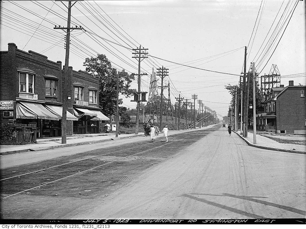
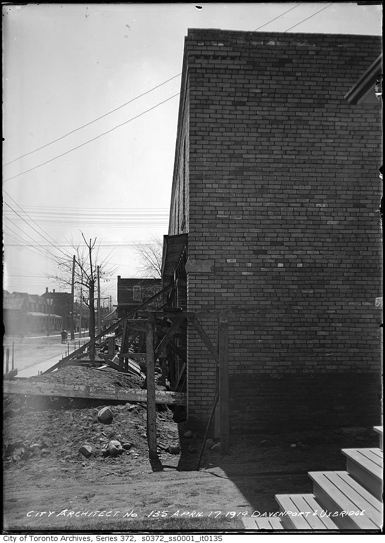
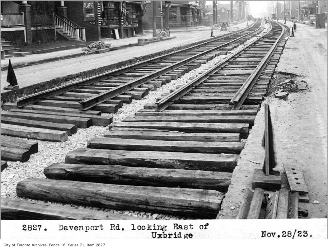
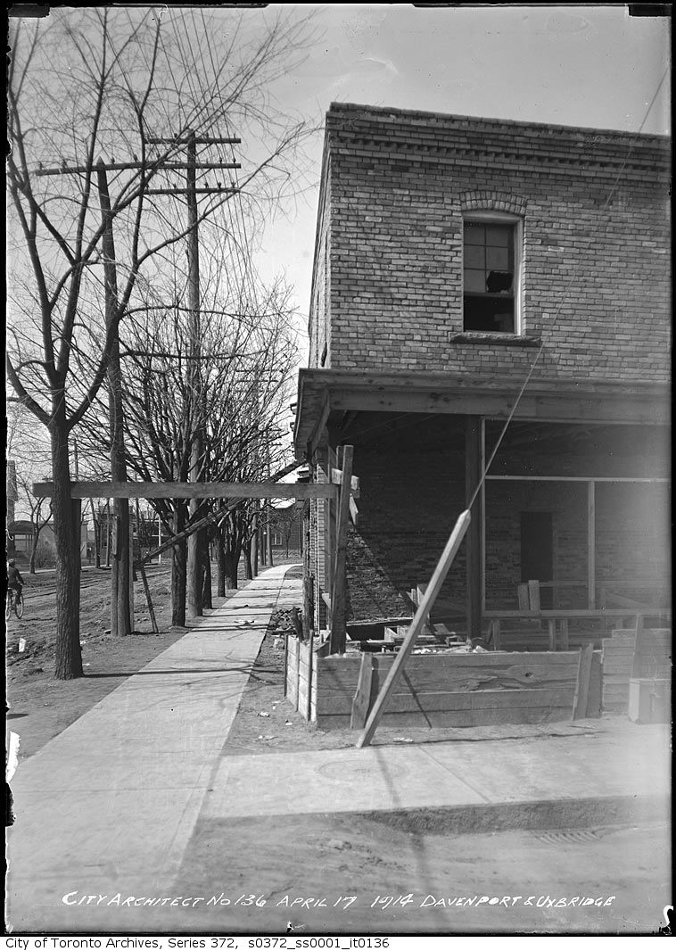
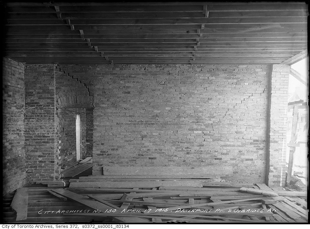
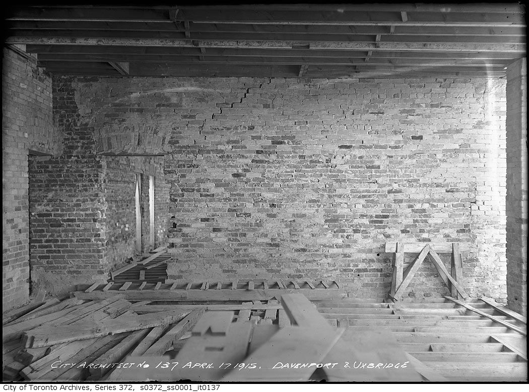
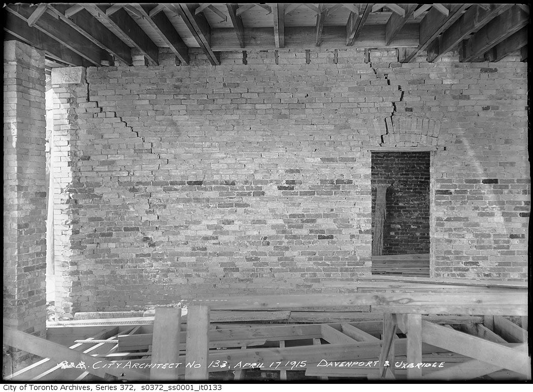
1923 · 82 m awayDavenport Road east at Symington AvenueCity of Toronto Archives, Fonds 1231, Item 21131915 · 243 m awayNorthwest corner Davenport Road and Uxbridge Avenue — Defective buildingCity of Toronto Archives, Fonds 200, Series 372, Subseries 1, Item 1351923 · 243 m awayDavenport Rd, looking east of UxbridgeCity of Toronto Archives, Fonds 16, Series 71, Item 28271915 · 243 m awayNorthwest corner Davenport Road and Uxbridge Avenue — Defective buildingCity of Toronto Archives, Fonds 200, Series 372, Subseries 1, Item 1361915 · 243 m awayNorthwest corner Davenport Road and Uxbridge Avenue — Defective buildingCity of Toronto Archives, Fonds 200, Series 372, Subseries 1, Item 1341915 · 243 m awayNorthwest corner Davenport Road and Uxbridge Avenue — Defective buildingCity of Toronto Archives, Fonds 200, Series 372, Subseries 1, Item 1371915 · 243 m awayNorthwest corner Davenport Road and Uxbridge Avenue — Defective buildingCity of Toronto Archives, Fonds 200, Series 372, Subseries 1, Item 133
Photo locations are matched from each photo’s title against City street and address data, so some may be off. Report a wrong location
myaddressintoronto.com/address/577-perth-ave · Information from public sources; not a substitute for a home inspection, legal advice or a TRCA site review.
Can we count your visit? With your OK, Google Analytics tells us which pages people use, so we know what to improve. It never sees the addresses you look up. Privacy policy
577 Perth Ave, Toronto M6N (Weston-Pelham Park): development nearby, crime, transit and schools · My Address in Toronto