My Address in Toronto · 89 Lillian St, Toronto · Data as of Nov 9, 2026
Address report · Ward 12 Toronto-St. Paul's
89 Lillian St
89 Lillian St is in South Eglinton-Davisville. There are 13 planning proposals within 250 m, including a 58‑storey building with 762 homes (under appeal). Eglinton Station is a 7‑minute walk.
Data as of Nov 9, 2026 · Every item lists its source
A 58-storey building with 762 homes is under appeal, 105 m away (141 Roehampton Ave).
Major crime rates in South Eglinton-Davisville were below Toronto's in 2025.
Eglinton Station (Line 1) is about a 7-minute walk.
The nearest elementary school is Eglinton Junior Public School, 265 m away.
Planning proposals12within 250 m
Major crimes230within 500 m, 12 months
Nearest transit452 mEglinton station
The red dot is 89 Lillian St. The circle shows 250 metres, about a 3-minute walk. Numbers match the proposals in section 01.
01What’s planned near 89 Lillian St
13 planning proposals within 250 m (about a 3‑minute walk): 13 in progress. Some cover several addresses; each proposal is listed once. That's more than at almost all Toronto addresses.
In progress
1
Subdivision
150 Eglinton Ave E and 4 more addresses · 71 m away
Subdivision: a request to divide land into new lots and streets
City planners are reviewing it. Residents can comment before a decision is made.
Draft Plan of Subdivision for the creation of 5 lots.
All 5 addresses
150 Eglinton Ave E · 160 Eglinton Ave E · 164 Eglinton Ave E · 134 Redpath Ave · 140 Redpath Ave
150 Eglinton Ave E and 4 more addresses · 71 m away
Site plan: City review of the design and layout of a new building
City planners are reviewing it. Residents can comment before a decision is made.
Site Plan application to permit a 61-storey multi-tower mixed use building with a maximum gross floor area of 90,000 square metres, 201 parking spaces, 1,329 bicycle parking spaces, and a north-south midblock connection.
All 5 addresses
150 Eglinton Ave E · 160 Eglinton Ave E · 164 Eglinton Ave E · 134 Redpath Ave · 140 Redpath Ave
Rezoning: a request to change the Official Plan or zoning so something new can be built
It has been appealed to the Ontario Land Tribunal (formerly the OMB), which will make the final decision.
Rezoning Application resubmission for a 58-storey residential building containing 762 residential dwelling units. A total gross floor area of 47,675.3 square metres is proposed, with an overall density equivalent to 16.12 times the area…
Site plan: City review of the design and layout of a new building
City planners are reviewing it. Residents can comment before a decision is made.
Site Plan Application for a 48-storey residential building. The building would consist of a 6-storey podium and 42-storey tower element containing 614 residential dwelling units. A total gross floor area of 36,849 square metres is…
Rezoning: a request to change the Official Plan or zoning so something new can be built
City planners are reviewing it. Residents can comment before a decision is made.
Zoning By-law Amendment for a 59-storey residential building with a height of 190 m (excluding the mechanical penthouse). The proposed redevelopment consists of a total gross floor area (GFA) of 48,233.4 sq. m., which results in a total…
181 Eglinton Ave E and 1 more address · 183 m away
Site plan: City review of the design and layout of a new building
City planners are reviewing it. Residents can comment before a decision is made.
Site Plan approval application for a 40-storey tower with an 8-storey podium and three-levels of underground parking. The proposal incorporates residential, retail, and office uses, and will replace the existing commercial/retail spaces.…
181 Eglinton Ave E and 1 more address · 183 m away
Rezoning: a request to change the Official Plan or zoning so something new can be built
It has been appealed to the Ontario Land Tribunal (formerly the OMB), which will make the final decision.
Rezoning for proposed 40-storey tower with an 8-storey podium and three-levels of underground parking. The proposal incorporates residential, retail, and office uses, and will replace the existing commercial/retail spaces. The building…
Site plan: City review of the design and layout of a new building
City planners are reviewing it. Residents can comment before a decision is made.
Site Plan Application for proposed 21-storey buidling and three-levels of underground parking, excluding mechanical penthouse. The proposal includes 11,242.7 square metres of residential and 237.4 square metres of retail use. The building…
808 Mount Pleasant Rd and 3 more addresses · 185 m away
Rezoning: a request to change the Official Plan or zoning so something new can be built
It has been appealed to the Ontario Land Tribunal (formerly the OMB), which will make the final decision.
Zoning By-law Amendment for a 61-storey mixed-use building with a height of 197.05 metres (excluding the mechanical penthouse). The proposed building will include approximately 812 square metres of non-residential Gross Floor Area and…
All 4 addresses
808 Mount Pleasant Rd · 247 Roehampton Ave · 249 Roehampton Ave · 251 Roehampton Ave
808 Mount Pleasant Rd and 3 more addresses · 185 m away
Site plan: City review of the design and layout of a new building
City planners are reviewing it. Residents can comment before a decision is made.
Site Plan Approval for a 35-storey mixed-use building having a non-residential gross floor area of 1005 square metres, and a residential gross floor area of 31,514 square metres. 514 residential dwelling units are proposed.
All 4 addresses
808 Mount Pleasant Rd · 247 Roehampton Ave · 249 Roehampton Ave · 251 Roehampton Ave
Rezoning: a request to change the Official Plan or zoning so something new can be built
It has been appealed to the Ontario Land Tribunal (formerly the OMB), which will make the final decision.
The redevelopment proposes a 70-storey mixed-use building with 187.4 sq. m. of retail space at-grade and 555 residential dwelling units above, resulting in a total gross floor area (GFA) of 39,275.7 sq. m., a total Floor Space Index (FSI)…
Development Applications and Committee of Adjustment Applications, City of Toronto. A proposal that covers several addresses is listed once. Decided: development files submitted in the last 4 years; Committee of Adjustment decisions in the last 2 years.
02Safety near 89 Lillian St
Police recorded 230 major crimes within 500 m of this address from Oct 2025 to Sep 2026. That's more than at 97% of Toronto addresses. The table compares the neighbourhood's rates with Toronto's.
Major crime
Near this addresswithin 500 m, last 12 months
South Eglinton-Davisville compared with Torontorate per 100,000 residents, 2025
◄ LowerTorontoHigher ►
Break-ins
58 near this address
32% lower128 vs 190 per 100,000
Assaults
135 near this address
43% lower436 vs 768 per 100,000
Thefts over $5,000
7 near this address
66% lower21 vs 61 per 100,000
Robberies
21 near this address
69% lower24 vs 79 per 100,000
Car thefts
9 near this address
74% lower59 vs 225 per 100,000
Source: Toronto Police Service Public Safety Data Portal, Major Crime Indicators (Oct 2, 2025 to Sep 30, 2026) and Neighbourhood Crime Rates. Reported incidents only; police place each incident at the nearest intersection. Five-year trends for South Eglinton-Davisville
03Getting around from 89 Lillian St
The nearest subway station is Eglinton Station (Line 1), about a 7‑minute walk (0.5 km). Within a 5‑minute walk there are 11 TTC stops served by the 5 streetcar and the 74, 34, 103 and 97 buses, with about 1,804 departures on a typical weekday. The nearest GO train station is Oriole GO, 6.9 km away, with 9 train stops on a weekday.
Nearest subway station
Eglinton Station452 m
Source: TTC · Line 1 · about 7 min walk
Buses
34 Eglinton, 74 Mount Pleasant, 103 Mount Pleasant North82 m
Nearest stop: Eglinton Ave East at Redpath Ave, plus 1 more stop for these routes within 250 m.
Streetcar
5 Line 5 Eglinton289 m
Nearest stop: Mount Pleasant Station Westbound Platform.
Bus
97 Yonge387 m
Nearest stop: Yonge St at Eglinton Ave East - Eglinton Station.
Nearest GO train station
Oriole GO6.9 km
Source: GO Transit · 9 train stops on a weekday
TTC and GO Transit schedules for a typical weekday (Nov 11, 2026). Walking times are estimates.
04Schools and child care near 89 Lillian St
The closest public and Catholic schools. They may not be the ones assigned to this address; check with the Toronto District School Board (TDSB) or Toronto Catholic District School Board (TCDSB).
Elementary schools
Share of Grade 6 students meeting the provincial standard. Toronto: 87% reading, 54% math.
The red tick on each bar is the Toronto average. Private schools within 1 km: Careerquest, Willowdale High School, Caesar International Academy, Toronto Stem School, Manor Montessori - De Savery Site and 8 more. Source: Ontario Ministry of Education (2026), EQAO results.
Within 500 m (about a 6‑minute walk): five licensed child care centres and one EarlyON centre.
Licensed child care
Mothercraft Midtown Ced148 m
44 Lillian St · 52 spaces · infant, toddler, preschool · in the $10-a-day program · fee subsidies
Licensed child care
Central Eglinton Childrens' Centre235 m
223 Eglinton Ave E · 289 spaces · toddler, preschool, kindergarten, school age · in the $10-a-day program · fee subsidies
Yonge Eglinton EarlyON Child and Family Centre107 m
160 Eglinton Ave E · free programs for children up to 6 and their caregivers
Show 1 more child care centre
Licensed child care
Alphabet Academy438 m
111 Manor Rd E · 39 spaces · toddler, preschool · in the $10-a-day program
Source: City of Toronto Licensed Child Care Centres, EarlyON Child and Family Centres, and ChildCareSafe (Toronto Public Health inspections).
05The building at 89 Lillian St
There are no building orders, by-law investigations, heritage listing or short-term rental registration on record for 89 Lillian St. Here is what the City does have.
Building permits, last 5 years
0 permits
0 building permits in the last 5 years. Permits show work the City approved; they don't show work done without a permit.
Source: Building Permits · 1 on record
Permit history: 1 project from 1 permit
Interior Alterations · completed Nov 23, 2020 Proposal for removal and relocation of existing non-load bearing walls and kitchen renovation. · Permit 20 192175
06Around the block
Short-term rentals43registered within 250 m
Stays of less than 28 days, like Airbnb. That's more than at almost all Toronto addresses.
Licensed rooming houses0within 250 m
Houses that rent individual rooms with shared kitchens or bathrooms. The City licenses them to enforce safety standards.
New storefront businesses5licensed in South Eglinton-Davisville, last 90 days
Cheeseorabakery (take-out or food shop), The Commons Nail Bar (salon or personal services), Trinity Property Services (parking lot), and 2 more.
Public spaces (POPS)4privately owned, open to the public, within 500 m
58 Roehampton Avenue (300 m), 8 Eglinton Avenue East (371 m), 2195 Yonge Street (395 m), and 1 more.
Shelters and respite sites0within 500 m
All new business licences in South Eglinton-Davisville (5)
Cheeseorabakery · Take-out or food shop · 2109 1/2 Yonge St · 527 m · licensed Oct 20, 2026
The Commons Nail Bar · Salon or personal services · 1975 Yonge St · 825 m · licensed Oct 10, 2026
Trinity Property Services · Parking lot · 2131 Yonge St · 496 m · licensed Sep 29, 2026
Coffeebuffet · Restaurant or bar · 2033 Yonge St · 673 m · licensed Aug 19, 2026
Tim Hortons · Restaurant or bar · 2171 Yonge St · 412 m · licensed Aug 18, 2026
Source: Short Term Rentals Registration, Multi-Tenant (Rooming) House Licences, Business Licences and Permits (storefront types; owners’ personal names are never shown), POPS, and Daily Shelter Occupancy (Nov 6, 2026). Confidential shelter locations are not published.
07Risks and environment at 89 Lillian St
Flood and shoreline hazards
OutsideThis address
TRCA's maps show this address is outside the areas that could flood from rivers in a major storm (TRCA plans for a storm like Hurricane Hazel in 1954) and outside lake shoreline hazards. Basement flooding from overloaded sewers can still happen anywhere in the city.
Source: TRCA Regulation mapping 2025
Lead in tap-water tests, postal area M4S
2.3% of tests above Ontario's limitYour area · M4S
In postal area M4S, 5 of 220 home tap-water samples (2.3%) tested above Ontario's limit for lead (10 micrograms per litre). Across Toronto, 2.0% of samples did, so M4S is about the same as the city overall. Health Canada recommends a stricter limit of 5 micrograms per litre: 17 samples here (7.7%) were above it. These are voluntary tests, mostly from older homes, so they don't tell you about this house. Lead comes from old pipes and plumbing, not the City's treatment plants. If your home was built before the mid-1950s, you can get a free test kit by calling 311.
Source: Non Regulated Lead Sample · 220 tests, Feb 20, 2014 to Oct 16, 2026
Air quality now
3 · Low riskYour area
Air Quality Health Index from Environment and Climate Change Canada's Toronto Downtown station, 3.5 km away, measured 11:00 AM EST Tuesday 10 November 2026. Forecast high for the next 24 hours: 3 (low risk). The scale runs from 1 to 10+; 1 to 3 is low risk.
Source: Environment and Climate Change Canada · hourly
TRCA mapping is for screening, not site-specific decisions. Lead results are voluntary samples from homes in the postal area, not this address.
08The neighbourhood: South Eglinton-Davisville
South Eglinton-Davisville had 22,735 residents in 2021. The median household income was $80,000, about the same as the typical Toronto neighbourhood ($85,000). 70% of households rent (typical neighbourhood: 46%). 46% of renters spend 30% or more of their income on housing. 44% of workers commuted by transit and 13% walked or cycled (typical neighbourhood: 26% and 5%). The most common first languages other than English and French are Spanish (4.3%), Iranian Persian (3.5%) and Portuguese (3.1%). Source: 2021 Census; the next census was taken in 2026.
Residents (2021)22,735South Eglinton-Davisville
Median household income$80,000typical neighbourhood $85,000
Households that rent70%typical neighbourhood 46%
Commute by transit44%typical neighbourhood 26%
Rents aren't published for single neighbourhoods. Across central Toronto (the old City of Toronto, before the 1998 amalgamation), a two-bedroom in a purpose-built rental building averaged $2,457 a month in October 2025, up 6% from a year earlier. The Toronto average was $2,055. The vacancy rate was 3.2%. These averages include long-term tenants; new listings usually cost more.
Average rent, October 2025
Central Toronto
Change in a year
Toronto
Studio
$1,526
+2%
$1,499
1 bedroom
$1,914
+4%
$1,763
2 bedrooms
$2,457
+6%
$2,055
3 bedrooms or more
$3,195
0%
$2,361
Source: CMHC, Rental Market Survey (October 2025), purpose-built rental apartments, central Toronto (the old City of Toronto, before the 1998 amalgamation). CMHC doesn’t publish rents for single neighbourhoods. Adapted by My Address in Toronto.
There are 13 planning proposals within 250 metres (13 in progress). The largest is a 58-storey building with 762 homes at 141 Roehampton Ave, 105 m away (under appeal). Source: Development Applications; Committee of Adjustment Applications, as of Nov 9, 2026.
Is the area around 89 Lillian St safe?
Police recorded 230 major crimes within 500 m from Oct 2025 to Sep 2026: 135 assaults, 58 break-ins, 21 robberies, 9 car thefts and 7 thefts over $5,000. That's more than at 97% of Toronto addresses. Per resident, in South Eglinton-Davisville in 2025, assaults, break-ins, car thefts, robberies and thefts over $5,000 were below it. Police place each incident at the nearest intersection, so these figures describe the area, not this address. Source: Toronto Police Service, as of Nov 9, 2026.
How do you get around from 89 Lillian St?
The nearest subway station is Eglinton Station (Line 1), 0.5 km away (about a 7-minute walk). Nearby: the 34 Eglinton, 74 Mount Pleasant and 103 Mount Pleasant North buses (stop at Eglinton Ave East and Redpath Ave, 82 m); the 5 Line 5 Eglinton streetcar (stop at Mount Pleasant Station Westbound Platform, 289 m); the 97 Yonge bus (stop at Yonge St and Eglinton Ave East - Eglinton Station, 387 m). Source: TTC and GO Transit schedules, as of Nov 9, 2026.
What schools are near 89 Lillian St?
The closest are Eglinton Junior Public School, St Monica Catholic School and North Toronto Collegiate Institute. These may not be the assigned schools; check with the school board. Source: Ontario Ministry of Education school information, as of Nov 9, 2026.
What neighbourhood is 89 Lillian St in?
89 Lillian St is in South Eglinton-Davisville, one of the City of Toronto's 158 official neighbourhoods, in Ward 12 Toronto-St. Paul's. South Eglinton-Davisville had 22,735 residents in 2021, with a median household income of $80,000. Source: City of Toronto neighbourhoods; 2021 Census, as of Nov 9, 2026.
What is rent like near 89 Lillian St?
Rents aren't published for single neighbourhoods. In October 2025, a two-bedroom in a purpose-built rental building across central Toronto (the old City of Toronto, before the 1998 amalgamation) averaged $2,457 a month. That's an average across all tenants, including long-term ones; new listings usually cost more. Source: CMHC Rental Market Survey, as of Nov 9, 2026.
Has 89 Lillian St been renovated?
Yes. The City has 1 building permit on record, 0 in the last 5 years. Source: Building Permits, as of Nov 9, 2026.
Is 89 Lillian St in a flood plain?
No. TRCA maps it outside river flood and lake shoreline hazard areas. Basement flooding from sewers can still happen anywhere. Source: TRCA Regulation mapping 2025, as of Nov 9, 2026.
Is 89 Lillian St a heritage property?
No. It isn't listed or designated on the City's Heritage Register. Source: Heritage Register, as of Nov 9, 2026.
Who is the city councillor for 89 Lillian St?
Josh Matlow, councillor for Ward 12 Toronto-St. Paul's. Email councillor_matlow@toronto.ca or call 416-392-7906. Source: City of Toronto elected officials, as of Nov 9, 2026.
When is garbage day at 89 Lillian St?
Collection is on Wednesdays. Green bin goes out every week; garbage and recycling alternate weeks. The next garbage pickup is Nov 11, 2026. Source: Solid Waste Collection Schedule, as of Nov 9, 2026.
Answers are generated from the data on this page and update when the data changes.
Archive photos from near this address: myaddressintoronto.com/address/89-lillian-st#sec-history
10From the archives
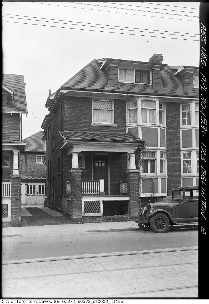
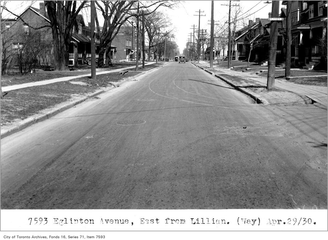
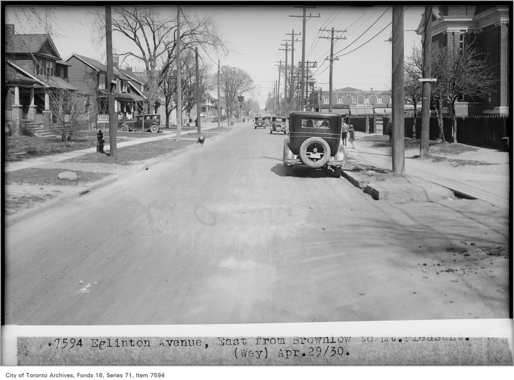
1931 · 47 m away123 Eglinton Avenue EastCity of Toronto Archives, Fonds 200, Series 372, Subseries 3, Item 11651930 · 80 m awayEglinton Avenue, east, from Lillian, (Way Department)City of Toronto Archives, Fonds 16, Series 71, Item 75931930 · 194 m awayEglinton Avenue, east, from Brownlow, to Mt Pleasant, (Way Department)City of Toronto Archives, Fonds 16, Series 71, Item 7594
Photo locations are matched from each photo’s title against City street and address data, so some may be off. Report a wrong location
myaddressintoronto.com/address/89-lillian-st · Information from public sources; not a substitute for a home inspection, legal advice or a TRCA site review.
Can we count your visit? With your OK, Google Analytics tells us which pages people use, so we know what to improve. It never sees the addresses you look up. Privacy policy
89 Lillian St, Toronto M4S (South Eglinton-Davisville): development nearby, crime, transit and schools · My Address in Toronto